Chronology Maps
Click a section name to see full details and a map.
| Completed | Route | Name | Start | End |
|---|---|---|---|---|
| M74 | Kingston - Fullarton Road | M8 J21 Seaward Street | J2A Fullarton Road | |
| M80 | Stepps - Haggs | J3 Hornshill | J7 Haggs | |
| A1(M) | Dishforth - Baldersby | J49 Dishforth | J50 Baldersby |
What's new
The road that made no sense
It was the UK's only single-carriageway motorway, and twenty years ago it ceased to exist. This is the story of the strange fascination it held, and of my place in history.
The forever bottleneck, part 2
The second part of the story, where we learn why exactly the M4 gets narrower on the final approach to Europe’s biggest city.
The forever bottleneck, part 1
The M4 into London was one of the UK's earliest and most ambitious motorway projects. It was bold, pioneering... and almost instantly regretted.
Have you seen...
Mancunian Way
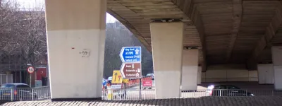
Manchester's highway in the sky, carrying traffic around the city centre and rapidly becoming an iconic part of the city's heritage.