The A39 is one of the south-west's most important roads, running from Bath to Falmouth via rural Somerset and the Atlantic coast. Large parts of it are primary, often providing the only fast road between towns and villages. That's certainly true of the top end and the bottom end; but look again on a map. Where does it go between Bridgwater and Barnstaple? Not down the straight roads, no. Oh — there it is. What's that wiggly, non-primary section on the north Devon coast all about?
The road from Barnstaple to Minehead could never be described as an important cross-country route. It doesn't look much like one on a map and it looks even less like one if you try and drive it. It is, however, an extremely beautiful and rewarding journey to make.
These pictures were taken on my first journey on the road, and at several points I found it hard to believe I was still on a road with such an important number. I found it even harder to believe that someone hadn't decided to give it a less important-sounding number or demote it to B-road status. But then, an awful lot about this road is rather improbable. So here it is: the improbable A39.

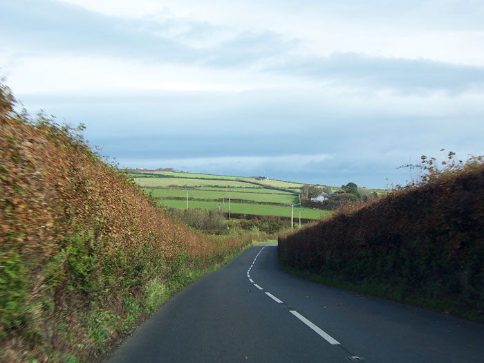
Heading out of Barnstaple, the road opens up into a country drive from one village to the next. It's not the heavily improved trunk route that runs through Cornwall — not by any stretch of the imagination — but it's a decent enough rural road with some opportunities to put your foot down.

A run downhill through the woods at Churchill Down provides an omen of things to come, but generally the innocent motorist might think that the road towards Minehead held nothing more surprising than an occasional sharp corner, like this one at Clifton.

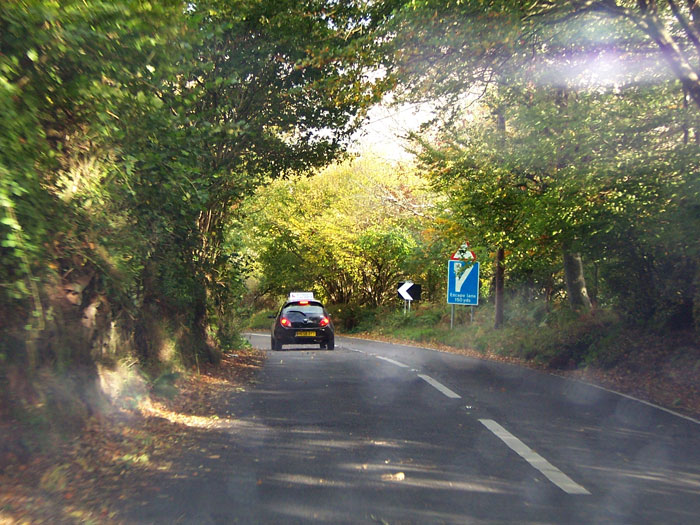
In truth, this sign (and its partner in crime, the warning triangle for "steep hill") is to be our close companion for most of the journey now, as the standard of the road deteriorates.
Lush, rolling hills dotted with sheep can be glimpsed between the high hedges, where it's safe to take your eyes off the twisting and curving road.

Approaching Lynton, the character of the road begins to change, first indicated by these warning signs. There's plenty more where they came from.

A steady descent — long and relatively easy in terms of curves — brings the road to Barbrook, where the B-road to Lynton takes away a large proportion of traffic. It runs through the town and along the coast to rejoin the A39 at Lynmouth, and between here and there is arguably the better standard road. It's also the shorter of the two.

The climb up to West Lyn starts with this left-hand corner, leading onto a steep ascent, which at the time I regarded as a hairpin bend. With hindsight it's just a bit of a corner.

There's a brief interlude of flat countryside at the top, before the A39 begins its descent by diving out of view in a rather unnerving fashion.

Approaching the bottom of the hill at Hillsford Bridge, this one really is a hairpin. That's more like it.

Here's another one! The B3223 begins here, and makes its way across Exmoor to Simonsbath. We are about to run through Watersmeet, a thickly wooded gorge, which lies behind us to our left.

The A39 now has a steep wooded slope to the left, and a low wall to the right that prevents stray vehicles from dropping into the small river below. The road here isn't wide enough for centre line markings.
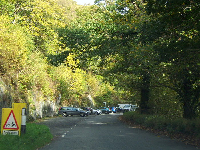
Here, opposite Watersmeet House, the road runs through a pay and display car park, and is now barely wide enough for two cars to pass. It was about here that I began to suspect I had taken a wrong turn and was no longer on the A39.

Now the road runs for another couple of miles as a single-track road, between exposed rock on the left and a steep drop to the river on the right. Passing places are generally at bends, where the rock face allows no visibility whatsoever.

Emerging from the tree canopy into Lynmouth, the sign confirms that yes, we really are still on the A39, but it's starting to look like this road isn't prepared to live up to its grandiose number!

There's a bridge over the river that we've been following, and from there the view ahead gives a pretty clear statement of intent: we're going to go up, and we're going to do it now.

A warning of a 25% uphill slope and falling rock — this is starting to feel like business as usual! The slope here is, unlike those that came before it, surprisingly straight. We're making a direct line towards the clifftops.

At the top of the hill, the A39 suddenly emerges from the trees to run along the top off the cliffs overlooking the Atlantic. Away to the left, there's a breathtaking view across Lynmouth Bay towards Foreland Point.

Ahead, the road follows the contour of the hills. Below, to the left, is a very sudden drop into the sea. Steer carefully!

Turning inland at Countisbury, the A39 now crosses into Exmoor, passing cattle grids as it does. There are warnings of wild horses here.

The scenery here is dramatically different. We're now travelling just under a mile inland, parallel with the coast, but to look at the view we could be in the heart of Exmoor. The road gets a little faster here, with better sightlines and easier curves.

There are points, in fact, where you could almost fool yourself you're on a major road again.

Crossing into Somerset, the road becomes a little more enclosed, and there's signs of affluence with the fashionable gastropub on the right and some grand country houses set back from the road.

Rounding a corner, the first warning of the feature for which this road is famous: Porlock Hill lies ahead, once the nemesis of early motor vehicles and now, still, a challenge for the average motorist. Signs at both ends advise drivers — especially those with caravans — to consider the parallel toll road, which is less steep.
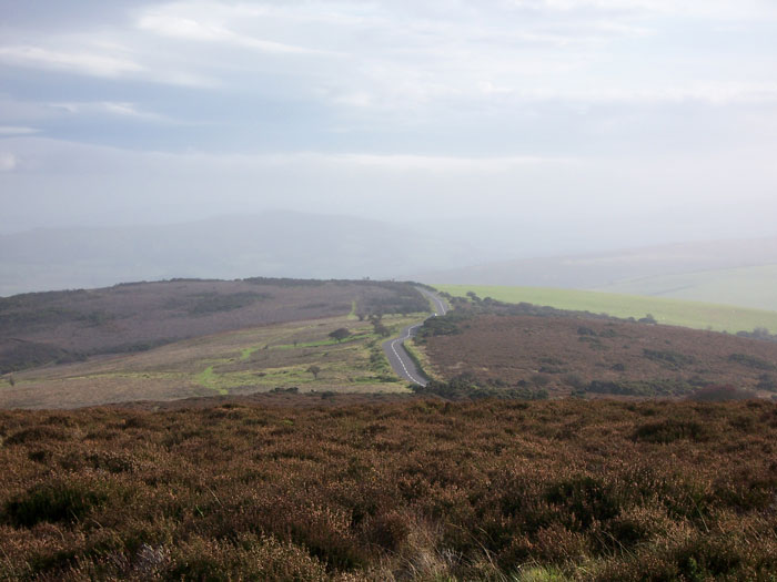
From Porlock Common, there's an opportunity to pull over and see the course of the road snaking across the barren moorland. Here, the road is exposed and windswept, battered by winds coming off the Atlantic and without shelter. Just out of sight, it drops suddenly down to Porlock.

Given the severe warning signs, and having some idea that the road ahead involves a steep gradient sustained over a considerable distance and multiple hairpin bends, I was somewhat surprised to see a double decker tourist bus coming the other way, which can only have come up Porlock Hill. Most impressive!

And so it begins! The sign declaring this to be the start of Porlock Hill isn't joking, and the road drops away suddenly just behind it. At first the road is a relatively sedate 13% gradient, or approximately 1 in 10.

Another cattle grid as we continue to descend. It's now quite easy to pick up speed as we rattle down the hill.
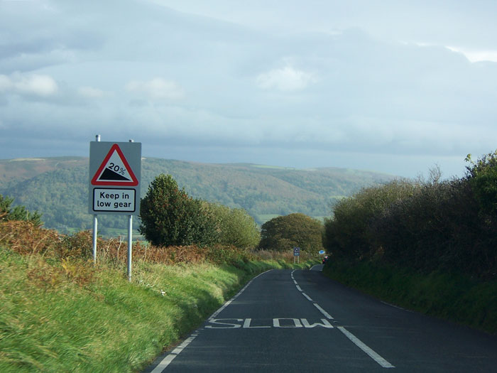
Keep in low gear — we start dropping more steeply now as the gradient picks up to 1 in 5.

A warning now to try your brakes. In fact the more serious warning about what lies ahead is the second sign — an indication of the first escape lane.

From here to the bottom — a distance of about another half a mile — the gradient is 1 in 4, or in layman's terms, very flipping steep indeed. In front is a car from a motoring school, in which a particularly sadistic driving instructor is giving his pupil a real grounding in hill driving.
Another escape lane is coming up as we round a blind left-hand bend.

The gravel escape lane lies in front as the road negotiates a hairpin onto the final descent. It's hard to believe that any of this route is the A39, but more so here because there are two easier ways down the hill. Unfortunately, as both are private toll roads, the only right of way that the A39 can follow is the most difficult.

The final part of the hill is this ruler-straight descent, still 1 in 4, which finishes on a last hairpin into the village. Directly ahead is a house, which has seen its fair share of vehicles coming towards it at terminal speed. This is the steepest A-road anywhere in the UK.

Around the final hairpin, the road is surprisingly level, now just descending very gently as it travels into Porlock itself. The A39 is back to its old tricks here, too narrow for vehicles to pass and hemmed in on both sides.

The sign at the bottom of the hill, facing drivers about to go up it, is designed to deter those without the confidence or skill to proceed, and in no uncertain terms advises heavy traffic and vehicles with trailers or caravans to take the toll road, which lies to the right.

Porlock itself is a historic and very pretty village, with ancient buildings fronting onto a narrow, picturesque main street. By now I was having no trouble in believing that this was the A39.

The route out of the village involves another hill to the east — nothing like as steep or challenging as Porlock Hill itself — but to get up it more easily, a peculiar one-way system exists that puts downhill traffic on the direct, steeper road and uphill traffic on an easier route to one side. There's an unusual single white line down the middle of the road here.

Beyond Porlock the change in surroundings is almost unbelievable: the A39 is back to the rural main road you might imagine, rolling around the gentle green countryside.

Ever surprising, on the way to Minehead the A39 suddenly opens up to an old-fashioned three lane road. That's the A39 for you: a surprise at every turn.
