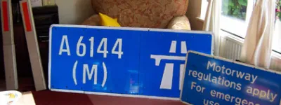
A470

The A470 is the north-south highway running the length of Wales. Mostly a quiet rural drive, it's suddenly transformed between Cardiff and Merthyr Tydfil, becoming a major and unique expressway route.

Think of the busiest roads in Wales and you will inevitably think of the M4 and the A55. You might also bring to mind the A465 Heads of the Valleys Road, and the A449 down the Usk valley. Often overlooked, though, is the twenty or so miles between Cardiff and Merthyr, a section of the A470 that carries as much traffic as many lengths of the Welsh M4 and considerably more - two or three times more, in fact - than the A55.

This section is, by any meaningful measure, an urban motorway. The length from the M4 to the A472 at Abercynon was built during the late 1960s and early 1970s and is a fast-paced, grade-separated route through a continuously built-up steep-sided valley. It comes complete with full hard shoulders and split-level running along hillsides.

If you enjoy ingenious 1960s highways threaded through town centres and difficult terrain, there's really nothing in the UK to match it; it's like a version of the M8 through Glasgow with better scenery. The ambition of the project was considerable; it originally came with an interchange at Coryton, but when the M4 arrived, that was replaced with Coryton Interchange - a three-level stacked roundabout interchange, yes, but one notable for having what is believed to be the UK's largest roundabout. The size of the roundabout, and the number of parallel lanes it carries, is scarcely believable until you've driven around it.

The "Cardiff-Merthyr Road" built in the late 1960s ran from the M4 to Abercynon, where the towns and villages spreading north from Cardiff along the valley of the Taff begin to thin out. It was extended in the 80s to reach the A4060 eastern bypass of Merthyr at Pentrebach. It was then extended further in the mid 1990s, passing around the west side of the town, to bypass the A470 through to a point north of Cefn Coed. That new length pushed the fast and very scenic dual carriageway further north, but it's not quite the same road - no longer at all urban, and with a series of flat roundabouts instead of those motorway-style junctions.

The chances that the expressway A470 will ever extend further north are very slim; north of Merthyr Tydfil right through to its northern extremity at Llandudno, the rest of the A470 is a much quieter route. But it will eventually connect to another modern expressway at Cefn Coed, where the final phase of the A465 dualling project will give this almost-motorway a northern terminus on Wales' new east-west route between Swansea and Raglan.

You're not looking at the whole A470

This page is about the parts of the A470 that are designated a motorway or that have motorway characteristics. Other sections of this road will not be featured here and will not count towards the length of the road as shown below.


Start

Merthyr Tydfil

End

Cardiff

Connects to

M4

Length

21 miles

Exit list

Symbols and conventions are explained in the key to exit lists. You can click any junction to see its full details.

Junction   Northbound               Southbound  
Castell-Nedd
Neath A465
Aberhonddu
Brecon A470
Y Fenni
Abergavenny A465


A465
NORTH
A470


A465
LanesLanesLanesLanes LanesLanesLanesLanes
1 mile, 2 lanes 1 mile, 2 lanes
Gelli-deg
Merthyr Tudful
Canol y dref
Merthyr Tydfil
Town centre
A4102
A4102 Merthyr Tudful
Canol y dref
Merthyr Tydfil
Town centre
A4102
Gelli-deg
LanesLanesLanesLanes LanesLanesLanesLanes
1.2 miles, 2 lanes 1.2 miles, 2 lanes
Rhyd-y-car
A4102
A4102 Rhyd-y-car
A4102
LanesLanesLanesLanes LanesLanesLanesLanes
1.6 miles, 2 lanes 1.6 miles, 2 lanes
Pentrebach
A4060
Y Fenni
Abergavenny (A465)
A4060
(A465)
Pentrebach
A4060
Y Fenni
Abergavenny (A465)
LanesLanesLanesLanes LanesLanesLanesLanes
5 miles, 2 lanes 5 miles, 2 lanes
Signs Signs
0.6 miles, 2 lanes 0.6 miles, 2 lanes
Aberpennar
Mountain Ash
Aberdâr
Aberdare
A4059
Ystrad Mynach A472
Aberfan (A4054)
A4059 A4054
A472
A4054
Ystrad Mynach A472
Aberfan (A4054)
Aberdâr
Aberdare
A4059
LanesLanesLanesLanes SignsSigns LanesLanesLanesLanes SignsSigns
0.6 miles, 2 lanes  
Services Abercynon
LanesLanesLanesLanes
0.5 miles, 2 lanes  
Abercynon
B4275
B4275


A4054

A4054
LanesLanesLanesLanes
3 miles, 2 lanes 3.4 miles, 2 lanes


A4223


(A4054)
Pontypridd A4223
Cwm Rhondda
Rhondda Valleys
(A4058)
Ynys-y-bwl (B4273)
Llantrisant
(A473)
LanesLanesLanesLanes
   
Pontypridd
Cwm Rhondda
Rhondda Valleys
A4058
Ynys-y-bwl (B4273)
A4058


LanesLanesLanesLanes
0.6 miles, 2 lanes  
Llantrisant
(A473)
B4595

A4054
A4054
LanesLanesLanesLanes
1.9 miles, 2 lanes 3.2 miles, 2 lanes
Rhydfelen
Rhydyfelin
A4054
A4054
A473
A4054
Yst Ddiw Trefforest
Treforest Ind Est
A4054
LanesLanesLanesLanes LanesLanesLanesLanes
1.6 miles, 2 lanes 1.6 miles, 2 lanes
Yst Ddiw Trefforest
Treforest Ind Est
A4054
Caerffili
Caerphilly
A468
(A4054) A468 Caerffili
Caerphilly
A468
Ffynnon Taf
Taff's Well
A4054
LanesLanesLanesLanes LanesLanesLanesLanes
1.7 miles, 2 lanes 1.7 miles, 2 lanes
Ffynnon Taf
Taff's Well A4054
Radyr B4262
A4054
B4262


A4054
Tongwynlais
A4054
Radyr B4262
LanesLanesLanesLanes LanesLanesLanesLanesLanes
1.1 miles, 2 lanes 1.1 miles, 3 lanes
(M4 J32) M4


A4054

A470
SOUTH
A4054

M4


Casnewydd
Newport
Pen-y-bont
Bridgend
M4 Link
LanesLanesLanesLanes SignsSigns LanesLanesLanesLanesLanes SignsSigns
Routes

Picture credits

In this section

What's new

Schrödinger’s speed limit

In 2022, Manchester City Council say they reduced the speed limit on the Mancunian Way to 30mph. But it’s not clear if they did. It’s not even clear if they can.

Sorry, wrong number

Road numbering is a system with clear rules. What happens when the people responsible for numbering roads don't follow them?

We need to talk about Wisley

National Highways are spending a third of a billion pounds rebuilding one of the most congested junctions on the M25. Is it money well spent?

Share this page

Have you seen...

Thelwall Viaduct

Thousands of vehicles travel the M6 between the M56 and M62 each day. They all cross the River Mersey and the Manchester Ship Canal, and the bridge that carries them is notorious from travel reports nationwide. But what does it actually look like from the ground?

About this page

Published

Last updated