M74 and A74(M)

Two numbers, one road. The main road south from Glasgow, and indeed most of Scotland thanks to its connections with the M73 and A702, is having something of an identity crisis.

In the 1960s, most of the A74 from Gretna to Glasgow was upgraded to dual carriageway - a relatively simple job becaise it passed through vast swathes of remote country, and running a second carriageway alongside the first wasn't a problem. Near the northern end the route begins to see some larger towns, and this part was bypassed by the M74. By the early 1990s, the dual carriageway - with all its nasty right turns, sharp corners and steep hills - was becoming dangerous and overloaded. A considerable amount of money was spent, over the course of the decade, on replacing sixty miles of road with a new motorway, which was open by the early 1990s.

North of junction 13, this new motorway was mostly built on a new alignment, and was called the M74. South of there, the road was mostly upgraded from the old dual carriageway, with a service road built alongside for non-motorway traffic, and was called the A74(M). Giving an upgraded A-road a number like this is not unusual, but making a road arbitrarily change its number half way along certainly is.

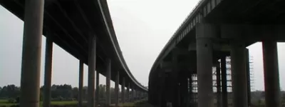
The M74 has been the source of a great deal of controversy. At its northern end, in Glasgow, the last few miles that bring the motorway to its terminus on the M8 are an elevated urban motorway that was, astonishingly, built in the early 21st century and opened in 2011. This sort of project just doesn't happen in this country, and the legal and political wrangling involved to get it off the ground was nothing short of epic.

At its southern end (or, strictly, the southern end of the A74(M)), the route is a continuous motorway right down to the M1 at Rugby, thanks to the M6. When the Scottish part of the motorway was built, the new signs were manufactured with "A74(M)" and "M74" on stuck-on plates, and it is known that if these were removed it would read "M6" underneath. Originally it was proposed that it would be renumbered once the motorway was connected to the M6, but the two were linked in 2008 and no change in number ever happened. The Scottish Government are now very evasive about the whole issue, not actually ruling out the idea of ever extending the M6 into Scotland, but certainly making it clear that there's no current plan to do it.

Aside from its current peculiar number, the M74 is one of Scotland's oldest and most interesting motorways. Its early, northern section, with two lanes each way, has some odd junctions, most notably the very extravagant free-flowing interchange at Motherwell, while the newer, southern sections form a smooth, well-engineered modern road through spectacular scenery. Whatever your views on the many oddities and controversies of this motorway route, it would be hard to argue that it's ever dull.

Start

Glasgow

End

Gretna

Passes

East Kilbride

Connects to

M6, M8, M73

Length

85 miles

Click a section name to see its full details, or click a map symbol on the right to see all motorways opened in that year.

Completed Name Start End
Hamilton Bypass Stage I J6 Hamilton Canderwater Chronology map for 1966
Hamilton Bypass Stage II (North) J4 Maryville J5 Raith Chronology map for 1968
Hamilton Bypass Stage II (South) J5 Raith J6 Hamilton Chronology map for 1968
Canderwater - Poniel Canderwater J11 Happendon Chronology map for 1986
Poniel - Millbank J11 Happendon J12 Millbank Chronology map for 1987
Millbank - Nether Abington J12 Millbank J13 Abington Chronology map for 1991
Elvanfoot - Paddy’s Rickle J14 Elvanfoot Paddy’s Rickle Bridge Chronology map for 1992
Kirkpatrick Fleming - Gretna J21 Kirkpatrick Fleming M6 J45 Guards Mill Chronology map for 1992
Nether Abington - Elvanfoot J13 Abington J14 Elvanfoot Chronology map for 1993
Dinwoodie Green - Ecclefechan Dinwoodie Green J19 Ecclefechan Chronology map for 1994
Cleuchbrae - Dinwoodie Green Cleuchbrae Dinwoodie Green Chronology map for 1994
Fullarton Road - Maryville J2A Fullarton Road J4 Maryville Chronology map for 1995
Ecclefechan - Kirkpatrick Fleming J19 Ecclefechan J21 Kirkpatrick Fleming Chronology map for 1995
Paddy’s Rickle - Beattock Paddy’s Rickle Bridge J15 Beattock Chronology map for 1999
Beattock - Cleuchbrae J15 Beattock Cleuchbrae Chronology map for 1999
Kingston - Fullarton Road M8 J21 Seaward Street J2A Fullarton Road Chronology map for 2011

Exit list

Symbols and conventions are explained in the key to exit lists. You can click any junction to see its full details.

Junction   Northbound               Southbound  
1 Clyde Tunnel
Greenock
Glasgow Airport
Paisley
M8 Link
Kinning Park
Tradeston
NORTH
M8


(A8)

M8

(A8)
(A8)
Tradeston
A8
LanesLanesLanesLanesLanesLanes Signs LanesLanesLanesLanesLanes Signs
1 mile, 3 lanes 1 mile, 3 lanes
1A Polmadie A728
Rutherglen (A730)
A728 A728
(A730)
Polmadie A728
Rutherglen (A730)
LanesLanesLanesLanesLanes LanesLanesLanesLanesLanes
0.5 miles, 3 lanes 0.5 miles, 3 lanes
Signs Signs
1 mile, 3 lanes 1 mile, 3 lanes
2 Rutherglen
Dalmarnock
A724
A724 A724 Rutherglen
Cambuslang
A724
LanesLanesLanesLanesLanes LanesLanesLanesLanesLanes
1.5 miles, 3 lanes  
River or canal River Clyde River or canal River Clyde
  1.5 miles, 3 lanes
2A Tollcross
A74
Rutherglen
(A74) Tollcross
A74
Cambuslang
LanesLanesLanesLanesLanes LanesLanesLanesLanesLanes
0.5 miles, 3 lanes  
3 Shettleston
(B765)
Cambuslang
A763
A763 A763
(B765)
LanesLanesLanesLanesLanes Signs Signs
2.5 miles, 3 lanes 2.5 miles, 3 lanes
3A A721
(A74)
(B7058)
Tannochside
Uddingston
A721
LanesLanesLanesLanesLanes
  0.5 miles, 3 lanes
4 Stirling
Kincardine Bridge
M73 Link
Uddingston
Mount Vernon
A721 (B7058)
A721


M73


A721

Stirling
Kincardine Bridge
Edinburgh
M73 Link
LanesLanesLanesLanesLanesLanes LanesLanesLanesLanesLanesLanes
3 miles, 4 lanes 2 miles, 4 lanes
Services Bothwell
LanesLanesLanesLanesLanesLanes
  1 mile, 4 lanes
5 Bellshill
Coatbridge
East Kilbride
A725
Edinburgh (A8)
B7071


A725


A725 Bellshill
Coatbridge
East Kilbride
A725
Edinburgh (A8)
LanesLanesLanesLanesLanes LanesLanesLanesLanesLanesLanes
1 mile, 3 lanes  
Services Hamilton
LanesLanesLanesLanesLanes
1 mile, 3 lanes 2 miles, 4 lanes
6 Wishaw
Hamilton
Motherwell
A723
A723 A723 Motherwell
Hamilton
Wishaw
A723
LanesLanesLanesLanesLanesLanes LanesLanesLanesLanesLanesLanes
6 miles, 2 lanes 3 miles, 2 lanes
7 A72 A72 Lanark
Larkhall
A72
LanesLanesLanesLanes
  3 miles, 2 lanes
8 Kilmarnock
Edinburgh
A71
Larkhall B7078
B7078
A71
B7078
A71 Kilmarnock
Edinburgh
A71
LanesLanesLanesLanes LanesLanesLanesLanes
6 miles, 2 lanes 4 miles, 2 lanes
9 B7078


B7078
Kirkmuirhill
Blackwood
Lesmahagow
Coalburn
B7078
LanesLanesLanesLanes
   
10 Lesmahagow
Kirkmuirhill
Blackwood
B7078
B7078 B7078
LanesLanesLanesLanes
6 miles, 2 lanes 7 miles, 2 lanes
11 B7078
Edinburgh
Ayr
B7078 (A70)
Services Happendon
LanesLanesLanesLanes
  1 mile, 2 lanes
12
207.7 km
Edinburgh
Ayr
A70
Services Happendon
A70


A70


LanesLanesLanesLanesLanes LanesLanesLanesLanesLanes
8 miles, 3 lanes 8 miles, 3 lanes
13 A74(M) becomes M74
Edinburgh A702
Lanark (A73)
Services Abington
B7078
A702
A702
M74 becomes A74(M)
Edinburgh A702
Lanark (A73)
Services Abington
LanesLanesLanesLanesLanes LanesLanesLanesLanesLanes
10 miles, 3 lanes 5 miles, 3 lanes
14 A702

A702
Crawford
A702
Thornhill (A76)
LanesLanesLanesLanesLanes
   
14 Crawford
A702
Thornhill (A76)
A702
(A76)
A702

B7076
LanesLanesLanesLanesLanes
13 miles, 3 lanes 18 miles, 3 lanes
15
553.3 km
Moffat
Dumfries
A701
B7076

A701
A701
(A708)
Moffat
Selkirk (A708)
A701
LanesLanesLanesLanesLanes LanesLanesLanesLanesLanes
7 miles, 3 lanes 7 miles, 3 lanes
16
542 km
Johnstonebridge
B7076
Services Annandale Water
(B7076) Johnstonebridge
B7076
Services Annandale Water
LanesLanesLanesLanesLanes LanesLanesLanesLanesLanes
6 miles, 3 lanes 6 miles, 3 lanes
17
532 km
Lockerbie
B7076
(B7076)
(A709)
Lockerbie
Dumfries (A709)
B7076
LanesLanesLanesLanesLanes LanesLanesLanesLanesLanes
2 miles, 3 lanes  
18
528 km
Lockerbie
Dumfries (A709)
B723
B723 B723
(A709)
(B7076)
LanesLanesLanesLanesLanes
4 miles, 3 lanes 6 miles, 3 lanes
19
521.5 km
Ecclefechan
B7076
B725
(B7076)


B725
Ecclefechan
B7076
LanesLanesLanesLanesLanes LanesLanesLanesLanesLanes
2 miles, 3 lanes 2 miles, 3 lanes
20
517 km
Eaglesfield
Annan
B722
B722 B722
(B7076)
Eaglesfield
Annan
B722
Kirtlebridge B7076
LanesLanesLanesLanesLanes LanesLanesLanesLanesLanes
4 miles, 3 lanes 4 miles, 3 lanes
21
511.5 km
Kirtlebridge
Kirkpatrick Fleming
B7076
Canonbie
B6357
B7076

B6357
B6357

B7076
Canonbie
B6357
Kirtlebridge
Kirkpatrick Fleming
B7076
LanesLanesLanesLanesLanes LanesLanesLanesLanesLanes
2 miles, 3 lanes 2 miles, 3 lanes
508 km Services Gretna Green Services Gretna Green
LanesLanesLanesLanesLanes LanesLanesLanesLanesLanes
2 miles, 3 lanes 1 mile, 3 lanes
22
505.5 km

B7076
(A6071)
B7076


Longtown (A6071)
Gretna
Green Gretna
(B7076)
LanesLanesLanesLanesLanes
   
22
505.2 km
South West Scotland
Dumfries
Stranraer
A75
Gretna (B7076)
(A75)
(B7076)
LanesLanesLanesLanesLanes
1 mile, 3 lanes 2 miles, 3 lanes
Welcome to Scotland
M6 becomes A74(M)

M6
SOUTH
Welcome to England
A74(M) becomes M6 Link
Routes

Picture credits

  • Photograph of the A74(M) taken from an original by Andy Taylor-Lloyd and used with permission.

With thanks to Bob, Hugh Everett, Alistair Stewart, John Prentice, Stuart Clink and Bill Brown for information on this page.

In this section

What's new

A century of motorways

It's 100 years since the opening of the world's first motorway, the Autostrada from Milan to the Lakes.

Schrödinger’s speed limit

In 2022, Manchester City Council say they reduced the speed limit on the Mancunian Way to 30mph. But it’s not clear if they did. It’s not even clear if they can.

Sorry, wrong number

Road numbering is a system with clear rules. What happens when the people responsible for numbering roads don't follow them?

Share this page

Have you seen...

Thelwall Viaduct

Thousands of vehicles travel the M6 between the M56 and M62 each day. They all cross the River Mersey and the Manchester Ship Canal, and the bridge that carries them is notorious from travel reports nationwide. But what does it actually look like from the ground?

About this page

Published

Last updated