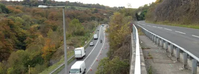
South London is a problem. Travel by road is always slow and always difficult. London's urban motorway network was supposed to fix that.
When you get to know London you soon learn that the suburbs south of the Thames are unlike the suburbs in the north. They developed in different ways at different times. Large parts of North London were built up in the early 20th century, spurred on by the growing Underground network, and patchy gaps in the urban area were used to provide new arterial roads like Western Avenue and the North Circular that, today, form the backbone of a major road network.
South London is older. Much of it grew up in the Victorian era, thanks to the many suburban railways of the nineteenth century, and when the arterial road programme got under way, there were fewer opportunities to build new roads.
North London's road network in the motorway age was improved by widening and building out from the arterial roads that already existed. In South London there was no similar starting point. If new roads were needed they'd have to be created from scratch, and as the years went by, open space became ever more sparse.
The roads in this group are the southern radials, the major roads and motorways that would have reached out from the city to the suburbs, Surrey, Sussex and Kent. They would have woven a grid through Ringways 2 and 3, new motorways in the thick of the urban jungle.
In the far south east and south west, the A2 and A3 saw improvements where a 1920s arterial road provided a starting point. In between, though, lay the dense bulk of South London, untouched by new roads, not so much a blank canvas as an impenetrable maze. Three new radials were supposed to clear bold new paths through it - the M23, the A20(M) and something called Parkway E.
As you read the stories that follow, you'll see the advantage of expanding a 1920s arterial road, since the A2 and A3 are largely complete. The M23, A20(M) and Parkway E, however, remain a fantasy. Today, South London thrives, but that's thanks to public transport. Its roads are still a problem.
Picture credits
- Plan of Tibbet's Corner is extracted from GLC/TD/C/36/013.
- Photograph of dualling work at Shannon Corner is extracted from item 6706/2/1 at Surrey History Centre.

