A short connection between Ringway 1 and Ringway 2 turns out to have a surprisingly complicated history - and would have played a critical role for traffic travelling both around and into London.
In the late 1950s and very early 60s, as London County Council planners were drawing up their very first drafts for a future urban motorway network in absolute secrecy, they sketched a motorway called the South Cross Route across the southern edge of Central London that continued west towards Wandsworth, Putney and Barnes. In later versions of the plan, as more motorways were sketched in, that long route was broken up and allocated to other schemes.
The main part of it kept its name and became the Ringway 1 South Cross Route. The western part was initially the Basingstoke Link before settling down as the Ringway 2 Western Section. But a short length between those parts was not needed for either Ringway 1 or 2, and became a length of motorway that simply connected them at their closest point. The Greater London Council referred to it as the Clapham-Wandsworth Link.

Detailed designs were produced for this short motorway in 1965 as part of a consultants' report into the South Cross Route, which means that its route and its interchange with Ringway 1 are easily found. However, at that time Ringway 2 did not yet exist, so the designs include a complex double-deck section and an interchange for the Balham Loop, neither of which would have been required once the Loop was cancelled in 1967.
At the western end of the route, no designs for the vast interchange at Wandsworth have come to light, so the way in which the Clapham-Wandsworth Link would have interacted with Ringway 2 and the A3 remains uncertain.
Despite being a very short link in the overall motorway network, its uses would have been numerous. It would have connected the two inner ring roads, of course, facilitating short hops from one to the other for orbital traffic, but it would also have enabled the South Cross Route and Ringway 2's Western Section to function as a single east-west route, useful for traffic to and from the west accessing South London. It would have been a radial link for traffic on the adjacent A3 but also, less obviously, for traffic approaching London on the M23, which would have terminated on Ringway 2.
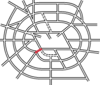
Outline itinerary
![]() Ringway 1 West Cross Route and South Cross Route
Ringway 1 West Cross Route and South Cross Route
![]() Ringway 2 Western Section and Southern Section
Ringway 2 Western Section and Southern Section
![]() Connection to A3
Connection to A3
Cost summary
| Property acquisition (1970) | £9,700,000 |
| Rehousing (1970) | £4,700,000 |
| Construction (1970) | £18,100,000 |
| Environmental works (1970) | £840,000 |
| Total cost at 1970 prices | £33,340,000 |
| Estimated equivalent at 2014 prices Based on RPI and property price inflation |
£413,400,456 |
See the full costs of all Ringways schemes on the Cost Estimates page.
Route map
Scroll this map horizontally to see the whole route

Key to map symbols
| "Primary Road" Network | |
|---|---|
| Primary Road | |
| Primary Road section in tunnel | |
| Primary Road approximate or assumed line | |
| Primary Road cancelled or deleted before start of GLDP Inquiry | |
| "Secondary Road" Network | |
| Secondary Road single carriageway or of unknown formation | |
| Secondary Road known to be dual carriageway | |
| Secondary Road section in tunnel | |
| Junctions | |
| Location of Primary Road junction where layout is not known | |
| Location of Secondary Road junction where layout is not known | |
| Location of a junction cancelled or deleted before start of GLDP Inquiry where layout is not known | |
The route
This route description begins at the eastern end of the route and travels west.
The Clapham-Wandsworth Link would begin on Ringway 1 at Clapham, at the point where the West and South Cross Routes met at the railway junction surrounding Latchmere Road. A free-flowing triangular junction would allow movements in all directions to and from the Link, with the sliproads closely following the shape of the railway lines.
Travelling west along the south side of the railway tracks towards Clapham Junction, the route would be elevated, passing through what are now two supermarkets before crossing the southern platforms of Clapham Junction railway station itself. In the original designs for the motorway, this initial section would have had a total of eight carriageways arranged on two levels, with sliproads rising and falling to provide fully segregated links between two adjacent interchanges. Another free-flowing interchange at Clapham Junction station would mark the start of the Balham Loop.

From 1967, when the Balham Loop was cancelled, its interchange and the complex braided links joining it to Ringway 1 would no longer be needed, so it's safe to assume the double-deck structure and parallel carriageways would be replaced with a simple elevated motorway passing over Clapham.
Continuing west, houses on Harbut Road would be demolished to make way for the motorway as it continued along the railway lines from Waterloo towards Richmond, spanning the A214 Wandsworth Bridge Southern Approach. In 1965, designs show it running on either side of the railway line from Clapham Junction to Wandsworth, but by about 1969 the whole motorway was to run on the south side of the railway, crossing over to the north side west of Wandsworth Town station.
Reaching the A3209 Putney Bridge Road, just to the west of Wandsworth town centre, the motorway would terminate at a large free-flowing interchange on Ringway 2, at the point the Southern and Western Sections met. The interchange would also connect to the A3. It is possible that, had all the proposed motorways been built as planned, the Clapham-Wandsworth Link would have been presented to motorists as an inward continuation of the A3 towards Central London, and in some plans the two roads appear to meet head-on at Wandsworth. Certainly, for many people travelling in and out of London on the A3, the Clapham-Wandsworth Link would have served that purpose. But planning documents never make that connection, and the two are always referred to as entirely separate and unrelated projects.
Floating in the air
Other than the plans for the motorway that were drawn up in 1965 - which include a number of features that would have to be deleted when the Balham Loop was dropped - evidence for the Clapham-Wandsworth Link is hard to come by. Certainly no plans for its terminal interchange at Wandsworth have yet come to light. One place where it makes an appearance, though, is in the plans for a different road altogether, the Wandsworth Bridge Southern Approach.
Wandsworth Bridge itself was opened in the 1930s, but didn't have a southern approach road. It just ended on York Road on the south side of the river. An approach road was planned, but only built in the 1960s, by which time the Greater London Council were in charge, and designed it as a component of their London-wide road plans. Consequently, it opened in the late 1960s as a three-lane dual carriageway with a major grade-separated junction beneath the A3 East Hill and a huge square roundabout at York Road.
The Southern Approach was meant to be continued further in both directions - south towards the A24, by widening Trinity Road, and north to Wandsworth Bridge on a flyover that would lift off from a gap in the central reservation and pass across the top of the railway and the roundabout. North of the bridge, the dual carriageway would continue, turning the corner into Townmead Road, which would be widened in similar fashion to form an approach to Chelsea Interchange on Ringway 1's West Cross Route. The whole thing would have ended up being one of the more substantial and important links in the Secondary Road Network.

A previous version of this page made the brash claim that the Wandsworth Bridge Southern Approach was in the way of the Clapham-Wandsworth Link and may have been altered or even demolished to make way for it. That absolutely isn't the case, and in fact the construction plans for the Southern Approach include an elevation plan for the flyover that shows it passing over the top of not just the railway but also a large empty space labelled "future motorway".
It's a very rare, fleeting glimpse of a little motorway plan that is not just difficult to spot now, but was almost entirely overshadowed by bigger and more destructive plans even in the 1960s.
Sources
- South Cross Route originally from Barnes to Kidbrooke; name "Basingstoke Link"; route plan with braided junction and interchange for Balham Loop: GLC/TD/DP/LDS/02/097.
- Name "Clapham-Wandsworth Link": appears in HLG 159/2673 and HLG 159/1672.
- Change of alignment to south side of railway by 1969; layout of Wandsworth Bridge Southern Approach; flyover designed to span C-W Link as well as railway: MT 118/379.
- Southern Approach planned since 1930s; route across Wandsworth Bridge to continue north-east on Townmead Road to R1 WCR: GLC/DG/PTI/P/05/075.
Picture credits
- Route map contains OS data © Crown copyright and database rights (2017) used under the terms of the Open Government Licence.
- Artist's impression of braided interchange at Clapham Junction extracted from GLC/TD/DP/LDS/02/097.
- Elevation plan labelled "Basingstoke Link" extracted from GLC/TD/DP/LDS/02/097.
- Wandsworth Bridge Southern Approach elevation plan extracted from MT 118/379.
