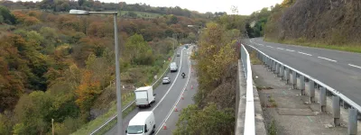
It was, arguably, the last huge motorway project the UK built. Opened in 1991, the M40 between Oxford and Birmingham is a 57-mile length of motorway built and opened as a single project. It's one of the biggest single motorway projects ever, eclipsed only by the 1959 section of M1 from Watford to Crick and the sections of M6 opened in 1963 between Stafford and Preston (though even that was really two projects that opened in the same year). Its scale was like nothing else in the previous twenty years and nothing like it has been seen since.
This is the book that marked the opening of that huge scheme, celebrating the achievement in a way that is very much of its time. While most of the books in this section date from the 1960s and 70s, and talk about the engineering achievements of a far-seeing, benevolent government, this book is a product of the late 1980s and early 90s, and like the M25 London Orbital book is stuffed with colourful adverts for the companies that built the road celebrating the role of private enterprise in this public project.
It's also very proud of the environmental credentials of the new M40, and in that sense could only be from the early 1990s. Environmental concerns were coming to the fore at this time, and met - as this book describes in detail - by planting more trees, making shallower embankments and providing ways for animals to cross the road. It doesn't look like much by modern standards, but this was a departure from the way motorways had been built during the 1960s and 70s, and with some justification the book can talk about the M40 setting new standards for treatment of the environment.

Front cover
Page 1
Page 2
Page 3
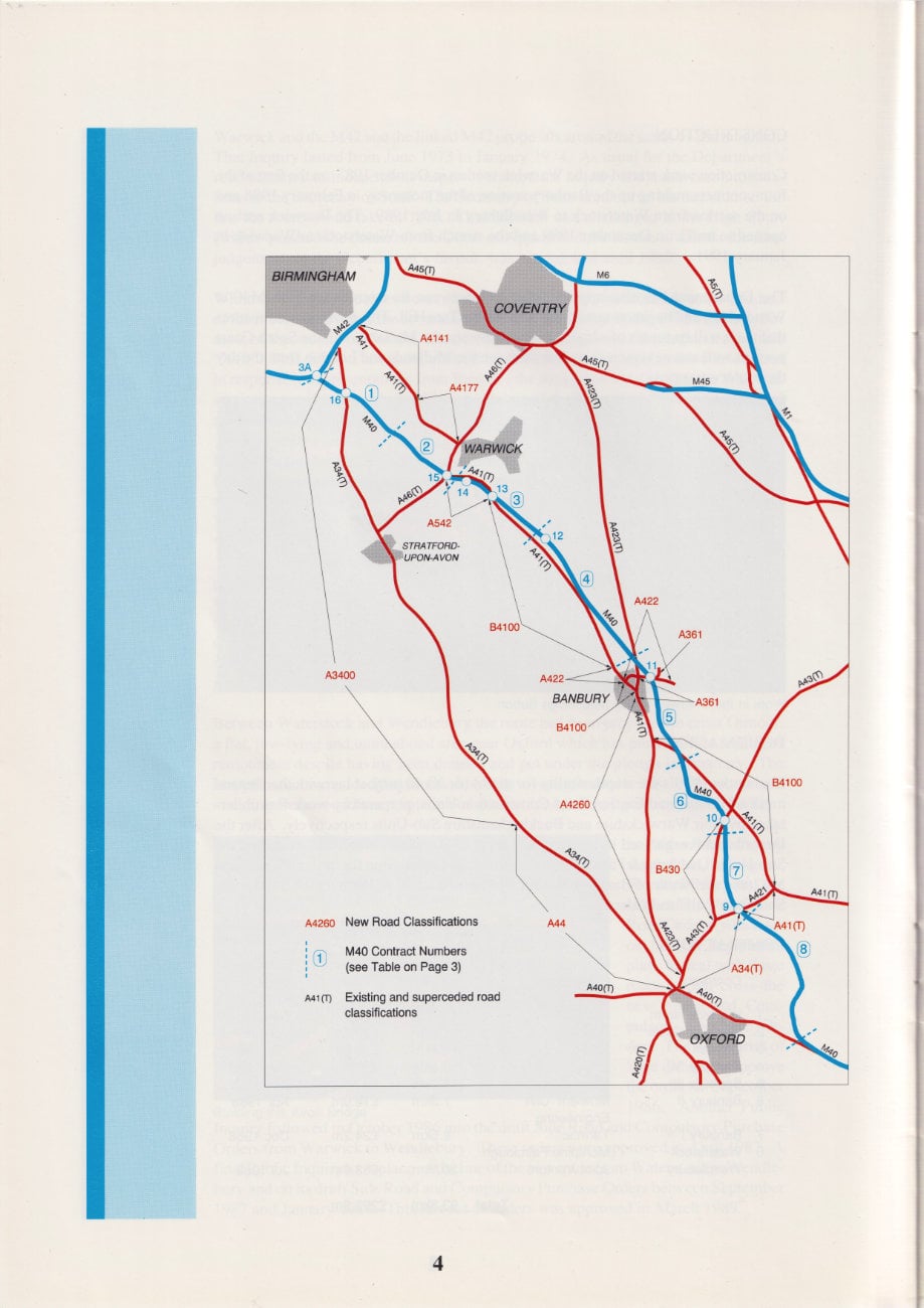
Page 4
Page 5
Page 6
Page 7
Page 8
Page 9
Page 10
Page 11
Page 12
Page 13
Page 14
Page 15
Page 16
Page 17
Page 18
Page 19
Page 20
Page 21
Page 22
Page 23
Page 24
Page 25
Page 26
Page 27
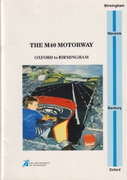
Front cover
THE M40 MOTORWAY
OXFORD to BIRMINGHAM
The Department of Transport
Advertisement
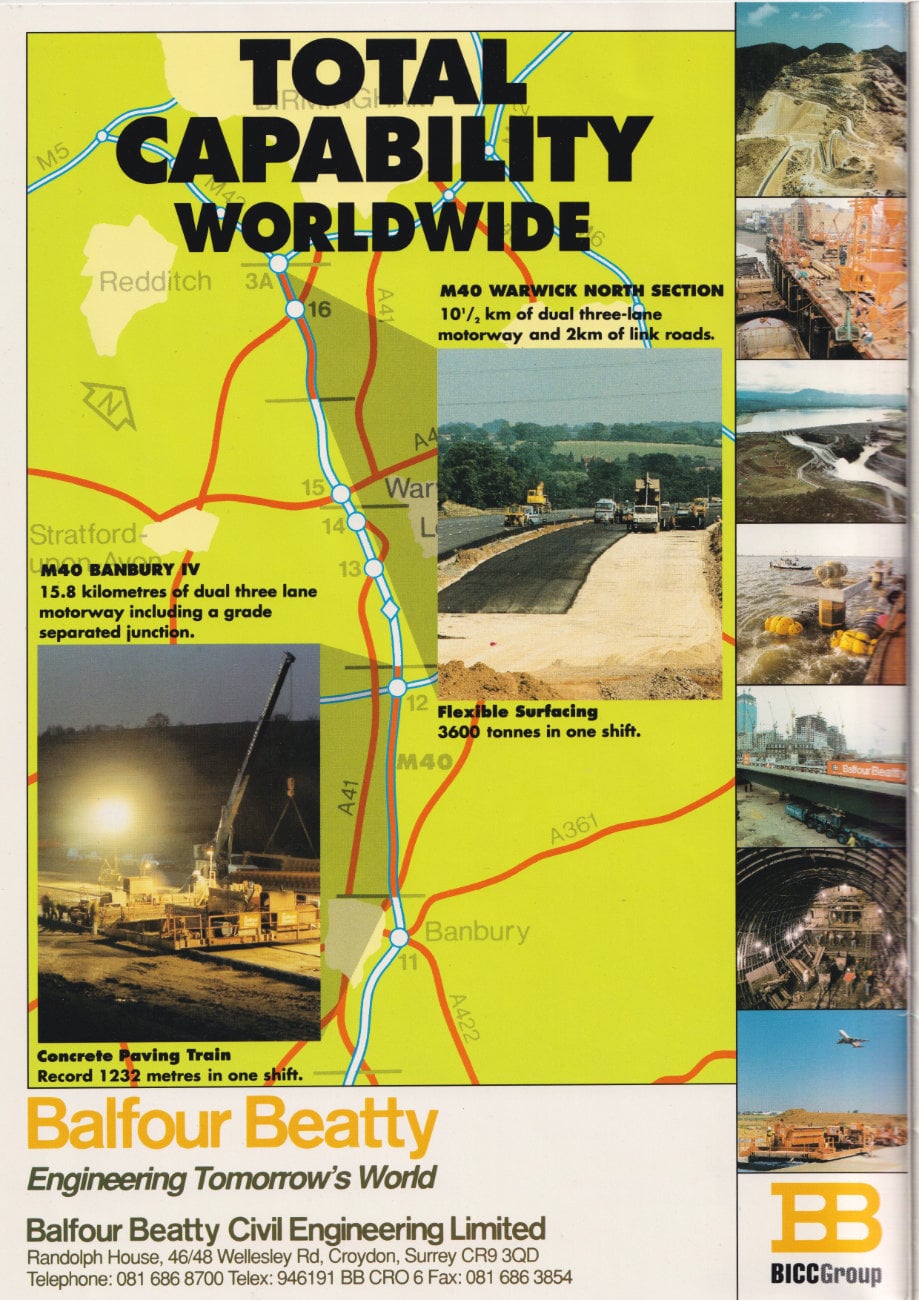
TOTAL CAPABILITY WORLDWIDE
- M40 WARWICK NORTH SECTION: 10 1/2 km of dual three-lone motorway and 2km of link roads.
- M40 BANBURY IV: 15.8 kilometres of dual three lane motorway including a grade separated junction.
- Flexible Surfacing: 3600 tonnes in one shift.
- Concrete Paving Train: Record 1232 metres in one shift.
Balfour Beatty: Engineering Tomorrow's World
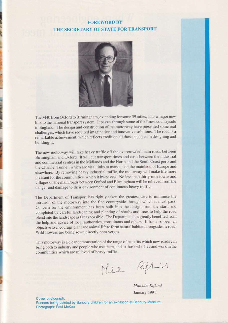
Foreword by The Secretary of State for Transport
The M40 from Oxford to Birmingham, extending for some 59 miles, adds a major new link to the national transport system. It passes through some of the finest countryside in England. The design and construction of the motorway have presented some real challenges, which have required imaginative and innovative solutions. The road is a remarkable achievement, which reflects credit on all those engaged in designing and building it.
The new motorway will take heavy traffic off the overcrowded main roads between Birmingham and Oxford. It will cut transport times and costs between the industrial and commercial centres in the Midlands and the North and the South Coast ports and the Channel Tunnel, which are vital links to markets on the mainland of Europe and elsewhere. By removing heavy industrial traffic, the motorway will make life more pleasant for the communities which it by-passes. No less than thirty-nine towns and villages on the main roads between Oxford and Birmingham will be relieved from the danger and damage to their environment of continuous heavy traffic.
The Department of Transport has rightly taken the greatest care to minimise the intrusion of the motorway into the fine countryside through which it must pass. Concern for the environment has been built into the design from the start, and completed by careful landscaping and planting of shrubs and trees to help the road blend into the landscape as far as possible. The Department has greatly benefited from the help and advice of local authorities, consultants and others. It has also been an objective to encourage plant and animal life to form natural habitats alongside the road. Wild flowers are being sown directly onto verges.
This motorway is a clear demonstration of the range of benefits which new roads can bring both to industry and people who use them, and to those who live and work in the communities which are relieved of heavy traffic.
Malcolm Rifkind
January 1991
Advertisement
HALCROW
Focusing on advanced technology
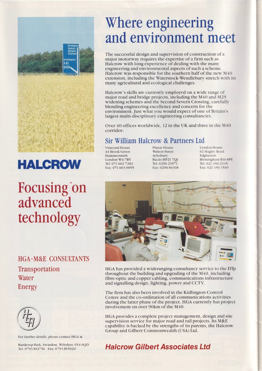
Where engineering and environment meet
The successful design and supervision of construction of a major motorway requires the expertise of a firm such as Halcrow with long experience of dealing with the main engineering and environmental aspects of such a scheme.
Halcrow was responsible for the southern half of the new M40 extension, including the Waterstock-Wendlebury stretch with its many agricultural and ecological challenges.
Halcrow's skills are currently emploved on a wide range of major road and bridge projects, including the M40 and M25 widening schemes and the Second Severn Crossing, carefully blending engineering excellence and concern for the environment. Just what you would expect of one of Britain's largest multi-disciplinary engineering consultancies.
Sir William Halcrow & Partners Ltd
HGA has provided a wide-ranging consultancy service to the DTp throughout the building and upgrading of the M40, including fibre-optic and copper cabling, communications infrastructure and signalling design, lighting, power and CCTV.
The firm has also been involved in the Kidlington Control Centre and the co-ordination of communications activities during the latter phase of the project. HGA currently has project involvement on over 9Okm of the M40.
HGA provides a complete project management, design and site supervision service for major road and rail projects. Its M&E capability is backed by the strengths of its parents, the Halcrow Group and Gilbert Commonwealth CUSA Ltd.
Halcrow Gilbert Associates Ltd
History
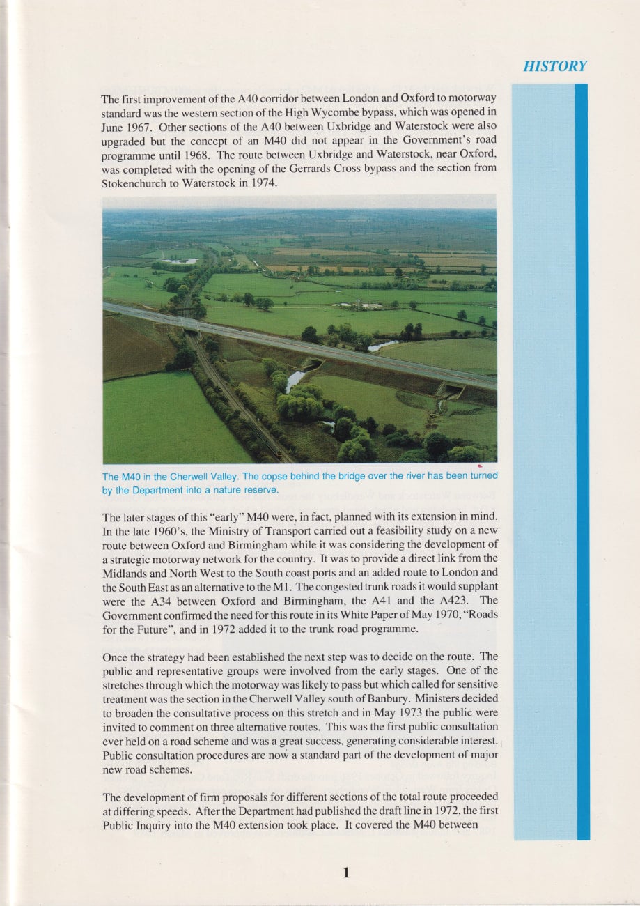
The first improvement of the A40 corridor between London and Oxford to motorway standard was the western section of the High Wycombe bypass, which was opened in June 1967. Other sections of the A40 between Uxbridge and Waterstock were also upgraded but the concept of an M40 did not appear in the Government's road programme until 1968. The route between Uxbridge and Waterstock, near Oxford, was completed with the opening of the Gerrards Cross bypass and the section from Stokenchurch to Waterstock in 1974.
The later stages of this "early" M40 were, in fact, planned with its extension in mind. In the late 1960's, the Ministry of Transport carried out a feasibility study on a new route between Oxford and Birmingham while it was considering the development ofna strategic motorway network for the country. It was to provide a direct link from the Midlands and North West to the South coast ports and an added route to London and the South East as an alternative to the M1. The congested trunk roads it would supplant were the A34 between Oxford and Birmingham, the A41 and the A423. The Government confirmed the need for this route in its White Paper of May 1970, "Roads for the Future", and in 1972 added it to the trunk road programme.
Once the strategy had been established the next step was to decide on the route. The public and representative groups were involved from the early stages. One of the stretches through which the motorway was likely to pass but which called for sensitive treatment was the section in the Cherwell Valley south of Banbury. Ministers decided to broaden the consultative process on this stretch and in May 1973 the public were invited to comment on three alternative routes. This was the first public consultation ever held on a road scheme and was a great success, generating considerable interest. Public consultation procedures are now a standard part of the development of major new road schemes.
The development of firm proposals for different sections of the total route proceeded at differing speeds. After the Department had published the draft line in 1972, the first Public Inquiry into the M40 extension took place. It covered the M40 between Warwick and the M42 and the linked M42 proposals around the south of Birmingham. That Inquiry lasted from June 1973 to January 1974. As usual for the Department's road schemes an independent inspector chaired the Inquiry and made recommendations to the Secretary of State. The Secretary of State announced his decision on the line the route would take in 1976. That decision was challenged in the High Court (which quashed the decision), the Court of Appeal and the House of Lords; the final judgement, in the Department's favour, was not reached until 1980.
While those legal processes were running their course doubts arose about the standard of the route as a result of the economic down-turn generated by the 1973 oil crisis. For most of the second half of the decade scheme planning went forward under the title "X40". This did not, however, affect the principle of a new road in the corridor and in response to representations from Banbury the decision was taken that the Warwick section - even if approved - would not be built until the Secretary of State had approved a bypass of Banbury.
Following the decade of planning in the 1970's came a decade of design, further Public Inquiries and building. Forecast traffic demand had, by 1980, turned the X back firmly to M and the Department published a draft line for the full length from Warwick to Waterstock in 1981. The Public Inquiry to consider objections to the line - many of which questioned the need for a new motorway - convened in Banbury in September 1982 and closed, after 117 sitting days in June 1983. In December 1984, under revised procedures, the Secretaries of State for the Environment and Transport jointly decided that the line from Warwick to Wendlebury should be approved. The validity of that decision was challenged initially in the High Court (May 1985) and later in the Court of Appeal (December 1985). The judges rejected the challenge, however, and the scheme was able to move forward into detailed design and the remaining statutory procedures.
Between Waterstock and Wendlebury the route had been proposed to cross Otmoor, a flat, low-lying and uninhabited area near Oxford which has preserved its feeling of remoteness despite having been drained and put under the plough last century. The Inspector recommended that routes should be investigated to the east of Otmoor whilst avoiding Bernwood Forest, an area of ancient woodland of great value for wildlife.
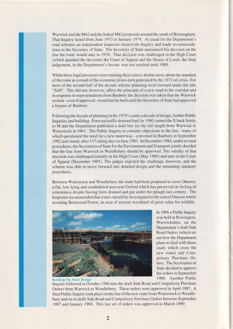
In 1986 a Public Inquiry was held at Rowington, Warwickshire on the Department's draft Side Road Orders (which set out how the Department plans to deal with those roads which cross the new route) and Compulsory Purchase Orders. The Secretaries of State decided to approve the orders in September 1986. Another Public Inquiry followed in October 1986 into the draft Side Road and Compulsory Purchase Orders from Warwick to Wendlebury. These orders were approved in April 1987. A final Public Inquiry took place on the line of the new route from Waterstock to Wendlebury and on its draft Side Road and Compulsory Purchase Orders between September 1987 and January 1988. This last set of orders was approved in March 1989.
Construction
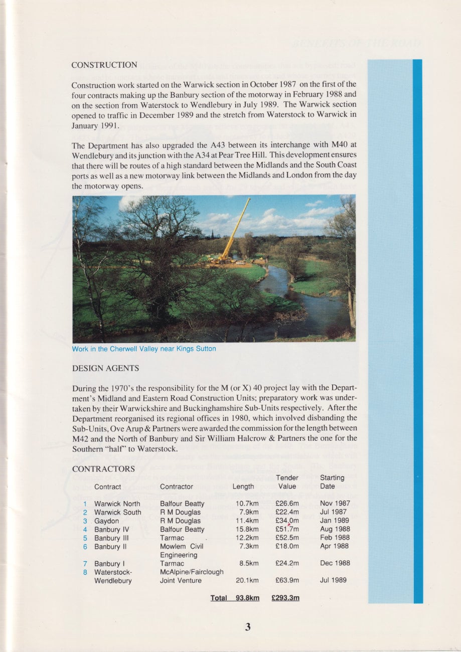
Construction work started on the Warwick section in October 1987 on the first of the four contracts making up the Banbury section of the motorway in February 1988 and on the section from Waterstock to Wendlebury in July 1989. The Warwick section opened to traffic in December 1989 and the stretch from Waterstock to Warwick in January 1991.
The Department has also upgraded the A43 between its interchange with M40 at Wendlebury and its junction with the A34 at Pear Tree Hill. This development ensures that there will be routes of a high standard between the Midlands and the South Coast ports as well as a new motorway link between the Midlands and London from the day the motorway opens.
Design agents
During the 1970's the responsibility for the M (or X) 40 project lay with the Department's Midland and Eastern Road Construction Units; preparatory work was undertaken by their Warwickshire and Buckinghamshire Sub-Units respectively. After the Department reorganised its regional offices in 1980, which involved disbanding the Sub-Units, Ove Arup & Partners were awarded the commission for the length between M42 and the North of Banbury and Sir William Halcrow & Partners the one for the Southern "half" to Waterstock.
Contractors
| Contract | Contractor | Length | Tender Value | Starting Date |
|---|---|---|---|---|
| 1 Warwick North | Balfour Beatty | 10.7km | £26.6m | Nov 1987 |
| 2 Warwick South | R M Douglas | 7.9km | £22.4m | Jul 1987 |
| 3 Gaydon | R M Douglas | 11.4km | £34.0m | Jan 1989 |
| 4 Banbury IV | Balfour Beatty | 15.8km | £51.7m | Aug 1988 |
| 5 Banbury III | Tarmac | 12.2km | £52.5m | Feb 1988 |
| 6 Banbury II | Mowlem Civil Engineering | 7.3km | £18.0m | Apr 1988 |
| 7 Banbury I | Tarmac | 8.5km | £24.2m | Dec 1988 |
| 8 Waterstock - Wendlebury | McAlpine/Fairclough Joint Venture | 20.1km | £63.9m | Jul 1989 |
| Total 93.8km | Total £293.3m |
Benefits of the road
The three chief beneficiaries of the M40 are the communities that are bypassed, road users, and businesses whose transport costs and times are cut and whose journey times become more reliable.
Bypassed communities
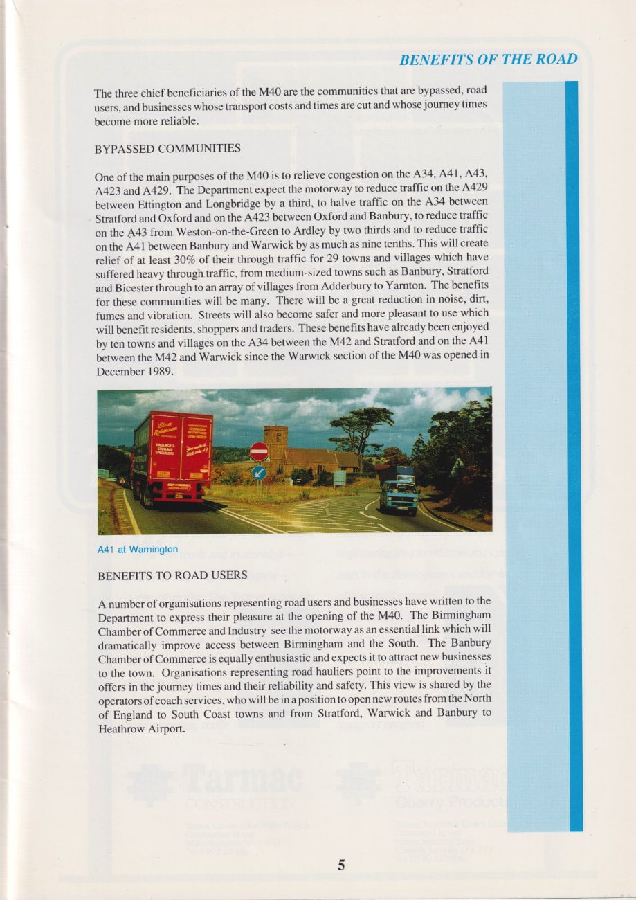
One of the main purposes of the M40 is to relieve congestion on the A34, A41, A43, A423 and A429. The Department expect the motorway to reduce traffic on the A429 between Ettington and Longbridge by a third, to halve traffic on the A34 between Stratford and Oxford and on the A423 between Oxford and Banbury, to reduce traffic on the A43 from Weston-on-the-Green to Ardley by two thirds and to reduce traffic on the A41 between Banbury and Warwick by as much as nine tenths. This will create relief of at least 30% of their through traffic for 29 towns and villages which have suffered heavy through traffic, from medium-sized towns such as Banbury, Stratford and Bicester through to an array of villages from Adderbury to Yarnton. The benefits for these communities will be many. There will be a great reduction in noise, dirt, fumes and vibration. Streets will also become safer and more pleasant to use which will benefit residents, shoppers and traders. These benefits have already been enjoyed by ten towns and villages on the A34 between the M42 and Stratford and on the A41 between the M42 and Warwick since the Warwick section of the M40 was opened in December 1989.
Benefits to road users
A number of organisations representing road users and businesses have written to the Department to express their pleasure at the opening of the M40. The Birmingham Chamber of Commerce and Industry see the motorway as an essential link which will dramatically improve access between Birmingham and the South. The Banbury Chamber of Commerce is equally enthusiastic and expects it to attract new businesses to the town. Organisations representing road hauliers point to the improvements it offers in the journey times and their reliability and safety. This view is shared by the operators of coach services, who will be in a position to open new routes from the North of England to South Coast towns and from Stratford, Warwick and Banbury to Heathrow Airport.
Over the past five years, there have been some 2000 casualties on the main roads between Oxford and Birmingham. Motorways have one quarter of the accident rate of rural roads. The opening of the M40 should contribute significantly towards the Government's aim of reducing casualties by a third by the end of the century.
The M40 will not only ease pressure on the A34, A41, A43 and A423. It will also reduce traffic significantly on the M1 which suffers from severe congestion. The Department expects that there will be a reduction of between 7,500 and 8,500 vehicles per day (between 15 and 20% of total traffic) in each direction on the M1 between the M25 and the M6 in the first year after the M40 extension is opened. At times of major maintenance the M40 could take another 10,000 vehicles per day from the M1.
Advertisement
The road sign for Quality
When you see the Tarmac name on roads and motorways - you're seeing a sign of progress - a sign of quality. The Tarmac name has been behind every move towards a better transportation network and our specialised skills in road materials, traffic management, surfacing and civil engineering are a formidable and valuable asset in the development and formation of new road systems.
From Britain's first motorway to today's new M40 link, Tarmac has been synonymous with transport progress.
Oxfordshire schools project
Building the M40 has brought momentous changes to the regions through which it passes. Oxfordshire's Museums Service is responding to these in some exciting and original ways. They will be holding an exhibition at Banbury Museum from 15 February 1991 which will display fossils, archaeological finds and a range of objects used during the construction of the road. The most dramatic exhibits at this show, however, will be the results of projects carried out by schools and youth groups with the help of the Museums Service. The Department of Transport and sponsors in local business and the construction industry helped to make these projects possible.
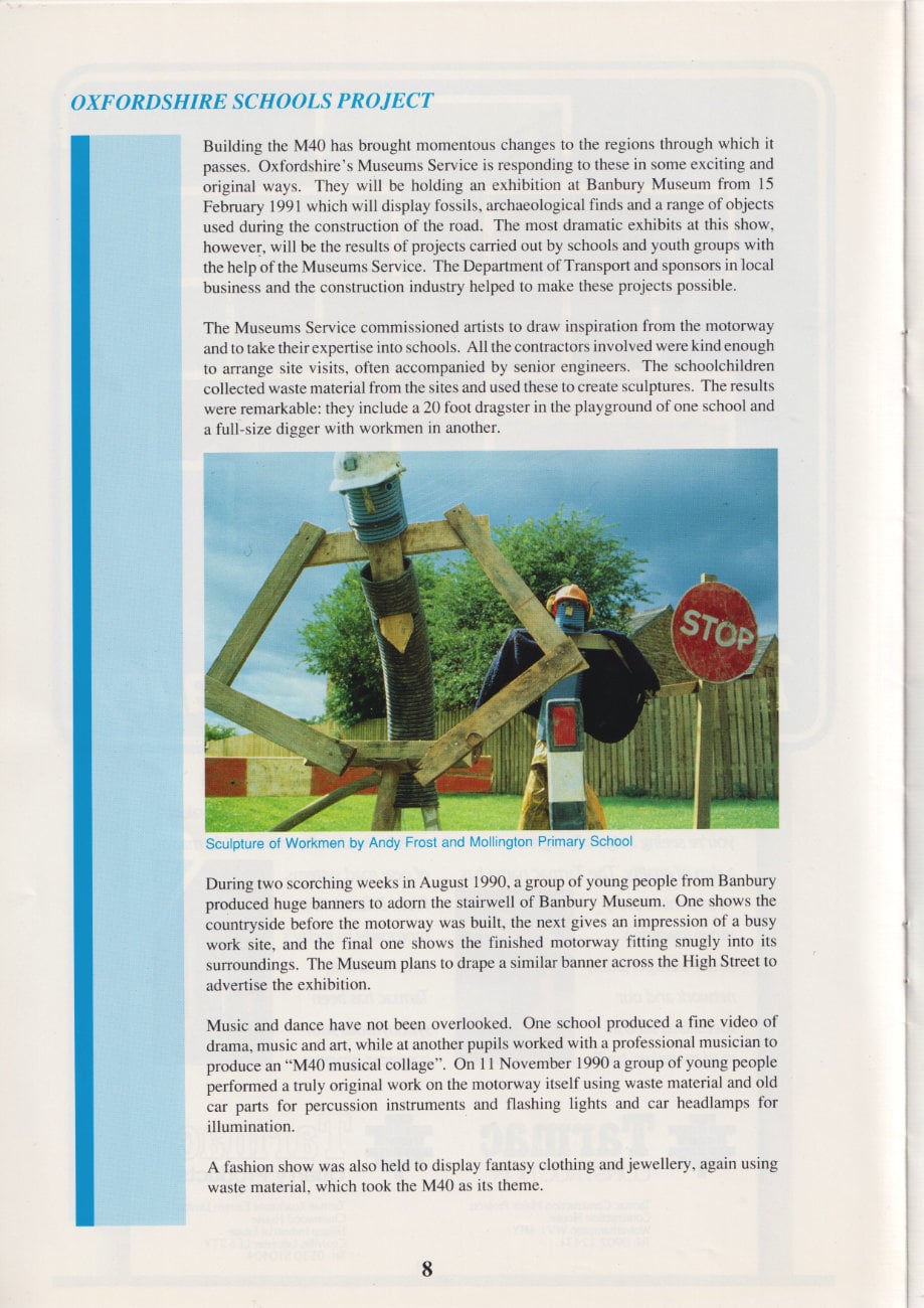
The Museums Service commissioned artists to draw inspiration from the motorway and to take their expertise into schools. All the contractors involved were kind enough to arrange site visits, often accompanied by senior engineers. The schoolchildren collected waste material from the sites and used these to create sculptures. The results were remarkable: they include a 20 foot dragster in the playground of one school and a full-size digger with workmen in another.
During two scorching weeks in August 1990, a group of young people from Banbury produced huge banners to adorn the stairwell of Banbury Museum. One shows the countryside before the motorway was built, the next gives an impression of a busy work site, and the final one shows the finished motorway fitting snugly into its surroundings. The Museum plans to drape a similar banner across the High Street to advertise the exhibition.
Music and dance have not been overlooked. One school produced a fine video of drama, music and art, while at another pupils worked with a professional musician to produce an "M40 musical collage". On 11 November 1990 a group of young people performed a truly original work on the motorway itself using waste material and old car parts for percussion instruments and flashing lights and car headlamps for illumination.
A fashion show was also held to display fantasy clothing and jewellery, again using waste material, which took the M40 as its theme.
Fitting the road into its surroundings
The M40 sets new standards in the treatment of its environment. The Department has taken unprecedented steps to blend the motorway into its surroundings and to protect and encourage native plants and wildlife. This has involved detailed surveys and investigations by environment and landscape experts throughout the development of the scheme. In response to their recommendations the Department has undertaken
extensive works and planting to ensure that the disturbance to affected areas Is minimised.
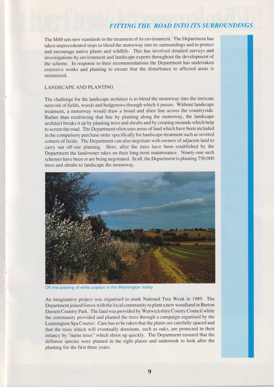
Landscape and planting
The challenge for the landscape architect is to blend the motorway into the intricate network of fields, woods and hedgerows through which it passes. Without landscape treatment, a motorway would draw a broad and alien line across the countryside. Rather than reinforcing that line by planting along the motorway, the landscape architect breaks it up by planting trees and shrubs and by creating mounds which help to screen the road. The Department often uses areas of land which have been included in the compulsory purchase order specifically for landscape treatment such as severed corners of fields. The Department can also negotiate with owners of adjacent land to carry out off-site planting. Here, after the trees have been established by the Department the landowner takes on their long-term maintenance. Ninety-one such schemes have been or are being negotiated. In all, the Department is planting 750,000 trees and shrubs to landscape the motorway.
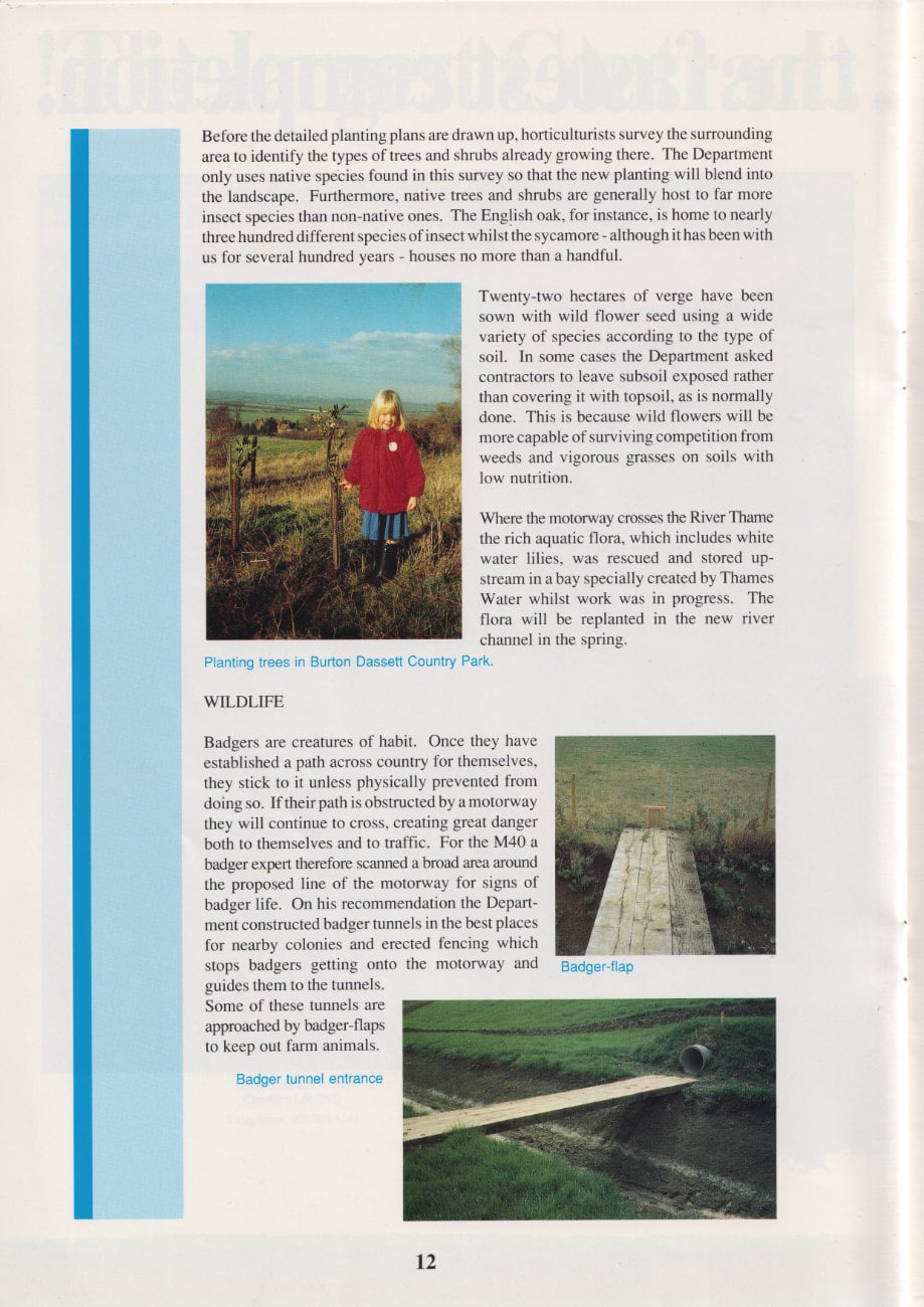
An imaginative project was organised to mark National Tree Week in 1989. The Department joined forces with the local community to plant a new woodland in Burton Dassett Country Park. The land was provided by Warwickshire County Council while the community provided and planted the trees through a campaign organised by the Leamington Spa Courier. Care has to be taken that the plants are carefully spaced and that the trees which will eventually dominate, such as oaks, are protected in their infancy by "nurse trees" which shoot up quickly. The Department ensured that the different species were planted in the right places and undertook to look after the planting for the first three years.
Advertisement
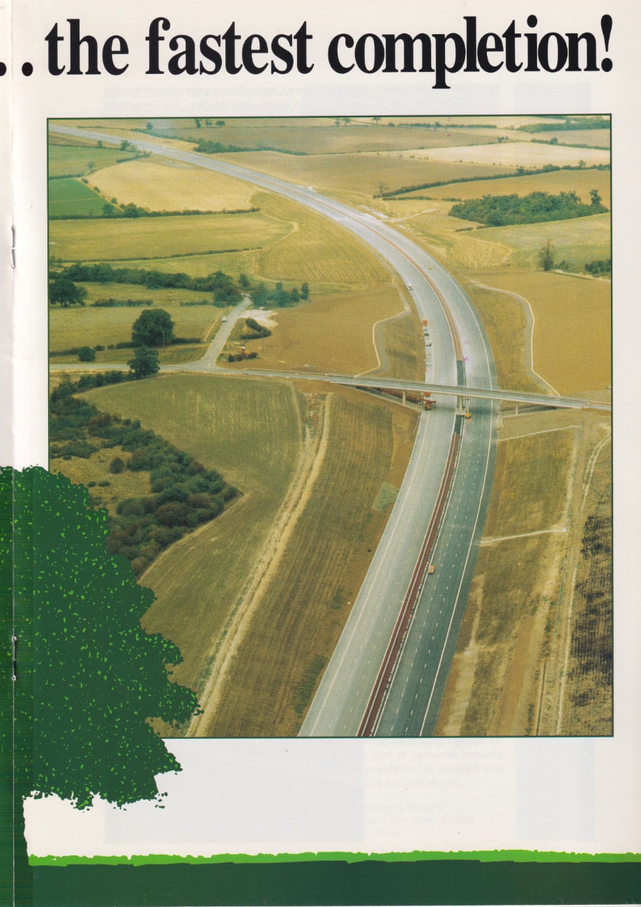
The largest contract...the fastest completion!
When tackling a £64 million contract, you make sure you have the right combination of experience and technical expertise.
Here on the Waterstock to Wendlebury Section of the M40, the Alfred McAlpine - Fairclough Joint Venture has beaten all records and completed the contract in a 16-month construction period, to provide a vital new length of motorway.
This is an outstanding example of how the two companies, through their long association, can successfully pool resources to undertake major civil engineering contracts.
Early completion has enabled the Oxfordshire countryside to be reinstated quickly - minimising the impact on the environment.
Fitting the road into its surroundings (continued)
Before the detailed planting plans are drawn up, horticulturists survey the surrounding area to identify the types of trees and shrubs already growing there. The Department only uses native species found in this survey so that the new planting will blend into the landscape. Furthermore, native trees and shrubs are generally host to far more insect species than non-native ones. The English oak, for instance, is home to nearly three hundred different species of insect whilst the sycamore - although it has been with us for several hundred years - houses no more than a handful.
Twenty-two hectares of verge have been sown with wild flower seed using a wide variety of species according to the type of soil. In some cases the Department asked contractors to leave subsoil exposed rather than covering it with topsoil, as is normally done. This is because wild flowers will be more capable of surviving competition from weeds and vigorous grasses on soils with low nutrition.
Where the motorway crosses the River Thame the rich aquatic flora, which includes white water lilies, was rescued and stored upstream in a bay specially created by Thames Water whilst work was in progress. The flora will be replanted in the new river channel in the spring.
Wildlife
Badgers are creatures of habit. Once they have established a path across country for themselves, they stick to it unless physically prevented from doing so. If their path is obstructed by a motorway they will continue to cross, creating great danger both to themselves and to traffic. For the M40 a badger expert therefore scanned a broad area around the proposed line of the motorway for signs of badger life. On his recommendation the Department constructed badger tunnels in the best places for nearby colonies and erected fencing which stops badgers getting onto the motorway and guides them to the tunnels. Some of these tunnels are approached by badger-flaps to keep out farm animals.
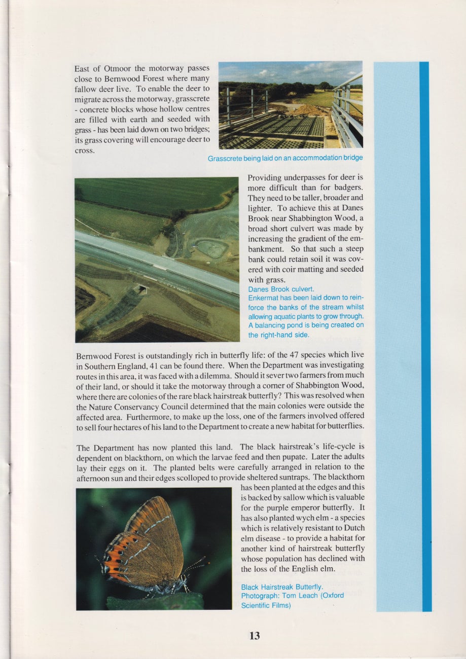
East of Otmoor the motorway passes close to Bernwood Forest where many fallow deer live. To enable the deer to migrate across the motorway, grasscrete - concrete blocks whose hollow centres are filled with earth and seeded with grass - has been laid down on two bridges; its grass covering will encourage deer to cross.
Providing underpasses for deer is more difficult than for badgers. They need to be taller, broader and lighter. To achieve this at Danes Brook near Shabbington Wood, a broad short culvert was made by increasing the gradient of the embankment. So that such a steep bank could retain soil it was covered with coir matting and seeded with grass.
Bernwood Forest is outstandingly rich in butterfly life: of the 47 species which live in Southern England, 41 can be found there. When the Department was investigating routes in this area, it was faced with a dilemma. Should it sever two farmers from much of their land, or should it take the motorway through a corner of Shabbington Wood, where there are colonies of the rare black hairstreak butterfly? This was resolved when the Nature Conservancy Council determined that the main colonies were outside the affected area. Furthermore, to make up the loss, one of the farmers involved offered to sell four hectares of his land to the Department to create a new habitat for butterflies.
The Department has now planted this land. The black hairstreak's life-cycle is dependent on blackthorn, on which the larvae feed and then pupate. Later the adults lay their eggs on it. The planted belts were carefully arranged in relation to the afternoon sun and their edges scolloped to provide sheltered suntraps. The blackthorn has been planted at the edges and this is backed by sallow which is valuable for the purple emperor butterfly. It has also planted wych elm - a species which is relatively resistant to Dutch elm disease - to provide a habitat for another kind of hairstreak butterfly whose population has declined with the loss of the English elm.
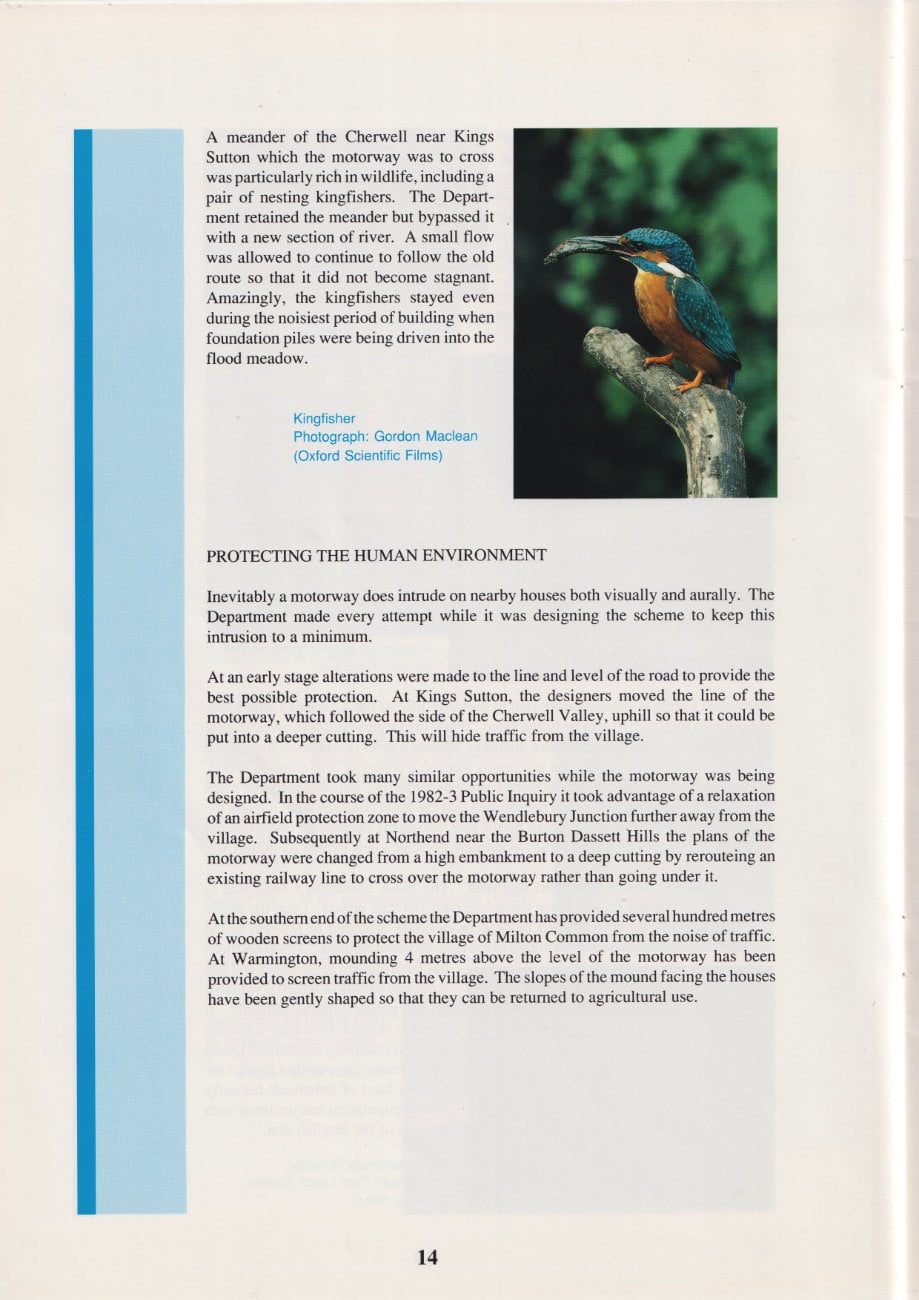
A meander of the Cherwell near Kings Sutton which the motorway was to cross was particularly rich in wildlife, including a pair of nesting kingfishers. The Department retained the meander but bypassed it with a new section of river. A small flow was allowed to continue to follow the old route so that it did not become stagnant. Amazingly, the kingfishers stayed even during the noisiest period of building when foundation piles were being driven into the flood meadow.
Protecting the human environment
Inevitably a motorway does intrude on nearby houses both visually and aurally. The Department made every attempt while it was designing the scheme to keep this intrusion to a minimum.
At an early stage alterations were made to the line and level of the road to provide the best possible protection. At Kings Sutton, the designers moved the line of the motorway, which followed the side of the Cherwell Valley, uphill so that it could be put into a deeper cutting. This will hide traffic from the village.
The Department took many similar opportunities while the motorway was being designed. In the course of the 1982-3 Public Inquiry it took advantage of a relaxation of an airfield protection zone to move the Wendlebury Junction further away from the village. Subsequently at Northend near the Burton Dassett Hills the plans of the motorway were changed from a high embankment to a deep cutting by rerouting an existing railway line to cross over the motorway rather than going under it.
At the southern end of the scheme the Department has provided several hundred metres of wooden screens to protect the village of Milton Common from the noise of traffic. At Warmington, mounding 4 metres above the level of the motorway has been provided to screen traffic from the village. The slopes of the mound facing the houses have been gently shaped so that they can be returned to agricultural use.
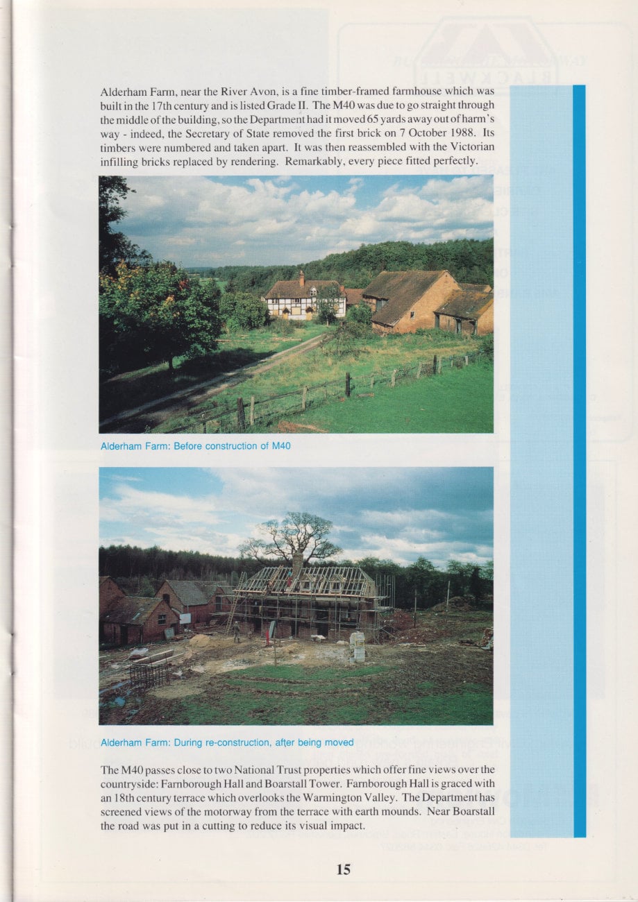
Alderham Farm, near the River Avon, is a fine timber-framed farmhouse which was built in the 17th century and is listed Grade II. The M40 was due to go straight through the middle of the building, so the Department had it moved 65 yards away out of harm's way - indeed, the Secretary of State removed the first brick on 7 October 1988. Its timbers were numbered and taken apart. It was then reassembled with the Victorian infilling bricks replaced by rendering. Remarkably, every piece fitted perfectly.
The M40 passes close to two National Trust properties which offer fine views over the countryside: Farnborough Hall and Boarstall Tower. Farnborough Hall is graced with an 18th century terrace which overlooks the Warmington Valley. The Department has screened views of the motorway from the terrace with earth mounds. Near Boarstall the road was put in a cutting to reduce its visual impact.
Advertisements
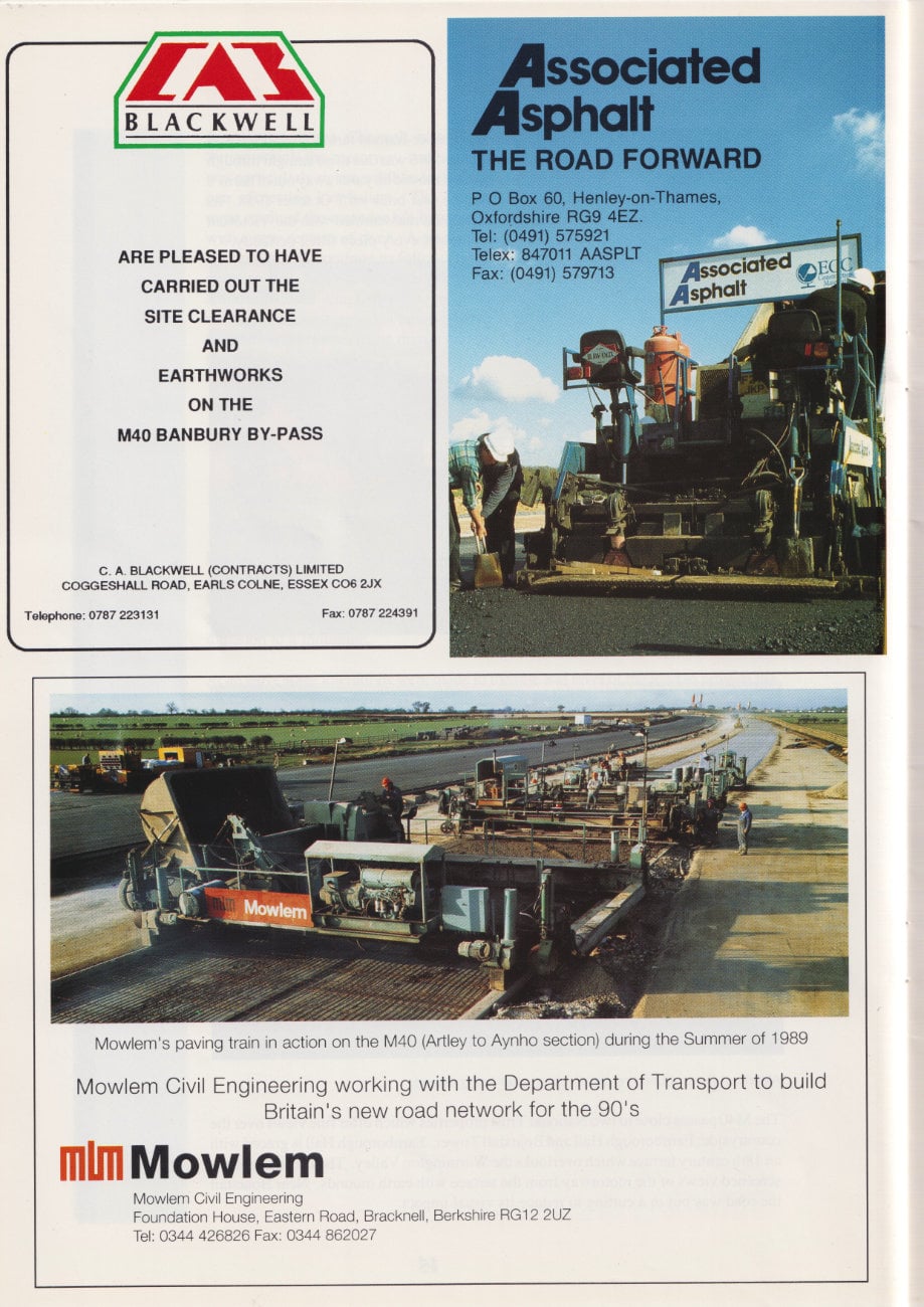
BLACKWELL are pleased to have carried out the site clearance and earthworks on the M40 Banbury By-Pass.
ASSOCIATED ASPHALT: THE ROAD FORWARD
Mowlem Civil Engineering: working with the Department of Transport to build Britain's new road network for the 90's.
Building the motorway
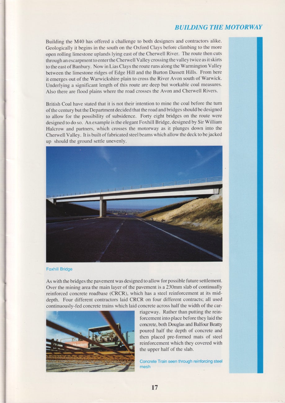
Building the M40 has offered a challenge to both designers and contractors alike. Geologically it begins in the south on the Oxford Clays before climbing to the more open rolling limestone uplands lying east of the Cherwell River. The route then cuts through an escarpment to enter the Cherwell Valley crossing the valley twice as it skirts to the east of Banbury. Now in Lias Clays the route runs along the Warmington Valley between the limestone ridges of Edge Hill and the Burton Dassett Hills. From here it emerges out of the Warwickshire plain to cross the River Avon south of Warwick. Underlying a significant length of this route are deep but workable coal measures. Also there are flood plains where the road crosses the Avon and Cherwell Rivers.
British Coal have stated that it is not their intention to mine the coal before the turn of the century but the Department decided that the road and bridges should be designed to allow for the possibility of subsidence. Forty eight bridges on the route were designed to do so. An example is the elegant Foxhill Bridge, designed by Sir William Halcrow and partners, which crosses the motorway as it plunges down into the Cherwell Valley. It is built of fabricated steel beams which allow the deck to be jacked up should the ground settle unevenly.
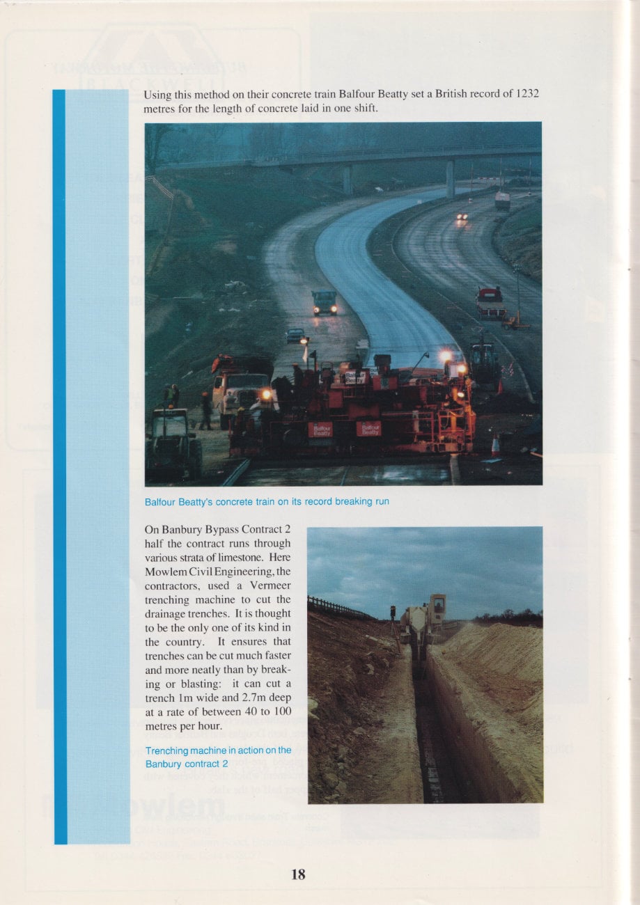
As with the bridges the pavement was designed to allow for possible future settlement. Over the mining area the main layer of the pavement is a 230mm slab of continually reinforced concrete roadbase (CRCR), which has a steel reinforcement at its mid-depth. Four different contractors laid CRCR on four different contracts; all used continuousIv-fed concrete trains which laid concrete across half the width of the carriageway. Rather than putting the reinforcement into place before they laid the concrete, both Douglas and Balfour Beatty poured half the depth of concrete and then placed pre-formed mats of steel reinforcement which they covered with the upper half of the slab.
Using this method on their concrete train Balfour Beatty set a British record of 1232 metres for the length of concrete laid in one shift.
On Banbury Bypass Contract 2 half the contract runs through varions strata of limestone. Here Mowlem Civil Engineering, the contractors, used a Vermeer trenching machine to cut the drainage trenches. It is thought to be the only one of its kind in the country. It ensures that trenches can be cut much faster and more neatly than by breaking or blasting: it can cut a trench 1m wide and 2.7m deep at a rate of between 40 to 100 metres per hour.
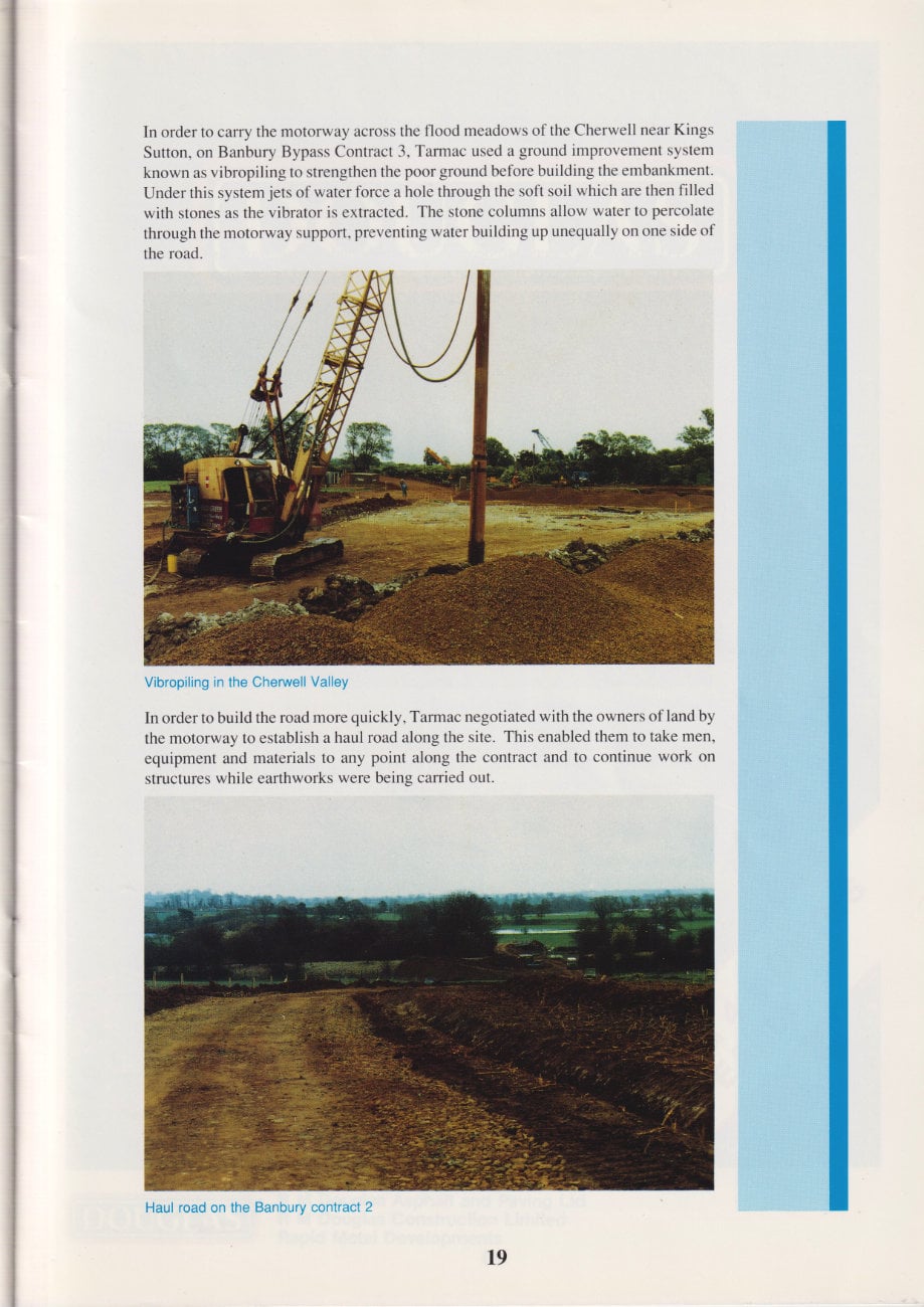
In order to carry the motorway across the flood meadows of the Cherwell near Kings Sutton, on Banbury Bypass Contract 3, Tarmac used a ground improvement system known as vibropiling to strengthen the poor ground before building the embankment. Under this system jets of water force a hole through the soft soil which are then filled with stones as the vibrator is extracted. The stone columns allow water to percolate through the motorway support, preventing water building up unequally on one side of the road.
In order to build the road more quickly, Tarmac negotiated with the owners of land by the motorway to establish a haul road along the site. This enabled them to take men, equipment and materials to any point along the contract and to continue work on structures while earthworks were being carried out.
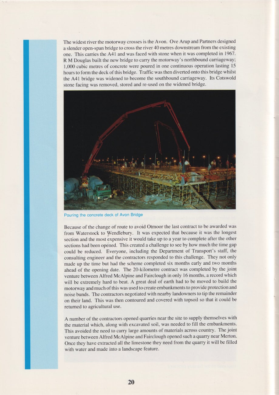
The widest river the motorway crosses is the Avon. Ove Arup and Partners designed a slender open-span bridge to cross the river 40 metres downstream from the existing one. This carries the A41 and was faced with stone when it was completed in 1967. R M Douglas built the new bridge to carry the motorway's northbound carriageway; 1,000 cubic metres of concrete were poured in one continuous operation lasting 15 hours to form the deck of this bridge. Traffic was then diverted onto this bridge whilst the A41 bridge was widened to become the southbound carriageway. Its Cotswold stone facing was removed, stored and re-used on the widened bridge.
Because of the change of route to avoid Otmoor the last contract to be awarded was from Waterstock to Wendlebury. It was expected that because it was the longest section and the most expensive it would take up to a year to complete after the other sections had been opened. This created a challenge to see by how much the time gap could be reduced. Everyone, including the Department of Transport's staff, the consulting engineer and the contractors responded to this challenge. They not only made up the time but had the scheme completed six months early and two months ahead of the opening date. The 20-kilometre contract was completed by the joint venture between Alfred McAlpine and Fairclough in only 16 months, a record which will be extremely hard to beat. A great deal of earth had to be moved to build the motorway and much of this was used to create embankments to provide protection and noise bunds. The contractors negotiated with nearby landowners to tip the remainder on their land. This was then contoured and covered with topsoil so that it could be returned to agricultural use.
A number of the contractors opened quarries near the site to supply themselves with the material which, along with excavated soil, was needed to fill the embankments. This avoided the need to carry large amounts of materials across country. The joint venture between Alfred McAlpine and Fairclough opened such a quarry near Merton. Once they have extracted all the limestone they need from the quarry it will be filled with water and made into a landscape feature.
Advertisement
DOUGLAS
Main contractor for the 20km Warwick South and Gaydon sections. Opening 4 months early.
Archaeology
Surveys to determine the location of any archaeological sites were undertaken during the planning of the M40 so that as far as possible they could be avoided. Inevitably, with such a large project and many other priorities to consider, it was not possible to avoid all the sites. Some other previously unknown sites were uncovered during construction. Both professional and amateur archaeologists worked to record, investigate and excavate these sites including the County archaeologists of four counties.
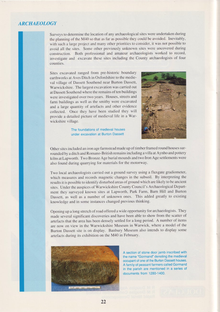
Sites excavated ranged from pre-historic boundary earthworks at Aves Ditch in Oxfordshire to the medieval village of Dassett Southend near Burton Dassett, Warwickshire. The largest excavation was carried out at Dassett Southend where the remains of ten buildings were investigated over two years. Houses, streets and farm buildings as well as the smithy were excavated and a large quantity of artetacts and other evidence collected. Once they have been studied they will provide a detailed picture of medieval life in a Warwickshire village.
Other sites included an iron age farmstead made up of timber framed round houses surrounded by a ditch and Romano-British remains including a villa at Aynho and pottery kilns at Lapworth. Two Bronze Age burial mounds and two Iron Age settlements were also found during quarrying for materials for the motorway.
Two local archaeologists carried out a ground survey using a fluxgate gradiometer, which measures and records magnetic changes in the subsoil. By interpreting the results it is possible to identify disturbed areas of ground which are likely to be ancient sites. Under the auspices of Warwickshire County Council's Archaeological Department they surveyed known sites at Lapworth, Park Farm, Barn Hill and Burton Dassett, as well as a number of unknown ones. This added greatly to existing knowledge and in some instances changed previous thinking.
Opening up a long stretch of road offered a wide opportunity for archaeologists. They made several significant discoveries and have been able to show from the scatter of artefacts that the area has been densely settled for a long period. A number of items are now on view in the Warwickshire Museum in Warwick, where a model of the Burton Dassett site is on display. Banbury Museum also intends to display some artefacts during its exhibition on the M40 in February.
Advertisement
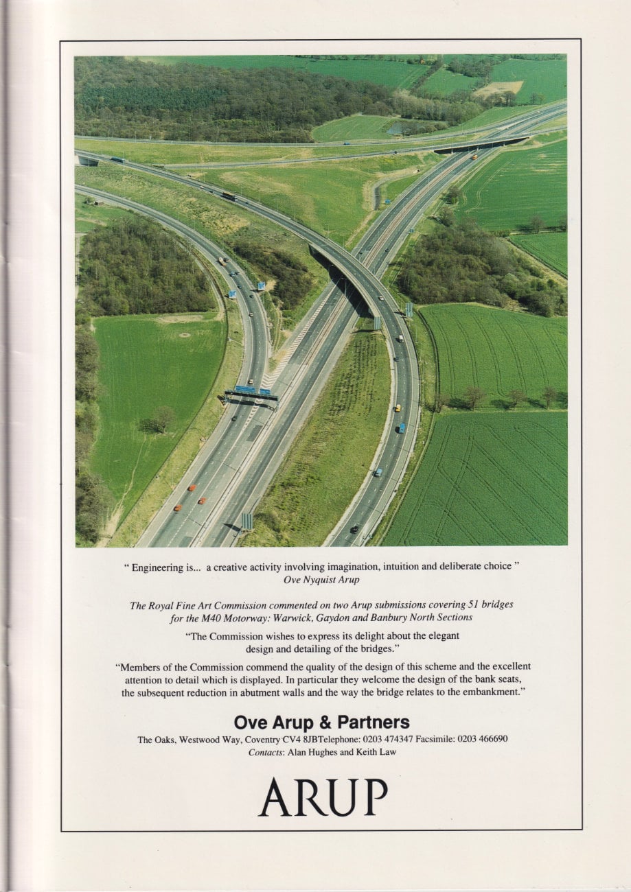
"Engineering is... a creative activity involving imagination, intuition and deliberate choice" - Ove Nyquist Arup
The Royal Fine Art Commission commented on two Arup submissions covering 51 bridges for the M40 Motorway: Warwick, Gaydon and Banbury North sections.
"The Commission wishes to express its delight about the elegant design and detailing of the bridges."
"Members of the Commission commend the quality of the design of this scheme and the excellent attention to detail which is displayed. In particular they welcome the design of the bank seats, the subsequent reduction in abutment walls and the way the bridge relates to the embankment."
Ove Arup & Partners
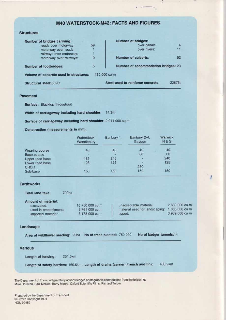
M40 Waterstock-M42: facts and figures
Structures
- Number of bridges carrying:
- roads over motorway: 59
- motorway over roads: 1
- railways over motorway: 1
- motorway over railways: 9
- Number of footbridges: 5
- Number of bridges:
- over canals: 4
- over rivers: 11
- Number of culverts: 92
- Number of accommodation bridges: 23
- Volume of concrete used in structures: 180,000 cu m
- Structural steel: 6,026 t
- Steel used to reinforce concrete: 22,876 t
Pavement
- Surface: blacktop throughout
- Width of carriageway including hard shoulder: 14.3m
- Surface of carriageway including hard shoulder: 2,911,000 sq m
Construction (measurements in mm):
| Waterstock-Wendlebury | Banbury 1 | Banbury 2-4, Gaydon | Warwick N & S | |
|---|---|---|---|---|
| Wearing course | 40 | 40 | 40 | 40 |
| Base course | - | - | 60 | 60 |
| Upper road base | 185 | 245 | - | 240 |
| Lower road base | 125 | 125 | - | 125 |
| CRCR | - | - | 230 | - |
| Sub-base | 150 | 150 | 150 | 150 |
Earthworks
- Total land take: 700ha
- Amount of material:
- excavated: 10,750,000 cu m
- used in embankments: 5,761,000 cu m
- imported material: 3,178,000 cu m
- unacceptable material: 2,880,000 cu m
- material used for landscaping: 1,385,000 cu m
- tipped: 3,939,000 cu m
Landscape
- Area of wildflower seeding: 22ha
- No. of trees planted: 750,000
- No. of badget tunnels: 14
Various
- Length of fencing: 251.5km
- Length of safety barriers: 160.6km
- Length of drains (carrier, French and fin): 403.9km