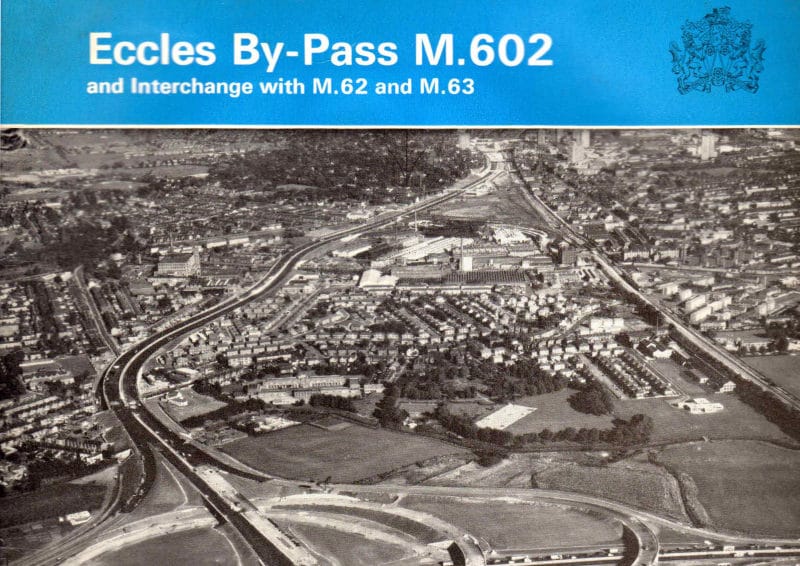
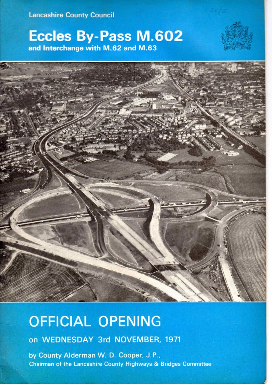
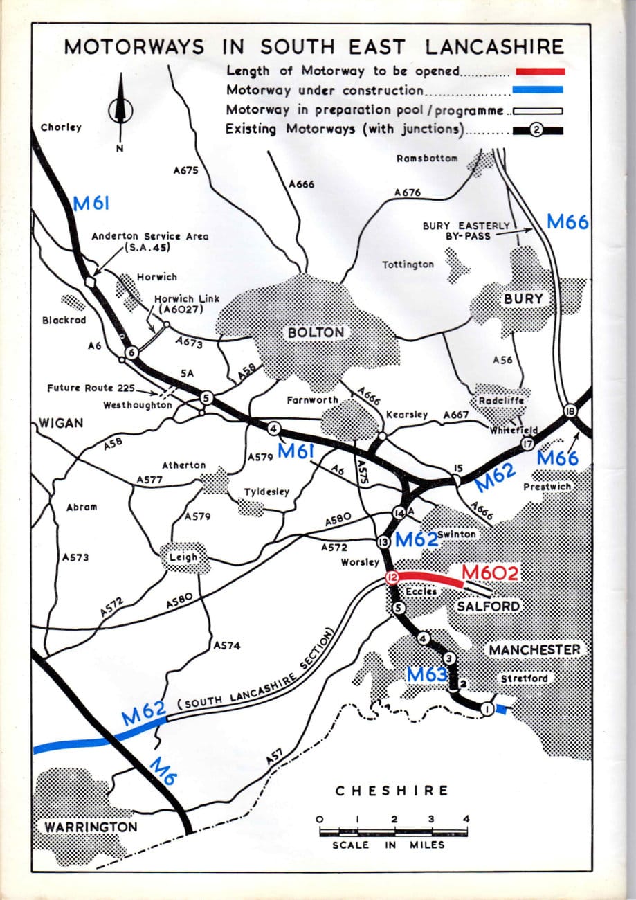
Back in the 1960s, Greater Manchester - then usually referred to as "SELNEC", a clunky agglomeration of "South East Lancashire and North East Cheshire" - had grand ambitions for an urban motorway network serving the twin cities of Manchester and Salford and their numerous satellite towns. The routes proposed in the 1962 SELNEC Highway Plan were so numerous that the Ministry of Transport didn't think there were enough vacant motorway numbers to go around.
It was this realisation that caused the agreement that Manchester (and, later, other cities) could use three-digit motorway numbers. And that, in turn, led to this route in the west of the urban area losing its original number of M64. By the time it opened it had become the M602.
Most of Manchester's urban motorway network never happened, and there are still enough free numbers to go around, so the M602 never really needed its extra-long number. It was never joined by the planned M601 or any other three-digit motorways anywhere nearby (though there is an M606 in Bradford). The M602 itself never made it all the way in to central Manchester, and the other motorways it would have met had it been completed are mostly also missing. But here is a fine slice of 1960s optimism for what was, at that time, one of Lancashire County Council's first bold steps in attempting to build a thrilling future for Greater Manchester as a motoring metropolis.
Page 1
Page 2
Page 3
Page 4
Page 5
Page 6
Page 7
Page 8
Page 9
Page 10
Page 11
Page 12
Page 13
Page 14
Page 15
Page 16
Page 17
Page 18
Page 19
Page 20
Page 21
Page 22
Comments
It’s still there, but it’s on Old Wellington Road and the church goes by a different name now. The current owners have given it quite a striking red paint job - you can see it on Streetview.
Add new comment
Picture credits
"Eccles By-Pass M.602 and Interchange with M.62 and M.63" (1971) is Crown Copyright and subject to OGL; scans appear here courtesy of John.

New Immanuel Methodist church looks pretty radical in that picture.
I've been researching it for a good hour now and can't find any reference to it actually being built on monton road as it suggests.
Any ideas??