We often associate mass roadbuilding with the 1960s and 70s, but there was an earlier heyday of roadbuilding that sometimes gets overlooked. Between the two World Wars, major roads were built through and around our major towns and cities. Some of them are, now, so much a part of the furniture that we no longer think of them as new roads - but they form the backbone of our urban road networks in many places.
One of the biggest projects of this era was the London-Southend Road, which was a joint project with Eastern Avenue and the Woodford Spur in East London. Together, they formed a new route from Wanstead to Southend, with a branch linking to the new North Circular Road. In all more than 30 miles of road were opened as a single project. This book was published to mark the completion of all three, and to celebrate their opening by Prince Henry, son of King George V.
As the book describes, this was a far-sighted project that provided the first half of a dual carriageway, and which improved communications between London and South Essex to a degree that is scarcely imaginable today. The description of the road, and its surroundings, is quite eccentric in places, taking in the unnamed author's opinions on Essex soil and the radio listening habits of an elderly resident of a rural Essex parish.
Page 1
Page 2
Page 3
Page 4
Page 5
Page 6
Page 7
Page 8
Page 9
Page 10
Page 11
Page 12
Page 13
Page 14
Page 15
Page 16
Page 17
Page 18
Front cover
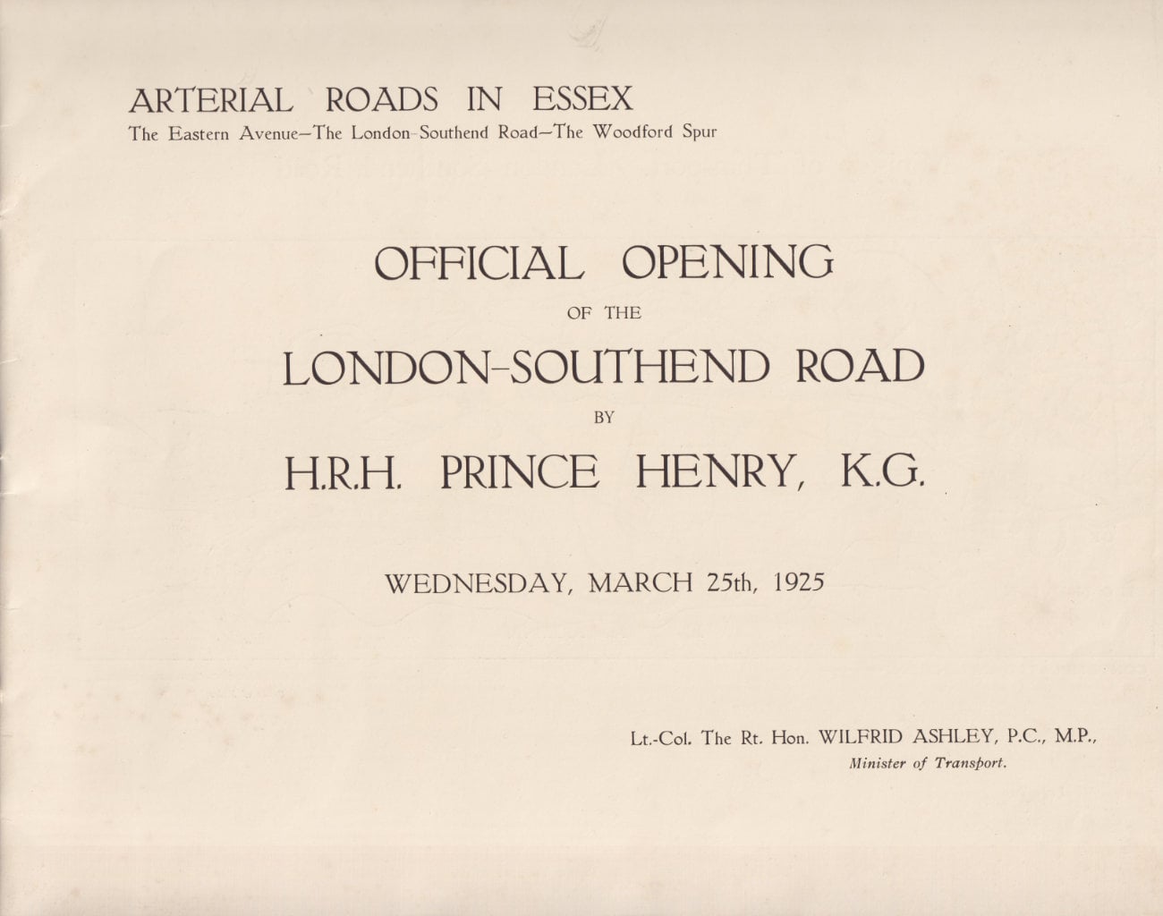
Arterial Roads in Essex
The Eastern Avenue - The London-Southend Road - The Woodford Spur
OFFICIAL OPENING OF THE LONDON-SOUTHEND ROAD BY H.R.H. PRINCE HENRY, K.G.
WEDNESDAY, MARCH 25th, 1925
Lt. Col. The Rt. Hon. WILFRID ASHLEY, P.C., M.P., Minister of Transport.
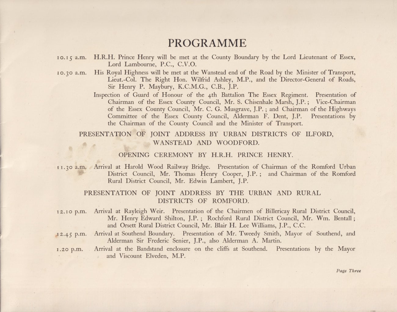
Programme
10.15 a.m. H.R.H. Prince Henry will be met at the County Boundary by the Lord Lieutenant of Essex, Lord Lambourne, P.C., C.V.O.
10.30 a.m. His Royal Highness will be met at the Wanstead end of the Road by the Minister of Transport, Lieut.-Col. The Right Hon. Wilfrid Ashley, M.P., and the Director-General of Roads, Sir Henry P. Maybury, K.C.M.G., C.B., J.P.
Inspection of Guard of Honour of the 4th Battalion The Essex Regiment. Presentation of Chairman of the Essex County Council, Mr. S. Chisenhale Marsh, J.P.; Vice-Chairman of the Essex County Council, Mr. C. G. Musgrave, J.P.; and Chairman of the Highways Committee of the Essex County Council, Alderman F. Dent, J.P. Presentations by the Chairman of the County Council and the Minister of Transport.
PRESENTATION OF JOINT ADDRESS BY URBAN DISTRICTS OF ILFORD, WANSTEAD AND WOODFORD.
OPENING CEREMONY BY H.R.H. PRINCE HENRY.
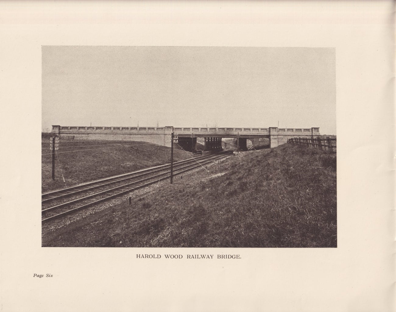
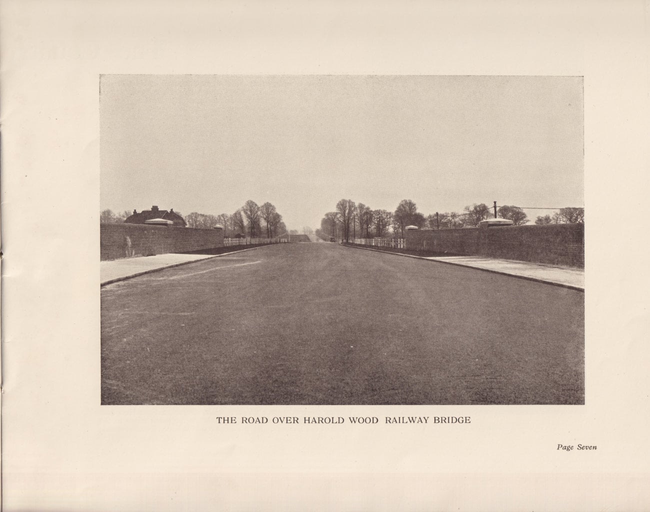
11.30 a.m. Arrival at Harold Wood Railway Bridge. Presentation of Chairman of the Romford Urban District Council, Mr. Thomas Henry Cooper, J.P.; and Chairman of the Romford Rural District Council, Mr. Edwin Lambert, J.P.
PRESENTATION OF JOINT ADDRESS BY THE URBAN AND RURAL DISTRICTS OF ROMFORD.
12.10 p.m. Arrival at Rayleigh Weir. Presentation of the Chairmen of Billericay Rural District Council, Mr. Henry Edward Shilton, J.P.; Rochford Rural District Council, Mr. Wm. Bentall; and Orsett Rural District Council, Mr. Blair H. Lee Williams, J.P., C.C.
12.45 p.m. Arrival at Southend Boundary. Presentation of Mr. Tweedy Smith, Mayor of Southend, and Alderman Sir Frederic Senier, J.P., also Alderman A. Martin.
1.20 p.m. Arrival at the Bandstand enclosure on the cliffs at Southend. Presentations by the Mayor and Viscount Elveden, M.P.
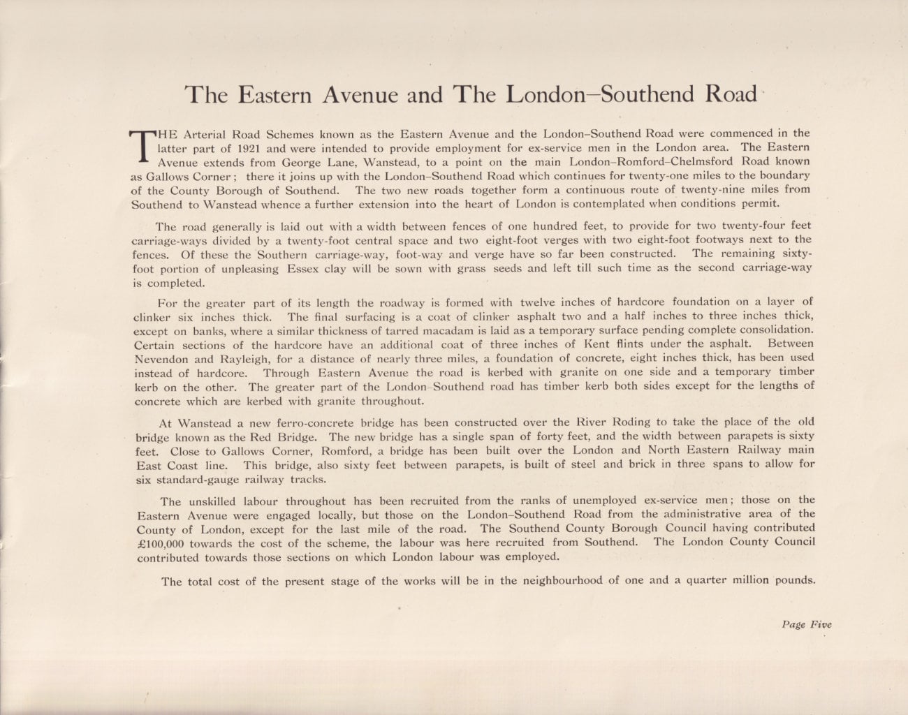
The Eastern Avenue and The London-Southend Road
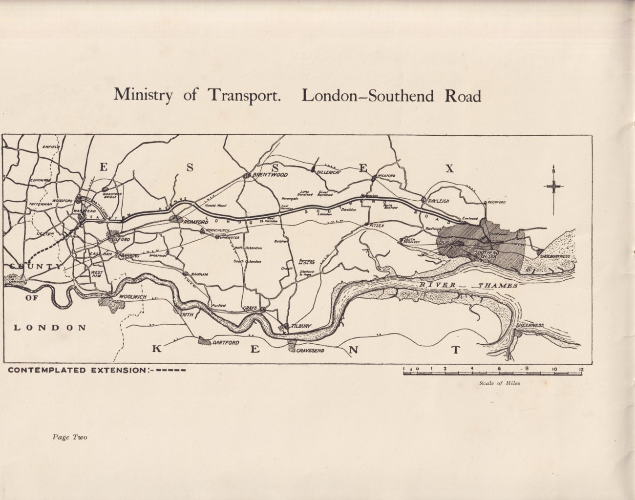
The Arterial Road Schemes known as the Eastern Avenue and the London-Southend Road were commenced in the latter part of 1921 and were intended to provide employment for ex-service men in the London area. The Eastern Avenue extends from George Lane, Wanstead, to a point on the main London-Romford-Chelmsford Road known as Gallows Corner; there it joins up with the London-Southend Road which continues for twenty-one miles to the boundary of the County Borough of Southend. The two new roads together form a continuous route of twenty-nine miles from Southend to Wanstead whence a further extension into the heart of London is contemplated when conditions permit.
The road generally is laid out with a width between fences of one hundred feet, to provide for two twenty-four feet carriage-ways divided by a twenty-foot central space and two eight-foot verges with two eight-foot footways next to the fences. Of these the Southern carriage-way, foot-way and verge have so far been constructed. The remaining sixty-foot portion of unpleasing Essex clay will be sown with grass seeds and left till such time as the second carriage-way is completed.
For the greater part of its length the roadway is formed with twelve inches of hardcore foundation on a layer of clinker six inches thick. The final surfacing is a coat of clinker asphalt two and a half inches to three inches thick except on banks, where a similar thickness of tarred macadam is laid as a temporary surface pending complete consolidation. Certain sections of the hardcore have an additional coat of three inches of Kent flints under the asphalt. Between Nevendon and Rayleigh, for a distance of nearly three miles, a foundation of concrete, eight inches thick, has been used instead of hardcore. Through Eastern Avenue the road is kerbed with granite on one side and a temporary timber kerb on the other. The greater part of the London-Southend road has timber kerb both sides except for the lengths of concrete which are kerbed with granite throughout.
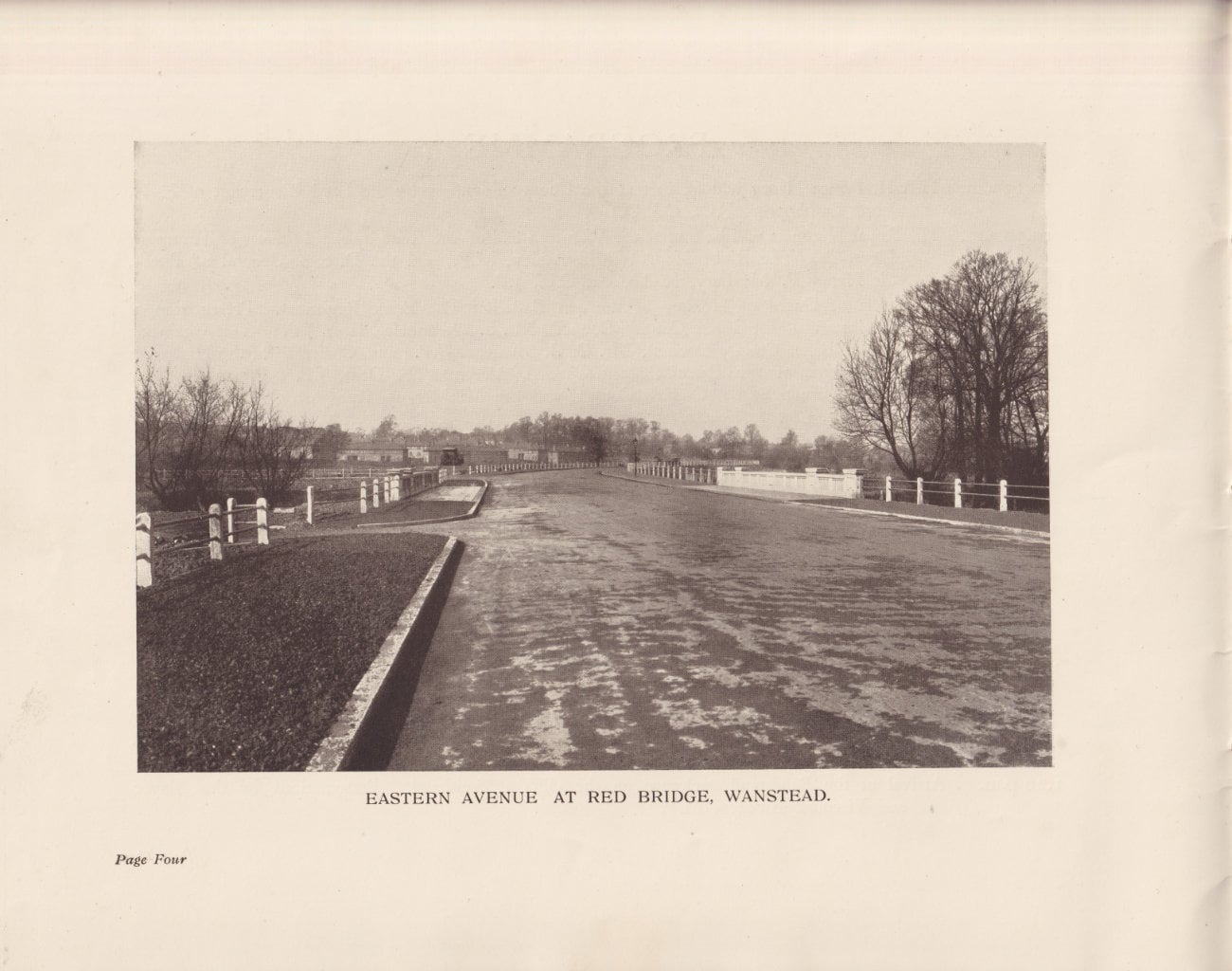
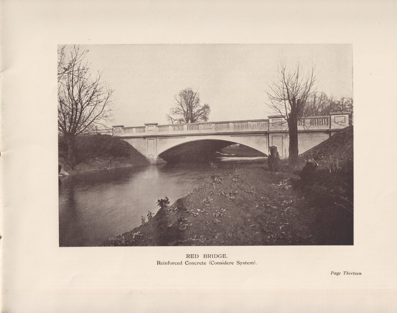
At Wanstead a new ferro-concrete bridge has been constructed over the River Roding to take the place of the old bridge known as the Red Bridge. The new bridge has a single span of forty feet, and the width between parapets is sixty feet. Close to Gallows Corner, Romford, a bridge has been built over the London and North Eastern Railway main East Coast line. This bridge, also sixty feet between parapets, is built of steel and brick in three spans to allow for six standard-gauge railway tracks.
The unskilled labour throughout has been recruited from the ranks of unemployed ex-service men; those on the Eastern Avenue were engaged locally, but those on the London-Southend Road from the administrative area of the County of London, except for the last mile of the road. The Southend County Borough Council having contributed £100,000 towards the cost of the scheme, the labour was here recruited from Southend. The London County Council contributed towards those sections on which London labour was employed.
The total cost of the present stage of the works will be in the neighbourhood of one and a quarter million pounds.
The Country of the Road
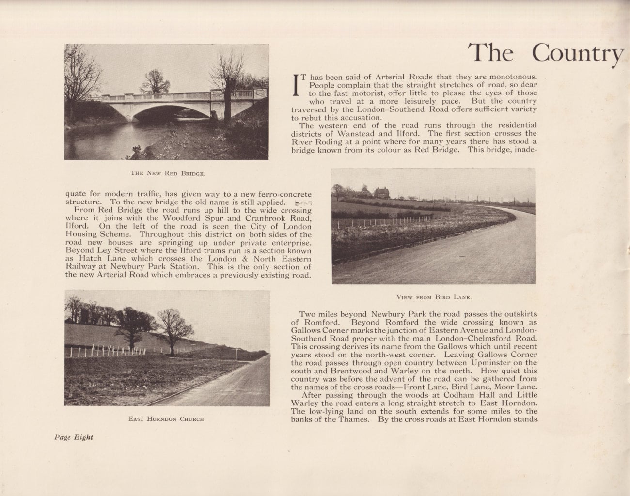
It has been said of Arterial Roads that they are monotonous. People complain that the straight stretches of road, so dear to the fast motorist, offer little to please the eyes of those who travel at a more leisurely pace. But the country traversed by the London-Southend Road offers sufficient variety to rebut this accusation.
The western end of the road runs through the residential districts of Wanstead and Ilford. The frst section crosses the River Roding at a point where for many years there has stood a bridge known from its colour as Red Bridge. This bridge, inadequate for modern traffic, has given way to a new ferro-concrete structure. To the new bridge the old name is still applied.
From Red Bridge the road runs up hill to the wide crossing where it joins with the Woodford Spur and Cranbrook Road, Ilford. On the left of the road is seen the City of London Housing Scheme. Throughout this district on both sides of the road new houses are springing up under private enterprise. Beyond Ley Street where the Ilford trams run is a section known as Hatch Lane which crosses the London & North Eastern Railway at Newbury Park Station. This is the only section of the new Arterial Road which embraces a previously existing road.
Two miles beyond Newbury Park the road passes the outskirts of Romford. Beyond Romford the wide crossing known as Gallows Corner marks the junction of Eastern Avenue and London-Southend Road proper with the main London-Chelmsford Road. This crossing derives its name from the Gallows which until recent years stood on the north-west corner. Leaving Gallows Corner the road passes through open country between Upminster on the south and Brentwood and Warley on the north. How quiet this country was before the advent of the road can be gathered from the names of the cross roads - Front Lane, Bird Lane, Moor Lane.
After passing through the woods at Codham Hall and Little Warley the road enters a long straight stretch to East Horndon. The low-lying land on the south extends for some miles to the banks of the Thames. By the cross roads at East Horndon stands an old red brick church. Its lonely position on the hill side will be relieved by the new road which traverses the parish.
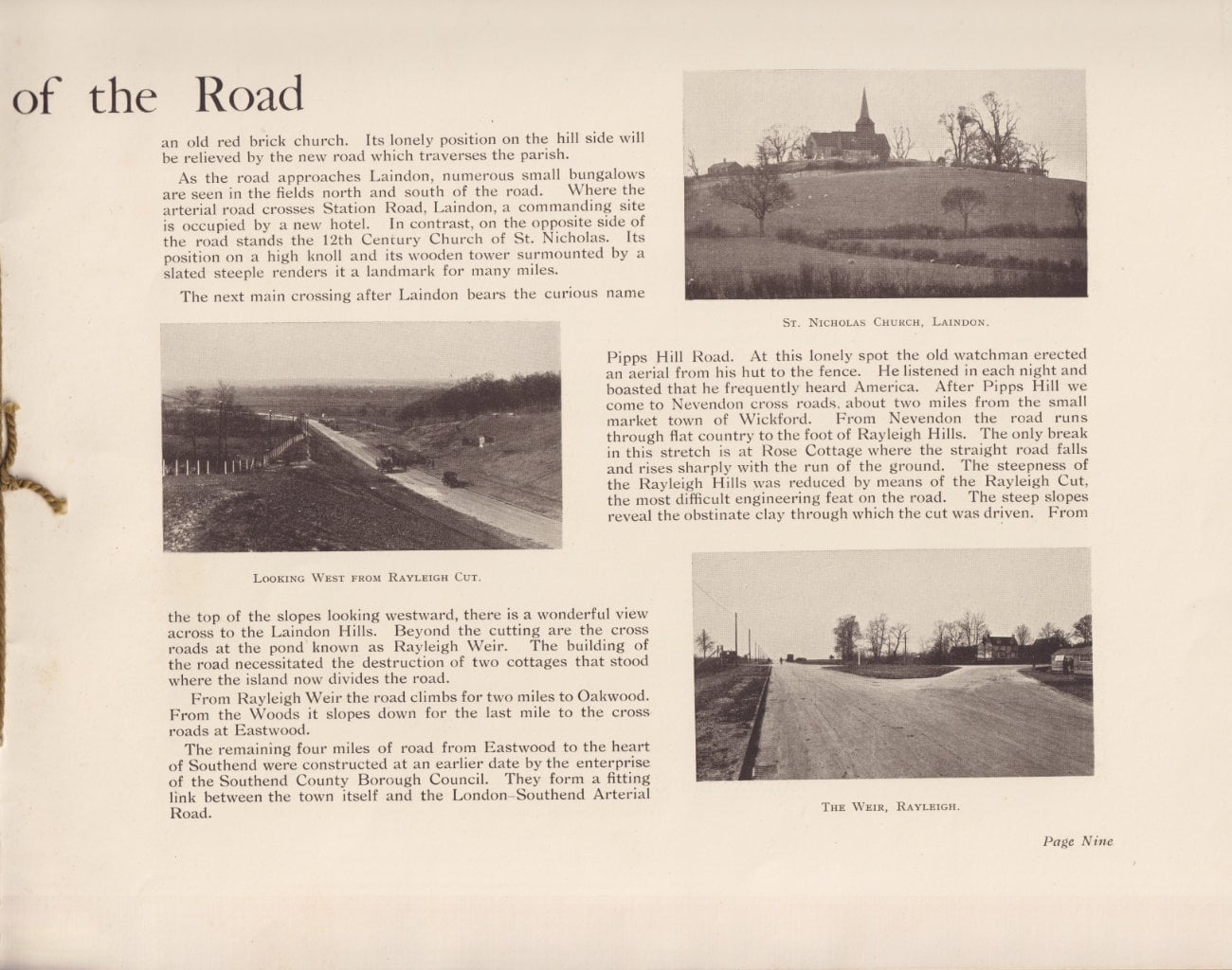
As the road approaches Laindon, numerous small bungalows are seen in the fields north and south of the road. Where the arterial road crosses Station Road, Landon, a commanding site is occupied by a new hotel. In contrast, on the opposite side of the road stands the 12th Century Church of St. Nicholas. Its position on a high knoll and its wooden tower surmounted by a slated steeple renders it a landmark for many miles.
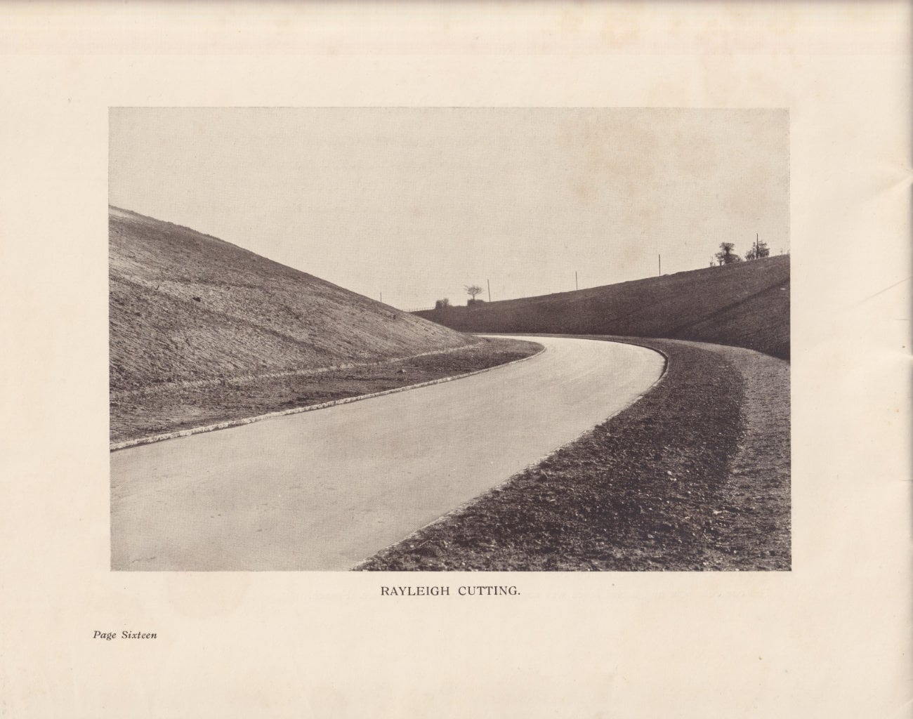
The next main crossing after Laindon bears the curious name Pipps Hill Road. At this lonely spot the old watchman erected an aerial from his hut to the fence. He listened in each night and boasted that he frequently heard America. After Pipps Hill we come to Nevendon cross roads, about two miles from the small market town of Wickford. From Nevendon the road runs through flat country to the foot of Rayleigh Hills. The only break in this stretch is at Rose Cottage where the straight road falls and rises sharply with the run of the ground. The steepness of the Rayleigh Hills was reduced by means of the Rayleigh Cut, the most difficult engineering feat on the road. The steep slopes reveal the obstinate clay through which the cut was driven. From the top of the slopes looking westward, there is a wonderful view across to the Laindon Hills. Beyond the cutting are the cross roads at the pond known as Rayleigh Weir. The building of the road necessitated the destruction of two cottages that stood where the island now divides the road.
From Rayleigh Weir the road climbs for two miles to Oakwood. From the Woods it slopes down for the last mile to the cross roads at Eastwood.
The remaining four miles of road from Eastwood to the heart of Southend were constructed at an earlier date by the enterprise of the Southend County Borough Council. They form a fitting link between the town itself and the London-Southend Arterial Road.
The Woodford Spur
At 9.45 a.m. on Wednesday, March 25th, Mrs. WINSTON CHURCHILL has kindly consented to open the Woodford Spur. The ceremony will take place at the New Railway Bridge.
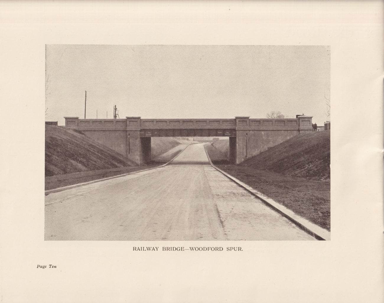
The Ilford-Woodford Road, known as the Woodford Spur, was commenced in January, 1922, and was intended to link up the London-Southend Road with the worth Circular Road round London. The length completed to date starts from Cranbrook Road, Ilford, and joins up with the main London-Epping Road at South Woodford. The extension from South Woodford to the Lea Valley Viaduct on the North Circular Road is at present in abeyance.
For the first two miles from Ilford the Spur Road is constructed on similar lines to the London-Southend Road. It is one hundred feet wide between fences to allow of two twenty-four feet carriage-ways. The northern carriage-way, footway and verge have, so far, been completed. The carriage-way foundation is of hardcore and clinker with a three inch water-bound coat of flints. The surface coat is three inches of water-bound granite to which has been added three inches of tarred macadam where the road is on embankment, and where consequently some time must elapse before entire consolidation takes place. In order to give access to the neighbouring farms these lengths have been open to traffic ever since completion.
The residential districts of Woodford and Wanstead are intersected by a suburban line of the London and North Eastern Railway Company. For a distance of six miles there is no bridge over or under this line, and traffic has been severely hampered by troublesome level crossings. This difficulty has now been solved by the construction of the last section of the Woodford Spur from Maybank Road to the High Road, Woodford. This section is in cutting throughout and passes underneath the London and North Eastern Railway line. For this reason the road is sixty feet wide overall to allow of one thirty-foot carriage-way, two seven-foot verges and two eight-foot paths. The foundation of this section of the road is nine inches of concrete, and is surfaced with three inches of tarred macadam. The gradient had to be adjusted to suit the railway bridge with the result that there is a slope of 1 in 19 from the bridge to the high road. To assist horse traffic on this gradient the width of tarred macadam is reduced and a border of granite setts six feet wide is laid on each side. The Railway Bridge is built of brick with a sixty-feet span and sixty feet wide between parapets to accommodate four standard-gauge tracks.
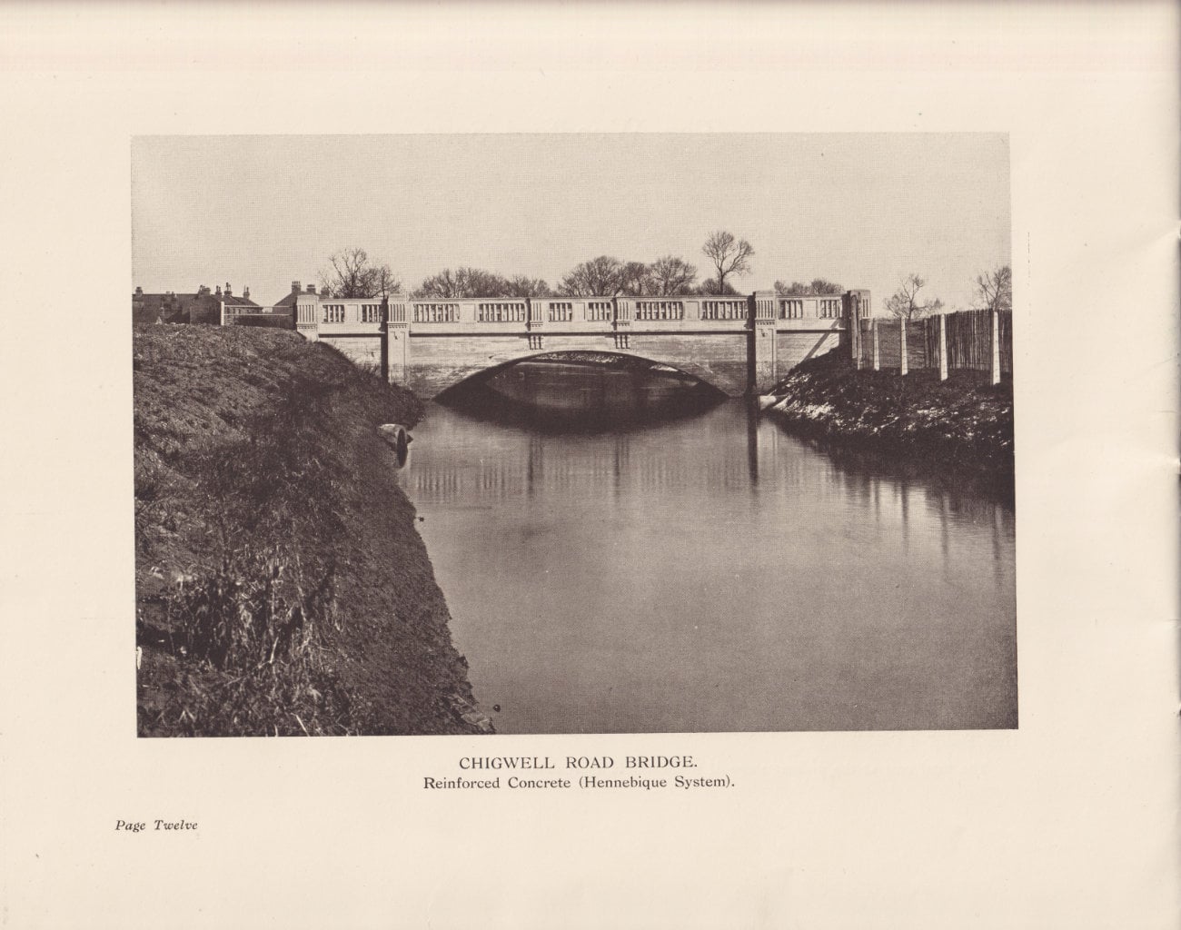
Where the Arterial Road joins the Chigwell Road the course of the River Roding ran so close to the old road as to be dangerous. The river was accordingly diverted and a ferro-concrete bridge built to carry the Arterial Road. This bridge has a forty-feet span and is sixty feet wide between parapets.
The County Boroughs of East and West Ham contributed to the cost of the Spur Road. The unskilled labour throughout was accordingly recruited from the administrative area of these Boroughs through the medium of the West Ham Board of Guardians.
The total cost at the present stage of the works is approximately £150,000.
Engineering Details
The previous routes from London to Southend were two in number. The Southern route passes through Canning Thomn, Barking, Stifford, Orsett, Stanford-le-Hope and Vange, and is about 42 miles in length. The Northern route follows the London-Colchester Main Road, through Stratford, Ilford and Brentwood, whence it diverges eastward through Billericay, Wickford and Rayleigh to Southend. The length of this route is about 43 miles. The new road offers a saving in distance of about five miles, but its main advantage lies in its easy gradients and gradual curves.
The most difficult engineering feat on the road was the construction of Rayleigh Cutting. The amount of earth excavated was approximately 170,000 cubic yards. The greatest depth of the cutting is thirty feet.
The deepest banks on the London-Southend Road are at Codham Hall Wood and Ingrebourne Valley. Codham Hall bank is 28 feet and the Ingrebourne 25 feet deep. The greatest length of embankment stretches for about one mile from the foot of Rayleigh Cutting.
On the Woodford Spur the longest cutting is 800 yards and averages 11 feet deep. The largest bank is 900 yards long and 14 feet deep at its deepest point. The construction of this bank was only rendered possible by the existence of a heap of ashes about half a mile distant. This heap containing approximately 50,000 cubic yards represented the accumulation of refuse from Ilford and district over a long period of years.
The clay soil which is general throughout Essex is very liable to slip, both in cuttings and embankment. This tendency has been aggravated by the heavy rainfall during the past twelve months. Examples of slips in embankment are found at Codham Hall and Little Warley Bank. In the case of the first named the tendency to subside was counteracted by hardcore drains driven at regular intervals down the sides of the bank. At Little Warley the field adjacent to the road also shows signs of cracking and subsidence. Here it is intended to drive a series of concrete piles to check this action and to form a buttress to the road. Where the slips have taken place in cuttings, as at Bird Lane and Rayleigh Cut, the action generally taken has been to burn the slopes of the cutting. The clay when burnt forms a red ballast which resists the tendency to movement and through which the water drains easily.
One of the main difficulties in the construction of the road has been the difficulty of access, especially with such lengths as that from Nevendon to Rayleigh. The only means of approach has been for the most part narrow country lanes.
The following figures will convey the magnitude of the task. Over 300,000 tons of hardcore alone have been used in the road. Approximately 20,000 cubic yards of flint have been transported from Kent by road or barge. During the summer of 1924 nearly three miles of concrete road were completed in three months, and over 400 tons of material were handled daily through Rayleigh on a two-feet gauge track. The Wanstead section of Eastern Avenue is built on a bank containing 35,000 cubic yards of clinker.
Personal Notes
- Minister of Transport: LT. COL. THE RT. HON. WILFRID WILLIAM ASHLEY, P.C., M.P.
- Parliamentary Secretary to the Ministry of Transport: Lt. CoL. J. T. C. MOORE-BRABAZON, D.S.O., M.P.
- Director General of Roads: SIR HENRY P. MAYBURY, K.C.M.G., C.B., J.P.
- Chief Engineer, Roads Department, Ministry of Transport: Mr. CHARLES HERBERT BRESSEY, C.B.E.
- Chief Engineer, Arterial Roads : Mr. ALFRED JONATHAN LYDDON, O.B.E., M.Inst.C.E.
- Supervising Engineer: Mr. A. P. REID.
- Resident Engineers: MESSRS. BRASSEY EDWARDS, A.M.Inst.C.E., J. A. BURNETT, A.M.Inst.C.E., G. KENYON, H. F. NAISH, H. R. SEABROOK and J. G. JEFFERY.
- Mr. J. L. French and Mr. B. C. Turner have been in charge of the work on behalf of Messrs. W. & C. French.
On Eastern Avenue and the London-Southend Road the bulk of the earthwork and road formation was executed by Messrs. Muirhead, Macdonald and Wilson, Ltd.
The Woodford Spur, Wanstead section of Eastern Avenue and the Southend section were undertaken and completed by Messrs. W. & C. French, who also carried out the hardcore and concrete road formation from Nevendon to Rayleigh and have executed all works on the entire London-Southend Road since April, 1924.
The two reinforced concrete bridges over the River Roding and the Railway Bridge at Woodford Spur were constructed by Messrs. W. & C. French; the Railway Bridge at Harold Wood was constructed by Mr. J. C. Bills, Railway Contractor.
The final surfacing of the road, consisting of clinker asphalt, was supplied and laid by Messrs. Geo. Wimpey & Co. Ltd., Messrs. Constable, Hart & Co. Ltd., and the Highways Construction, Ltd. Three sections of tarred macadam were supplied and laid by Messrs. Philip Shepherd & Co., Ltd. The tarred macadam on the Woodford Spur and Harold Wood Railway Bridge was supplied by Bristowes Tarvia, Ltd. and laid by Messrs. French.
On the London-Southend Road the concrete post and wire fence was erected by Messrs. Tidnams, Ltd., and the post and rail fence by Messrs. Quenby Fry.
The concrete post and barrel fence was supplied and erected bw Messrs. French.
Back cover
This book is presented with the compliments of Messrs. W. & C. French, Public Works Contractors, Buckhurst Hill, Essex.
