If you're not familiar with Middlesbrough, you might not be aware just how well served it is by road. There's the A19 and A66, of course, forming major through routes north-south and east-west. There's a dense grid of suburban distributor roads. And to the south, forming a sort of bypass connecting the A19 to the industrial areas east of the town, there's The Parkway, part of the A174.
It was built in the 1970s at a time when the County of Cleveland - as it was then known - was extensively regenerating the whole area, opening up swathes of land for development into modern suburban houses. Serving them was a whole new road network, of which The Parkway formed the centrepiece.
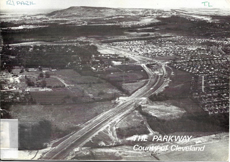
The road runs for seven miles, an expressway of extremely good and fast design, but the starry ambitions of the seventies weren't followed up as expected: at each end, the junctions are laid out for a continuation of the road, but none ever came, at least not to the same standard. All the same, the bold vision for a bright new Middlesbrough is visible in all its glory here, in the booklet published to mark the construction and opening of the initial phases.
Page 1
Page 2
Page 3
Page 4
Page 5
Page 6
Page 7
Page 8
Page 9
Page 10
Page 11
Page 12
Page 13
Page 14
Page 15
Page 16
Page 17
Page 18
Page 19
Page 20
Page 21
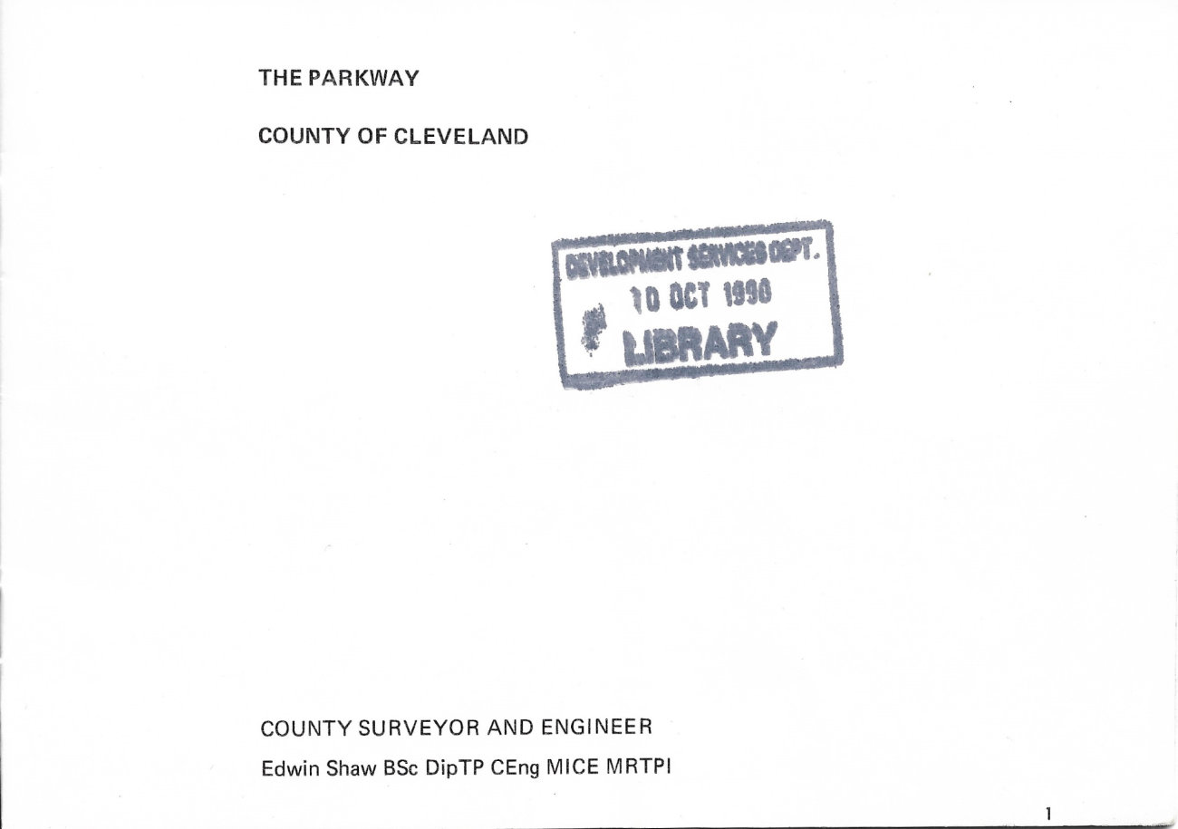
THE PARKWAY
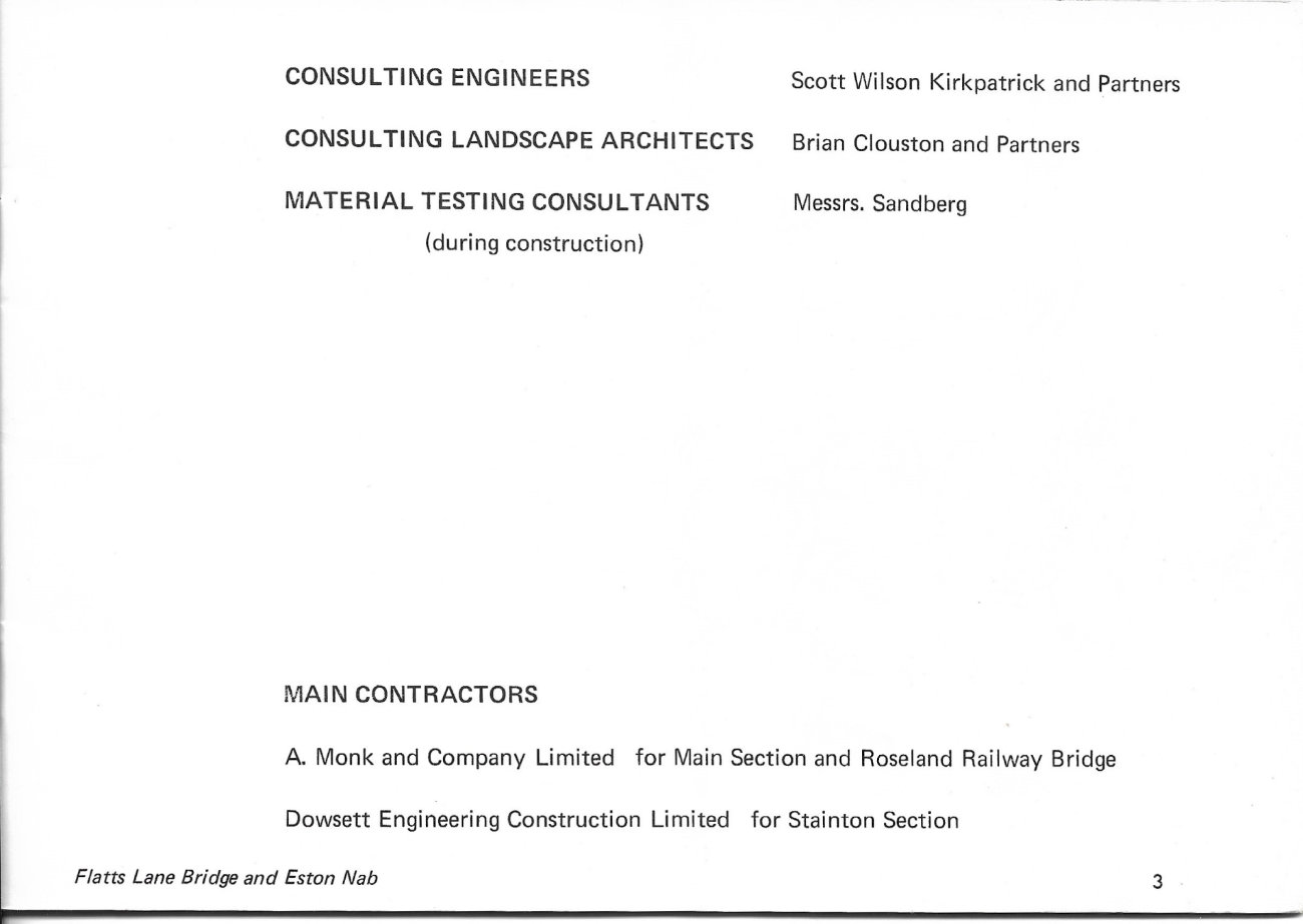
COUNTY OF CLEVELAND
- COUNTY SURVEYOR AND ENGINEER: Edwin Shaw BSc DipTP CEng MICE MRTPI
- CONSULTING ENGINEERS: Scott Wilson Kirkpatrick and Partners
- CONSULTING LANDSCAPE ARCHITECTS: Brian Clouston and Partners
- MATERIAL TESTING CONSULTANTS (during construction): Messrs. Sandberg
MAIN CONTRACTORS
- A. Monk and Company Limited for Main Section and Roseland Railway Bridge
- Dowsett Engineering Construction Limited for Stanton Section
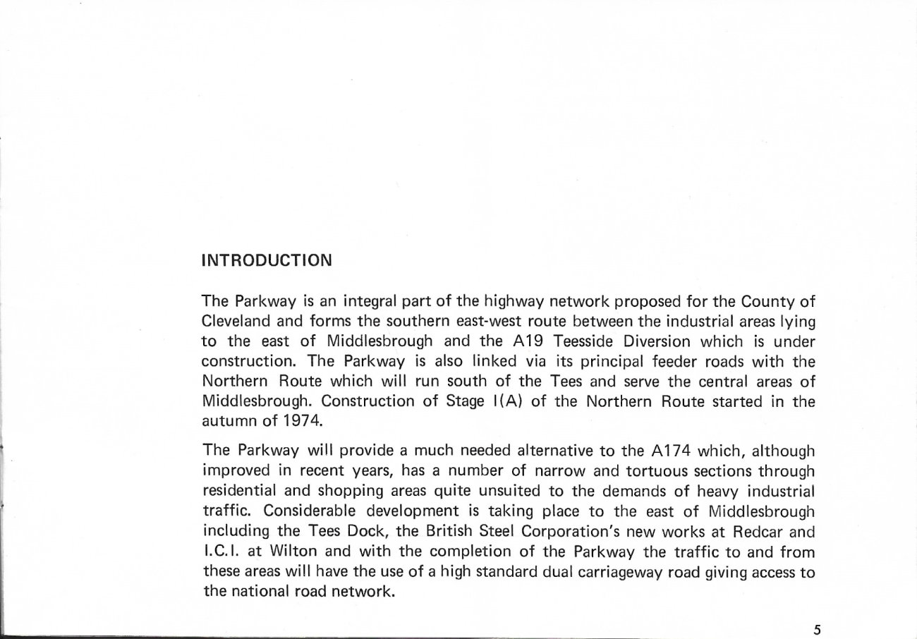
INTRODUCTION
The Parkway is an integral part of the highway network proposed for the County of Cleveland and forms the southern east-west route between the industrial areas lying to the east of Middlesbrough and the A19 Teesside Diversion which is under construction. The Parkway is also linked via its principal feeder roads with the Northern Route which will run south of the Tees and serve the central areas of Middlesbrough. Construction of Stage 1(A) of the Northern Route started in the autumn of 1974.
The Parkway will provide a much needed alternative to the A174 which, although improved in recent years, has a number of narrow and tortuous sections through residential and shopping areas quite unsuited to the demands of heavy industrial traffic. Considerable development is taking place to the east of Middlesbrough including the Tees Dock, the British Steel Corporation's new works at Redcar and I.C.I. at Wilton and with the completion of the Parkway the traffic to and from these areas will have the use of a high standard dual carriageway road giving access to the national road network.
THE PARKWAY
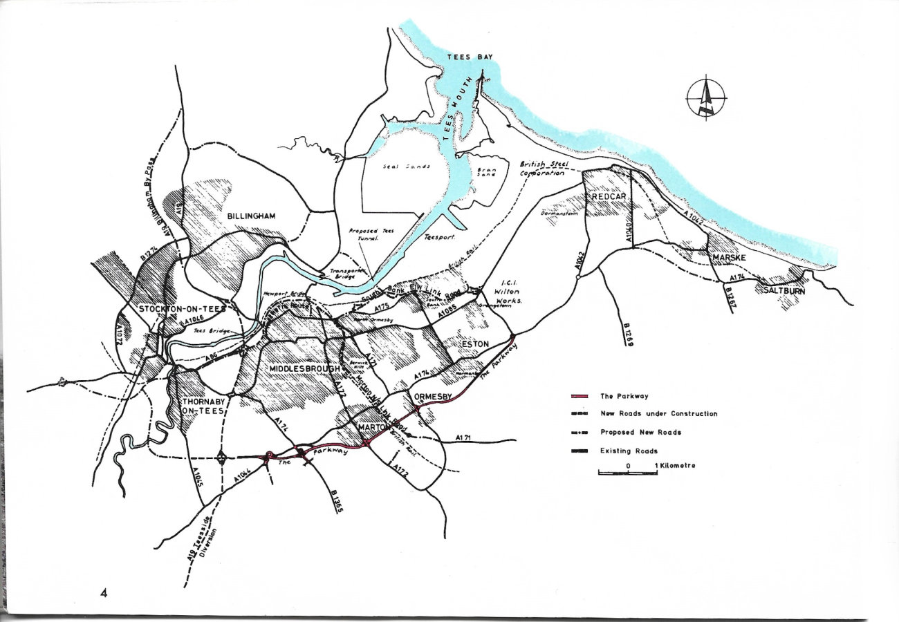
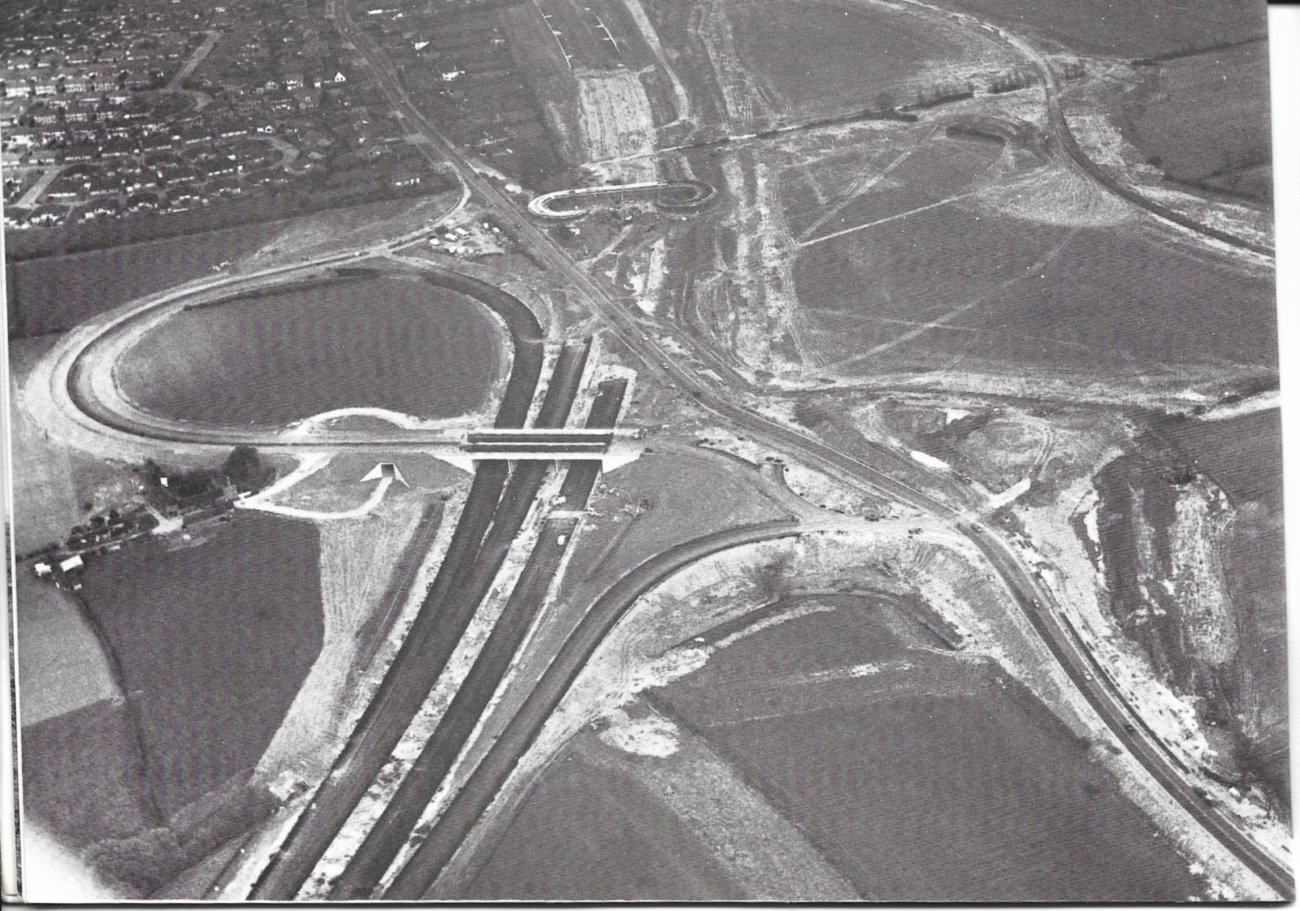
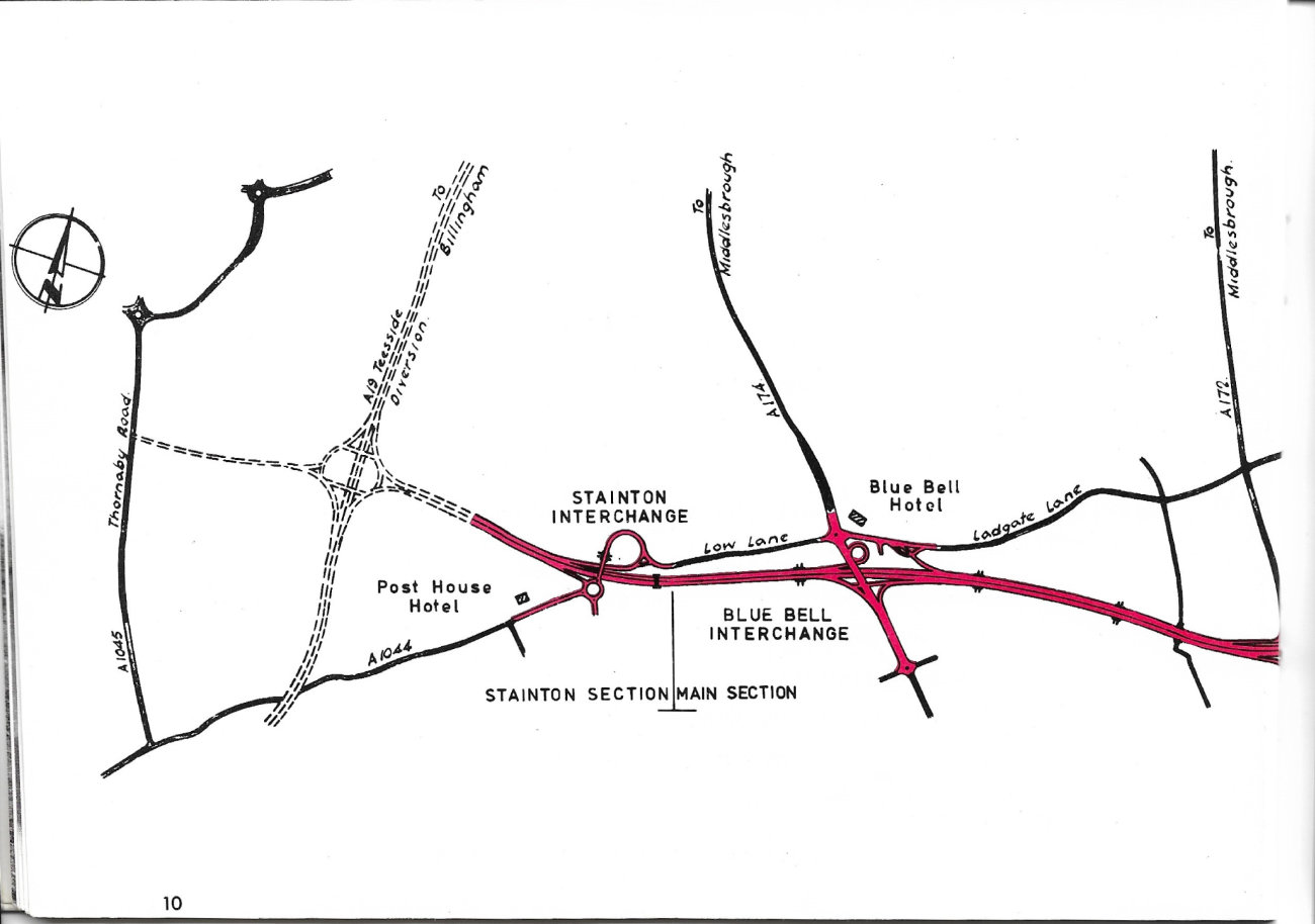
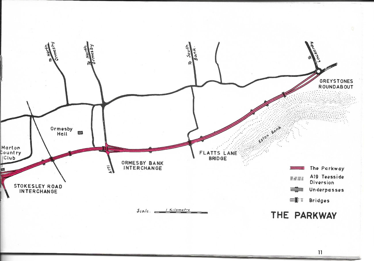
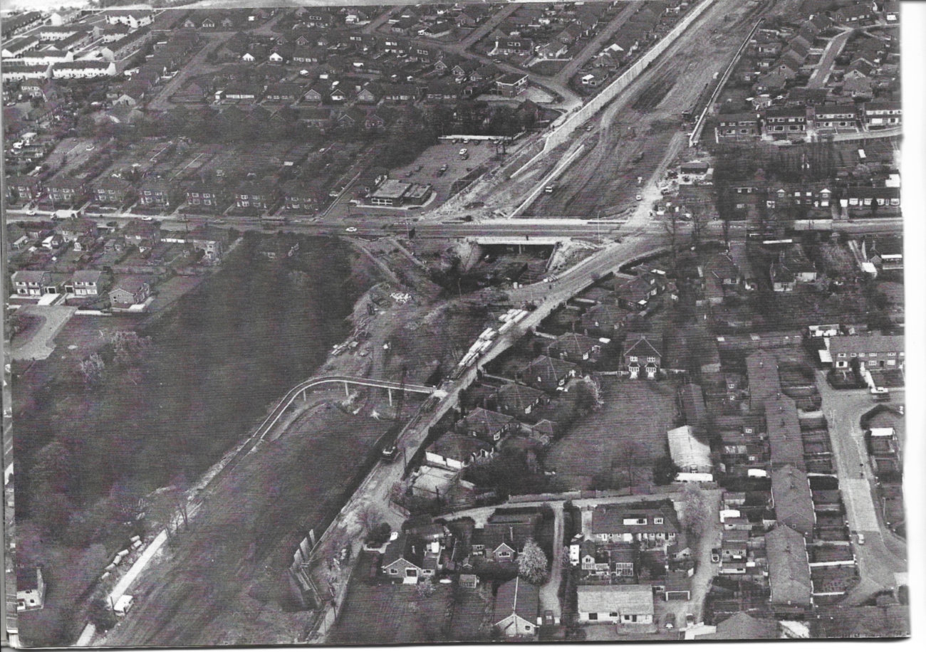
The route of the Parkway, illustrated on the map bound into the middle of this brochure, is located along the foot of the northern slopes of the Cleveland Hills and is on gently undulating sidelong ground which is dissected at irregular intervals by deep, steep sided valleys which drain to the River Tees.
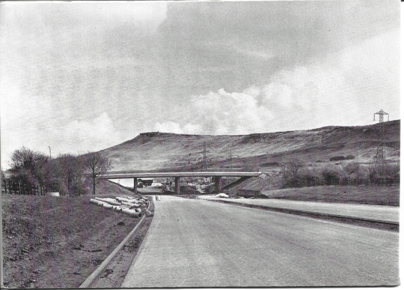
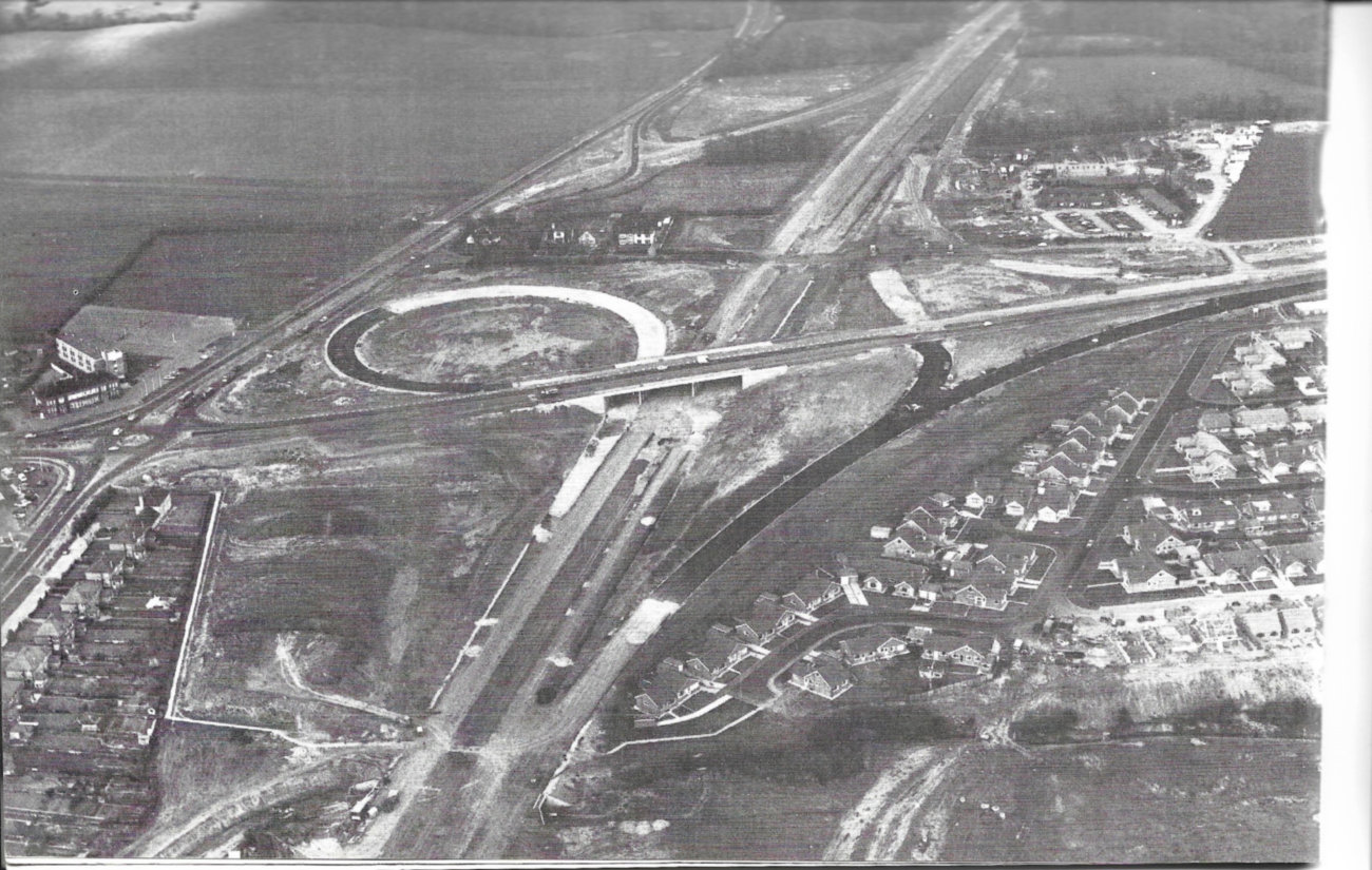
Long lengths of the Parkway are in cuttings due to the need to pass under various side roads and the Middlesbrough to Whitby railway line. Advantage has been taken of this requirement to lessen the impact of the road on adiacent residential areas. The route includes four grade separated interchanges, five road bridges and a railway bridge.
It is anticipated that the section of road west of Stokesley Road Interchange will carry the most traffic with up to 73,000 vehicles per day by the 1990's. A wide central reservation has been provided on this section which will allow widening to dual 3 lane carriageways when the traffic justifies this additional capacity.
The area south of the Parkway is rapidly being developed for residential purposes and eight underpasses and three footbridges have been provided to cater for pedestrians and also to maintain footpaths to the Eston Hills which are a popular recreational area.
Considerable thought was given to landscaping and surplus spoil has been used to provide mounding not only to improve the general appearance of the road but also wherever possible to provide screening for residential properties. Availability of land has dictated that much of this work has been concentrated in the section of the road between Ormesby Bank and Stainton Interchanges which includes most areas of new development. Tree and shrub planting will be undertaken under a separate contract in the autumn of 1976.
Although not included in the construction contracts mention must be made of the extensive double glazing which has been provided by Cleveland County Council to reduce noise problems on properties immediately adiacent to the Parkway both during construction and on completion of the road. This work was carried out in advance of Government legislation.
EXTENT OF WORKS
The works include:
- 11km of dual two lane Parkway
- 4km of side road diversions
- 4 interchanges
- 5 road bridges
- 1 railway bridge (Construction supervised by British Rail)
- 3 footbridges
- 1 farm bridge
- 2 vehicular underpasses
- 8 pedestrian underpasses
- 400m diaphragm retaining walls
- 270m R C cantilever retaining walls
- 340m mass concrete retaining walls
together with box and pipe culverts, drainage and other ancillary works
EARTHWORKS
Generally on the line of the Parkway there is a cover of 'Boulder Clay' which is a dull brown colour with traces of gravel at its base. In some sections the 'Boulder Clay' is overlain by a complicated mixture of sand, gravel and coarsely laminated silty clays.
The surface of the boulder clay is sensitive to changes in weather conditions and plant must be removed quickly after the start of rain to prevent damage. However, provided the surface is shaped to shed water quickly, drying out is fairly rapid.
DRAINAGE
Various methods of drainage are employed depending on circumstances. Generally in cuttings gullies discharge carriageway run-off into a carrier drain directly beneath a french drain and on high embankments the discharge is piped directly to open ditches.
Since much of the Parkway is in cutting, some long and large carrier drains are necessary.
In the Eston Cut, at the eastern end of the Site, artesian water conditions were encountered which affected the stability of the cutting. This was particularly critical due to the presence of the ICI Trans-Pennine Ethylene Pipeline and a high pressure gas main parallel and close to the top of the south slope.
An extensive deep drainage system to relieve the artesian pressure and a series of counterforts to drain and stabilize the cutting face were installed before the bulk of the earthworks was carried out. Subsequently the cutting was excavated without difficulty.
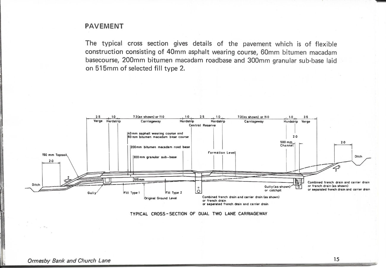
PAVEMENT
The typical cross section gives details of the pavement which is of flexible construction consisting of 40mm asphalt wearing course, 60mm bitumen macadam basecourse, 200mm bitumen macadam roadbase and 300mm granular sub-base laid on 515mm of selected fill type 2.
STRUCTURES
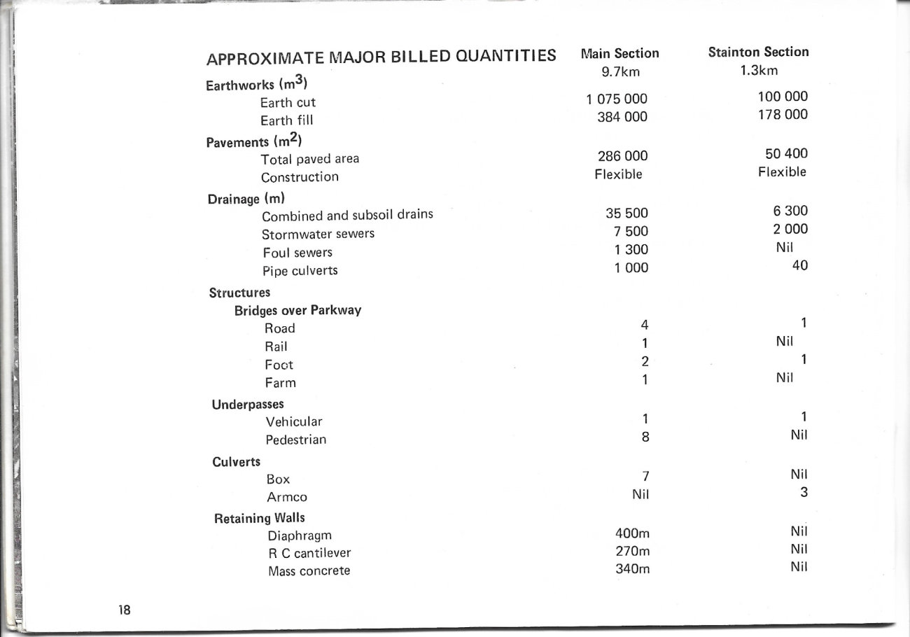
There are 36 structures including bridges, underpasses, culverts and conventional and diaphragm retaining walls sub divided as shown in the table of Approximate Major Billed Quantities.
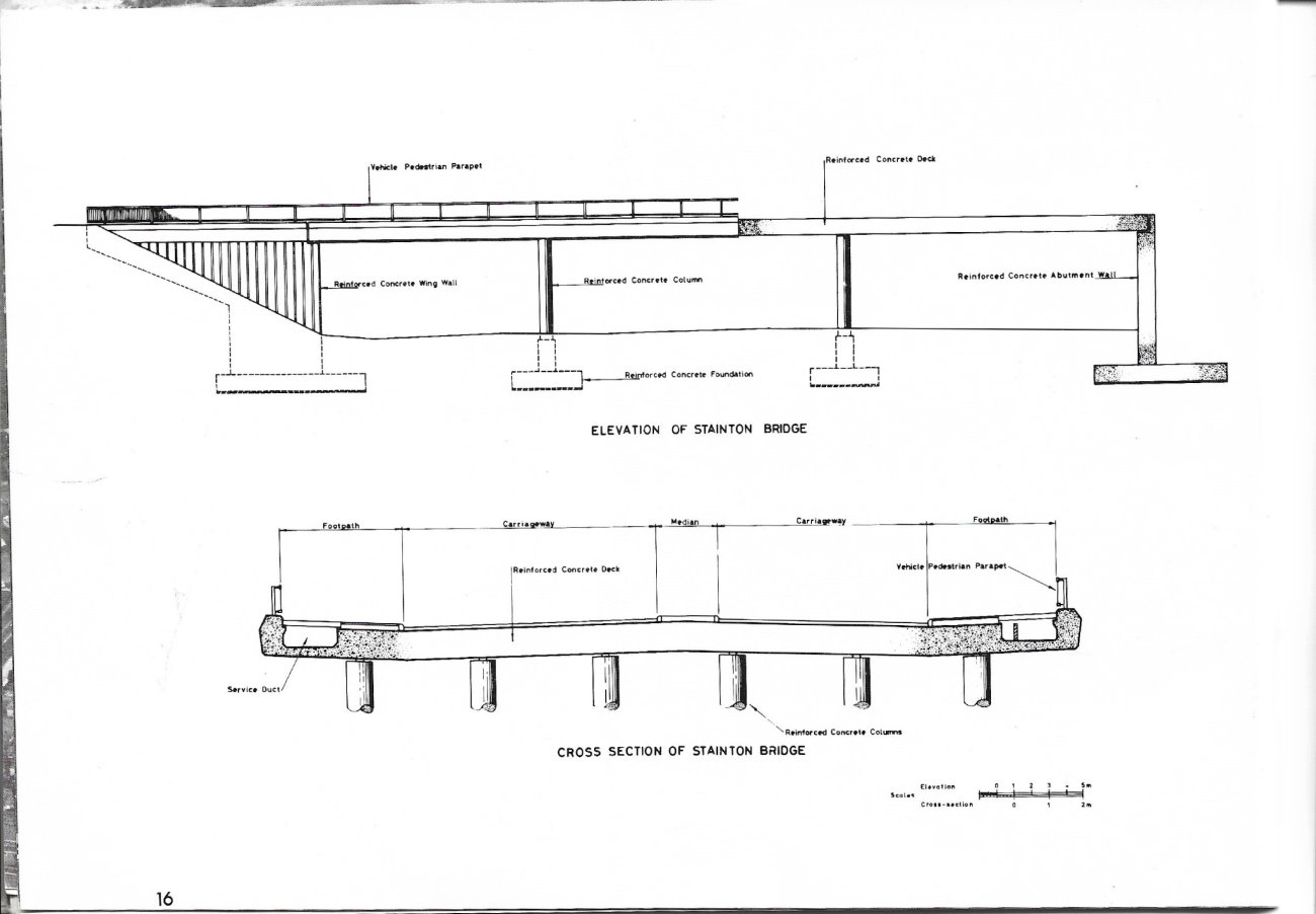
The road bridges are standardised to produce a continuity of appearance although there are variations of width, number and lengths of spans and form of abutments as required by the conditions at the various locations. The decks of the bridges sit directly on the tops of columns and the conventional capping beams have been eliminated. This treatment assists in emphasising the soffit lines of the decks. All road bridges have service ducts under the footpaths and Pylon Footbridge located in Eston Cut has a duct to carry a 15in water main and two oil filled 66kV cables plus three pilot cables.
All bridges have pad foundations on boulder clay.
The cross section of Stanton Bridge is typical of the various road bridges.
SERVICES
The works have necessitated the diversion of many large water and gas mains and overhead and underground electricity and telephone cables and services. To facilitate the works two major side road diversions were constructed by the Highway Authority to accommodate extensive temporary diversions of services prior to the award of the Contracts. Permanent diversions have been carried out by the various statutory bodies concurrently with the construction of the Parkway.
APPROXIMATE MAJOR BILLED QUANTITIES
| Main Section (9.7km) | Stainton Section (1.3km) | ||
|---|---|---|---|
| Earthworks (m³) | Earth cut | 1,075,000 | 100,000 |
| Earth fill | 384,000 | 178,000 | |
| Pavements (m²) | Total paved area | 286,000 | 50,400 |
| Construction | Flexible | Flexible | |
| Drainage (m) | Combined and subsoil drains | 35,500 | 6,300 |
| Stormwater sewers | 7,500 | 2,000 | |
| Foul sewers | 1,300 | Nil | |
| Pipe culverts | 1,000 | 40 |
Structures
| Main Section (9.7km) | Stainton Section (1.3km) | ||
|---|---|---|---|
| Bridges over Parkway | Road | 4 | 1 |
| Rail | 1 | Nil | |
| Foot | 2 | 1 | |
| Farm | 1 | Nil | |
| Underpasses | Vehicular | 1 | 1 |
| Pedestrian | 8 | Nil | |
| Culverts | Box | 7 | Nil |
| Armco | Nil | 3 | |
| Retaining Walls | Diaphragm | 400m | Nil |
| R C cantilever | 270m | Nil | |
| Mass concrete | 340m | Nil |
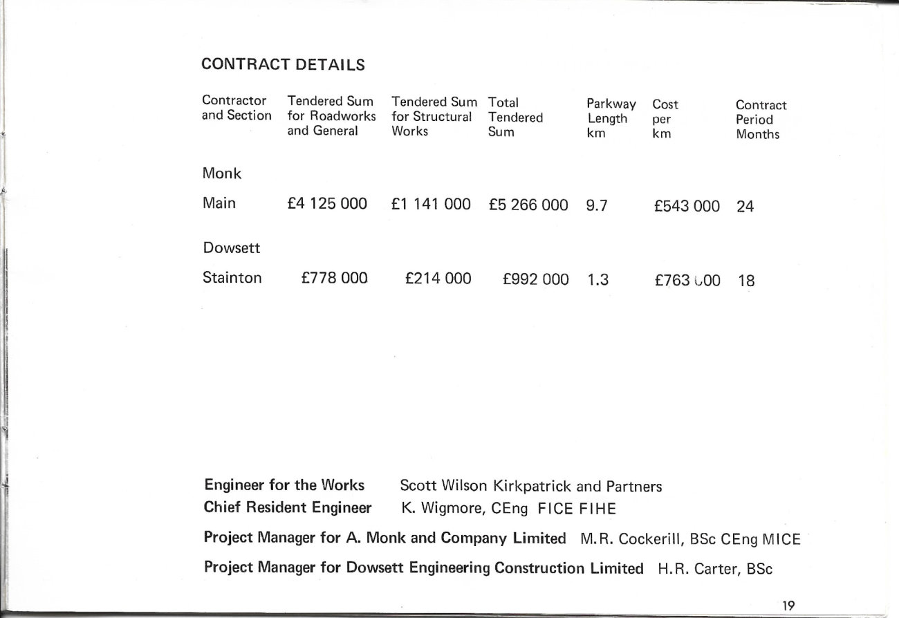
CONTRACT DETAILS
| Contractor and Section | Tendered Sum for Roadworks and General | Tendered Sum for Structural Works | Total Tendered Sum | Parkway Length km | Cost per km | Contract Period Months |
|---|---|---|---|---|---|---|
| Monk Main | £4,125,000 | £1,141,000 | £5,266,000 | 9.7 | £543,000 | 24 |
| Dowsett Stainton | £778,000 | £214,000 | £992,000 | 1.3 | £763,000 | 18 |
- Engineer for the Works: Scott Wilson Kirkpatrick and Partners
- Chief Resident Engineer: K. Wigmore, CEng FICE FIHE
- Project Manager for A. Monk and Company Limited: M.R. Cockerill, BS CEng MICE
- Project Manager for Dowsett Engineering Construction Limited: H.R. Carter, BSc
ACKNOWLEDGEMENT
The Consulting Engineers wish to thank the County Surveyor and Engineer Edwin Shaw Esq., BSc DipT CEng MICE MRTPI for his kind permission to publish this brochure.
- Brochure prepared by: Scott Wilson Kirkpatrick and Partners
- Printed by: The Basingstoke Press Limited
- Photography: Dennis Wompra Studios, Middlesbrough
Add new comment
Picture credits
- "The Parkway" was subject to Crown Copyright, now expired. Scans appear here courtesy of Paul Easby.