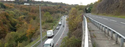
M65 Construction Photos
How do you build a motorway? If you've ever wondered how it's done, or what goes on during the years it takes to build a new road, then here's a chance to see it first hand.
The project to build the M65 between junctions 1A (Bamber Bridge, south of Preston) and 3 (Riley Green, near Blackburn) ran from 1994 to 1997, and was documented with scores of aerial photographs, taken every three months while the works were happening. That's unusual enough; what's remarkable is that you can see the full archive of 466 photographs here, and search through them to see individual structures being built and construction processes taking place as the motorway evolves.
On this page you can search through the photographs and use a map view to see the layout of the scheme and the most-photographed viewpoints. If you don't know where to start, try the highlights. You can also get to grips with the history of completing the M65, and read about the photos themselves.
This map shows the whole length of the works seen in these photographs and labels all the structures and other roads around it.
Click one of the red markers to see all pictures taken from that viewpoint. The red markers show all the most-photographed views of the construction works. These are the places where you can find a whole series of pictures showing the construction of a particular feature. Not all the photographs are found on this map: there are 86 different viewpoints in the full set, of which only the most common appear here.
Scroll this map horizontally to see the whole map
M6 interchange and Cuerden footbridge, view north
20 July 1995
Cuerden embankment, view north
20 July 1995
Cuerden embankment, view west
20 July 1995
A6 overbridge, view south west
20 July 1995
A6 overbridge, view east
20 July 1995
View west from Tramway Lane underbridge
20 July 1995
Walton Summit Motorway, looking east
20 July 1995
M61 interchange, view east
20 July 1995
M61 interchange, wide view north
20 July 1995
M61 interchange, view west
20 July 1995
M61 interchange, view east
20 July 1995
Gorton Brook culvert, view west
20 July 1995
Hill House Farm overbridge, view west
20 July 1995
Sandy Lane overbridge, view north
20 July 1995
Sandy Lane overbridge, view west
20 July 1995
View east from Sandy Lane to Marsh Lane
20 July 1995
View west from Marsh Lane to Sandy Lane
20 July 1995
View east from Marsh Lane to Leeds-Liverpool Canal
20 July 1995


