If you want to travel between South Wales and North Wales, you have two options. You can go through the middle of Wales, which ought to be the obvious option, but it's a bit hilly there and so most people take the alternative, which is to travel via England where it's a bit flatter and the roads are faster.
The road through the middle, travelling coast to coast in order to link Cardiff with Llandudno, is the A470 — the Trans-Wales Highway if you like. It's an important trunk route, receives huge investment for improvement works, and yet still — because of the geography — is extremely indirect and slow.
That's no reason not to use it though: it's also incredibly picturesque, pleasingly quiet and rather wonderfully varied. The whole drive takes about five hours, but it's well worth the ride. Below are 39 pictures giving a small flavour of the roadtrip (driven by the capable Bryn Buck) when we did the road in one shot.
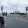
We begin in Llandudno, where this is the northern terminus of the A470. Can this be right? The road linking North and South Wales stops at a give-way line on the seafront? No signs, no fanfare? Well, according to most maps, yes — and as we're about to find, this is very much par for the course.
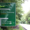
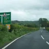
It's not far down the valley that we reach the A5 and the first real navigational test. Left at the first Give Way sign and then right again, on one of the A470's shorter attempts to share the road with another route. It's not really one road at all, you see: the A470 as it stands today is a fairly new invention, and for much of its time is actually borrowing sections of other roads.
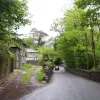
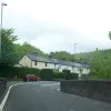
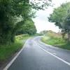
Shortly afterwards we find ourselves swooping through the woods, and in many places from here to Brecon the road doesn't look much like a trunk route. Here, it is too narrow to have a centre line for a while as we pass between a farm building and a high wall.
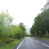
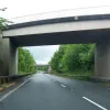
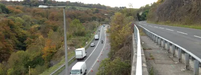
In other places, equally randomly distributed along the route — such as here, a short mile or two from the last picture — the road has been renovated quite extensively and is a very high standard single carriageway. The Welsh Assembly seems to want to do this sort of thing to the whole route. Whether that would make it a viable alternative to the motorway route through England is anyone's guess.
Welsh weather is notoriously changeable, and not far down the road in Blaenau Ffestiniog, it's foggy. In this picture the mist hangs romantically around the slate heap on the left. Actually, it's easy to mock, and I don't want to do that. Towns like Blaenau sacrificed their rural beauty centuries ago to provide for the rest of the UK, and they still bear the scars today. It seems rather churlish to mock the evidence that towns like this helped make Britain an industrial powerhouse. So I won't.
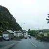
In fact let's not just do the stereotypical mid-Wales scene of rain over a slag mountain. Blaenau is in the middle of the Snowdonia National Park (though it's not part of the park — unusually there's a hole in the middle that excludes the town), and it is set in some stunning scenery. This cliff looms above the road as we pass through town.
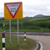
If you hadn't yet picked up the idea that the A470 is not very direct, here comes our next change of direction. At the Give Way sign ahead we turn left — round a 170-degree bend to the road at the top of that bank. Engage low gear now!
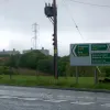
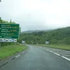
We're on our way out of the National Park now. Before we leave, the buildings in the distance are part of Trawsfynydd Nuclear Power Plant. As you can see, we've come to another Give Way line, and we turn left again, joining what used to be the A487 — and still is, to the right.
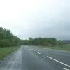
Mid-Wales is nothing if not changeable. For the next fifteen miles or so, the road is remarkably flat and straight, and very very fast. Pinch yourself! We're between Snowdonia and the Rhyader Pass and it's less hilly than Lincolnshire. Some mistake, surely?
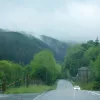
No, don't worry. We're definitely still in Wales. The fog and rain are lifting again and the wooded hills are looking damp but quite fetching.
The Dolgellau bypass provides two short bursts of dual carriageway — almost the only ones in this part of the country. To prevent us getting too excited, they have been painted down to one lane each way.
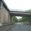
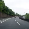
In between them we run up close to the town itself, providing a surprisingly urban bit of road, rubbing up against this chunky concrete retaining wall. Don't worry; it won't last long.
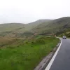
Between Dolgellau and Dinas Mawddwy, the route finds itself in this open and breathtakingly beautiful valley. Where I come from we'd call this moorland, but in Wales it probably has a different name.
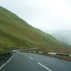
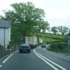
There's a bit of a mountain pass here, cutting through a low point in the hills and dropping sharply at the far side. It looks like that mist is still lingering around on the high ground. In the other direction, a line of cars followed a struggling camper van up the hill.
As the road settles into the valley, it rubs up alongside a railway line and finds itself pasing under and over it several times — often narrowing down to one lane in order to get through. This bridge crosses the river at Commins Coch, and is on the lengthy section of road borrowed from the A489.
Some more remarkably flat and straight sections of road follow, which come to a sudden and surprising stop here at Caersws. Warnings to the left of us, warnings to the right; into the valley of the Severn rode the A470. (Yes, we're joining the Severn Valley here — at the point where it flows northwards and has some considerable distance to go before it reaches even Shrewsbury).
At Llanidloes, we're in another concrete trench — which feels very peculiar after several hours' travel on wide open mountain roads. Not to worry; our next stop is Llangurig, where we join the route of the A44 to take the Rhyader Pass.
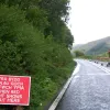
Onward to Rhyader, then, and we've now crossed the watershed to follow the Wye Valley instead. Another reminder of just how fragile this supposedly major transport artery is: the road here has collapsed into the valley, leaving traffic to negotiate the one remaining lane with a set of temporary traffic lights. Chaos, you might think, but no. There's no traffic around and we were the only car waiting in this direction.
At Rhyader itself we part ways from the A44 again; the crossroads in the town centre is the cause of a few minutes' delay and is laid out very, very oddly. Two major roads intersect here and the only one with priority is the A44 from the left. In our direction, we must Give Way; the B-road from the right is also asked to Give Way, and the A470 from the other direction is instructed to STOP. Who gets to set off first is, really, to be negotiated by the drivers.
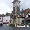
Rhyader itself is a pleasant town with a fine clock in its market square — one of several picturesque towns through which the A470 still passes, and which make this feel like a journey on which you really get to see some places rather than just going past them at speed.
Between Newbridge and Builth Wells, the road is particularly narrow and this whole section was set to be replaced by an entirely new road — visible here as a roadbed being laid out in an adjacent field. You get the impression, from driving the A470, that the Welsh Assembly would rather like to do this to the whole road eventually.
Meanwhile the A470 trundles on down this narrow road through villages and towns and through endless twists and turns — most of which are unnecessary given how uneventful the geography is on this part of the route.
At Builth Wells, delusions of grandeur as two huge petrol stations face each other across the road — between them forming "Heart of Wales Services". It's just not that sort of trunk route, lads! The illusion that this is some sort of high-speed, throbbing transport artery is shattered shortly afterwards where we turn left at another Give Way sign in Builth Wells town centre. We follow the erstwhile A479 for a bit here.
Further down the Wye Valley at Llyswen, we unexpectedly turn right, leaving the A479 to continue ahead while we take what used to be the A4073 to cut the corner towards Brecon.
This is what much of the A470 is all about: an existing road, often not much more than a back lane rolling across the hills, requisitioned and now, unchanged, calling itself the main road from Cardiff to the north.
Give Way — or Ildiwch, depending on your preference — once again. We turn right this time onto what used to be the A438.
It's not much more than a short hop and a skip to what feels, by contrast with much of the route so far, like civilisation on a grand scale. It's the Brecon Bypass, where we follow the A40 for a little while before branching off to find our way to Merthyr Tydfil. The sign here names this junction Brynich, but Bryn (who was driving) said at the time that he didn't feel anything of the sort, so it may be wrong.
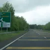
The dual carriageway Brecon Bypass feels remarkably fast and sterile by comparison — and for a 70mph dual carriageway is unusual these days in still having no central barrier. These jaunty yellow stripes mark the end of the line and we turn left here.
Beyond Libanus the road climbs to cross the Brecon Beacons and enter the Welsh Valleys. The pass hugs the eastern banks of Bryn Du.
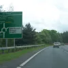
And suddenly — bang! There's the densely populated Valleys ahead of us. This roundabout is where we meet the A465 Heads of the Valleys Road; ahead lies Merthyr Tydfil, and from here to Cardiff the A470 is, uncharacteristically, a busy dual carriageway. Brace yourself.
From Abercynon to the M4, the road is decidedly urban — squeezed into the valley of the Taff between villages and woods, and in many places, like here, very heavily engineered. It's a very good road, and if the traffic's not too busy, quite fun to drive.
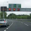
The final approach to the M4 indicates just how busy this road is, and how different it is to the miles and miles of empty, rural A470 that precede it: variable speed limits are in operation to reduce congestion on this heavily trafficked commuter road.
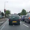
Traffic lights and a 30mph limit — we appear to have arrived in the suburbs of Cardiff. Not long now, surely?
Actually, there's some distance to go yet. Cardiff is a huge place, and has some surprises up its sleeve yet: not least this, following several miles of suburban dual carriageway. The A470 lifts off to cross a three-level junction over the A48 Eastern Avenue.
There are only a few miles left before we hit the sea, and our coast-to-coast journey is over, and yet the A470 is still doing its best to be the road with everything: for a mile or so it runs a tidal flow system, allowing two lanes in the busiest direction at peak times. Is there anything this road can't do?
The A470 has been stopping, turning unexpected corners and getting lost among other roads all the way since Llandudno, and it's not about to change its ways now. Finding the route it takes through Cardiff is no easy feat, and involves a great deal of circuitous tours of the city's many city centre relief roads. The Central Link is signposted left here and is desperate to take us directly to our destination — but it's not what we're looking for. Straight on and don't spare the horses!
This part of the city is almost entirely high-rise, post-War development and is rather impressive even in the late afternoon drizzle that has accompanied us since Merthyr.
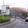
Another few swerves, a dog-leg under a railway bridge, and then suddenly it becomes much easier: the very last part of the journey is on Lloyd George Avenue, a dual carriageway that makes a bee-line for the sea. In the distance you can see the copper-coloured dome of the Millennium Centre, behind which sits the Welsh Assembly building. After so many indirect twists and turns it feels quite odd to be heading in a straight line for our destination.
With thanks to Peter, Ian Duff, Heather, Chris Cowdery, and Michael for information on this page.
