Experience lets us make certain assumptions about road plans. They will, for example, start off big, with a scheme that is bound to solve the problem. They will most likely be scaled back with each revision. They will assume that building out of congestion is not a realistic objective, and they will almost always deal with just one mode of travel at the expense of others. It's just how British planning works.

Welcome to Glasgow, which is about to blow those assumptions out of the water. In 1965 it started big with the Glasgow Highway Development Plan, resulting in a document called A Highway Plan for Glasgow. This was revised two years later in the Greater Glasgow Transportation Plan, taking in the whole region. With each revision, the plan got bigger. The tacit aim was to provide so much roadspace that congestion would, at best, be pretty unlikely. As well as more than 100 miles of new or upgraded roads, the study also proposed new rail lines, bus services, interchange facilities and other public transport improvements.
And guess what? None of it ever happened. It's just how British planning works.
This section sets out to explore the various plans and proposals that were made for the city of Glasgow and the surrounding area in the 1960s: not just the details of what was proposed, but also an exploration of what makes this plan so unusual, in terms of the way it was carried out and the way it has been handled since.

Incredibly ambitious transport plans can only be produced in the sort of city that's hoping to do incredibly ambitious things. Glasgow was exactly that - a place with big ideas.

Glasgow's plans weren't just unique in their scale, they were also something new and different in their approach, their development and their vision.

These proposals weren't just about drawing lines on a map - they were a brave new era for the whole city. Thanks to their talented artist, we can catch a glimpse of what they were hoping to create.

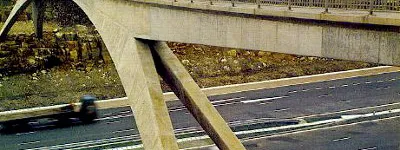
Whether implemented or not, many of the proposals were sufficiently influential that their effect is still felt (and seen) today.

See the various stages and versions of the plan in glorious Technicolor.
Sources
- Research carried out at the Mitchell Library, Glasgow (just off the M8, literally). My thanks go to their unfailingly helpful and attentive staff. Why aren't all libraries like this?
- All the information in this section is sourced directly from "A Highway Plan for Glasgow" and "The Greater Glasgow Transportation Study", except where text or links indicate otherwise.
With thanks to Steven Jukes for providing an excuse to visit Glasgow in the first place.