M65 Construction Photos
How do you build a motorway? If you've ever wondered how it's done, or what goes on during the years it takes to build a new road, then here's a chance to see it first hand.
The project to build the M65 between junctions 1A (Bamber Bridge, south of Preston) and 3 (Riley Green, near Blackburn) ran from 1994 to 1997, and was documented with scores of aerial photographs, taken every three months while the works were happening. That's unusual enough; what's remarkable is that you can see the full archive of 466 photographs here, and search through them to see individual structures being built and construction processes taking place as the motorway evolves.
On this page you can search through the photographs and use a map view to see the layout of the scheme and the most-photographed viewpoints. If you don't know where to start, try the highlights. You can also get to grips with the history of completing the M65, and read about the photos themselves.
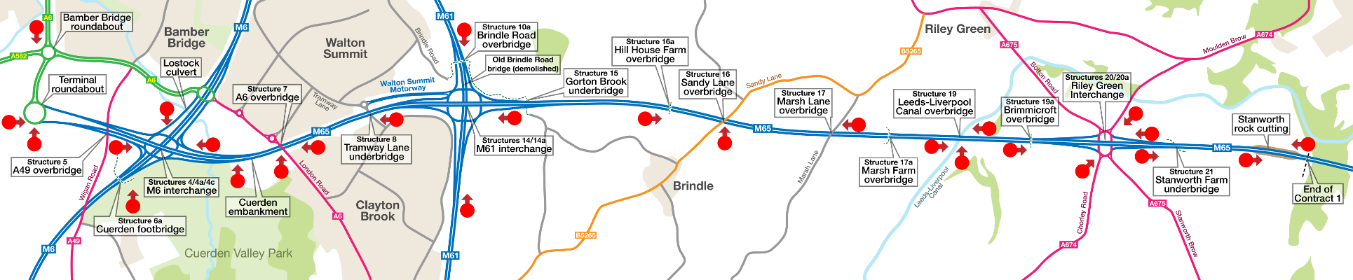
This map shows the whole length of the works seen in these photographs and labels all the structures and other roads around it.
Click one of the red markers to see all pictures taken from that viewpoint. The red markers show all the most-photographed views of the construction works. These are the places where you can find a whole series of pictures showing the construction of a particular feature. Not all the photographs are found on this map: there are 86 different viewpoints in the full set, of which only the most common appear here.
Scroll this map horizontally to see the whole map

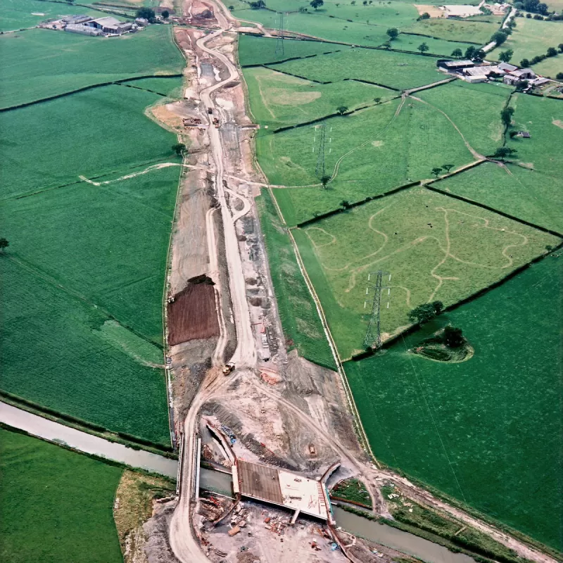
View west from Leeds-Liverpool Canal underbridge to Sandy Lane
12 January 1995


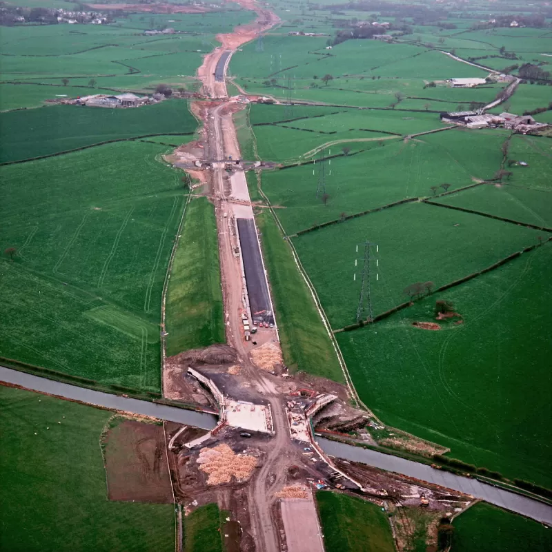
View west from Leeds-Liverpool Canal underbridge to Sandy Lane
10 January 1996


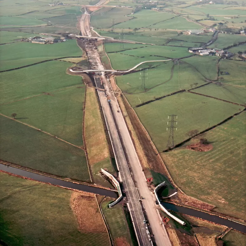
View west from Leeds-Liverpool Canal underbridge to Sandy Lane
21 October 1996
View west from Leeds-Liverpool Canal underbridge to Sandy Lane
14 February 1997
Search resulted in 8 pictures out of 466 in the series.

What's new
The road that made no sense
It was the UK's only single-carriageway motorway, and twenty years ago it ceased to exist. This is the story of the strange fascination it held, and of my place in history.
The forever bottleneck, part 2
The second part of the story, where we learn why exactly the M4 gets narrower on the final approach to Europe’s biggest city.
The forever bottleneck, part 1
The M4 into London was one of the UK's earliest and most ambitious motorway projects. It was bold, pioneering... and almost instantly regretted.
Have you seen...
Scammonden Bridge

If you've ever been on the M62 across the Pennines, you'll know the one. It's the huge arched bridge 120ft above the road. And this is what it's like when you're standing on top of it!