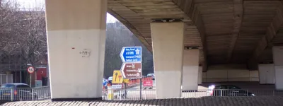
Croydon Ring Road:
Route map

To help orient the lost traveller who is not yet familiar with this part of South London, here is the full glory of the Croydon Ring Road, such as it is, in stylised map format.

This diagram includes the various odd concessions to the Croydon Tramlink system and the very numerous places that traffic stops at traffic signals, despite the various flyovers and underpasses on the way.

The Croydon Ring Road. Click to enlarge
Key of symbols used on the map

In this section

What's new

The Ringways Map is here

The wait is over! The full map of the Ringways, London’s unbuilt urban motorway network, is now online. Not even the system's planners had anything like this.

Red, white and blue

Kent County Council is run by eurosceptic nationalists. So why are they putting EU flags on their road signs?

The sunlit uplands

On Saturday 31 May something historic happened. The Heads of the Valleys Road was finally complete.

Share this page

Have you seen...

EuroRoute

Today you can catch a train to France. You can even put your car on it, and be there in less than an hour. But in the 1980s, Euro Tunnel had competition - including plans to build a motorway across the English Channel.

About this page

Published

Last updated