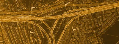
The oldest part of the Ring Road is the eastern side, opened in the very late 1950s. It was thought to be a rather daring piece of urban road design at the time, with a swooping underpass below George Street. In fact the ground had been excavated to a lower level over a wider area, allowing the underpass and a large underground car park for the then-new Fairfield Halls.
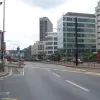
Today the tall buildings flanking Wellesley Road are one of the more memorable views of Croydon, but that doesn't make it a nice place to be.
The north-eastern corner of the ring road is more of a terminus really, something that a ring road probably shouldn't have. Looking north, the dual carriageway collapses quickly to a suburban street, the non-primary A212 towards Selhurst.
The first junction, a three-way signalised intersection with Station Road, is mostly for buses and trams. Regular traffic can enter the road here, but will usually find it slow progress behind a line of double deckers. The two tall buildings here are the last on Wellesley Road, which reverts to low-rise suburban housing just to the right.
Looking south down Wellesley Road, the eastern side of the ring road. The rows of office blocks down each side are what define this road. Originally this road had three lanes in each direction; now the innermost southbound lane is reserved for trams. This is the second signalised junction, at Bedford Park, though this time there's no break in the central reserve.
A few paces on and another junction, this time at Sydenham Road. The central tram lane is clearer here. This picture also gives a better view of just how vast and windswept this whole road is - and from a pedestrian's point of view, incredibly hard to cross.
The only alternative to hopping the barrier are one of Wellesley Road's mosaic-tiled subways. The road was designed in the 1950s, a time when few roads had been built on this scale in urban areas and the effect that it would have was largely unknown. The result is a road that doesn't integrate itself well with a town centre environment.
Further south, and now approaching the daring underpass. Once a diamond junction open to all traffic, it's now heavily restricted in certain places. The southbound off-slip is two lanes wide; today one is for trams and the other for buses. The other three sliproads are open to all traffic. The direction signage reading "All routes use underpass" is non-standard and quite strange.
Beyond the sign is what used to be a lane drop, with the left lane taking the sliproad and the other two heading for the underpass. Today it's signalised to allow trams to cross from the central reserve to the far left. Buses heading for the sliproad must go over the tram tracks (marked as a yellow box junction) and then turn hard left past the second traffic island. The stop line and signals are just behind the camera.
A look south through the underpass, with its rather grand signage. Note the cobbled area leading up to the diverge point, presumably original to the road. The signs here are keen to use the "railway" symbol because East Croydon, the town's main railway station, is just to the left of this picture and the most obvious way to get there would be via the sliproad.
The underpass is longer than it first looks, and on top there is a complex signalised junction and space for some raised flowerbeds like this one. These low shrubs have a difficult task trying to humanise a very harsh and barren place. This picture is looking south again, towards Fairfield Halls.
To the west of the junction is the town centre itself, but to the east, George Street heads away to East Croydon station. It was widened to a dual carriageway when the underpass was built, and the tall white block in the distance is in the centre of what used to be a roundabout at the far end of the dualled section. In those days it was the A232. The Croydon Tramlink scheme saw the road downgraded and closed to everything but buses and trams, with one carriageway for each.
The underpass was part of a wider development, including the adjacent Fairfield Halls, which saw a large patch of land excavated. This allowed the underpass to run below the original ground level, but much of its surroundings were reinstated on decking, allowing a roomy underground car park.
Looking north through the underpass from the other end. Wellesley Road looks really quite impressive here; not quite Manhattan but about as close as South London gets.
Looking south at the point where the southbound sliproad and main carriageway merge. Four lanes continue from here up to the roundabout, which is only 60m (65 yards) from the camera here. In that space traffic must fight its way right or left to be in the correct lane.
Running east from the elongated roundabout is Barclay Road, a dual carriageway opened in the 1990s which carries the A232, allowing it to bypass the closed section of George Street. This work came in handy when Tramlink arrived, and while a new dual carriageway in darkest South London is extremely rare, it isn't very long. This is another of the new roads proposed back in 1951.
Approaching the roundabout from that direction, the signage makes no mention of the failed ring road. The east flank is to the right here, and the A232 straight ahead forms the south side.
In the middle of the roundabout is this unusual turning circle, for emergency access only and usually closed off with a barrier. At first sight it looks like it's just the line of the roundabout before it was extended, but actually it goes entirely the wrong way: the original roundabout is to the left in this picture.


