The 1930s saw considerable work to expand and improve the road network of mainland Britain, with many new arterial roads built around London and many other bypasses and improvements to roads in major cities across the country. It was still fairly unusual, however, to see new rural bypasses built as dual carriageways.
The Mickleham Bypass in Surrey was different, taking a tricky section of A24 south of Leatherhead and improving it with a second carriageway through the wooded Mole Valley and a new road avoiding the centre of the village. It was opened in two stages, in November 1937 and June 1938. Virtually unmodified to the present day, it had become notorious for its atrocious accident record, mainly because of the narrow southbound carriageway in the Mole Valley where the original road had not been widened or straightened as part of the dualling works, and because of the incredibly tight bend north-west of Mickleham itself.
Until the mid-1990s there were extravagant plans for a tunnel to straighten the line of the A24, but inevitably the cost was too high and in the end Surrey County Council chose to reduce the speed limit and close one lane of the deadly southbound carriageway. Today it's not as slow or as adrenaline-fuelled as it once was, but is still a fascinating and scenic road that's well worth a tour.
You can see the Mickleham Bends in video too - it's part of our Retro Collection of archive video tours.
The A24 heads south from the Leatherhead Bypass and it's immediately obvious that something odd is going on. The left lane is blocked for a mile and there's an advisory speed limit of 50mph. What's that all about?
This is why: we're on a dual carriageway, but with only one lane southbound because this carriageway is very narrow. Until the late 1990s it was, however, marked out for two lanes of traffic and subject to a 70mph speed limit.
Northbound traffic has no such trouble, as this picture shows. The section from Leatherhead to Mickleham was dualled in the 1930s by building a new northbound carriageway next to the existing road, so the northbound side is of a much higher standard than the southbound.
The thickly wooded central reservation is broken here and there by alarmingly low-standard junctions. Brake sharply to turn!
Several bends southbound are marked with advisory 50mph limits — which is fairly meaningless, because the road is subject to a mandatory speed limit of 50mph anyway.
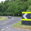
A long turn brings the road into Mickleham, seen here for northbound traffic, but just as sharp for southbound. The array of chevron signs here appear to be shouting "left! Left! Left! Left! Left!" at the driver.
The dual carriageway is the Mickleham Bypass, but its location is constrained by the river Mole and so it skirts the northern edge of the village here, with some houses and businesses fronting on to the southbound carriageway. The road is still restricted to one lane.
More crossovers in the central reserve here, and for some reason, the southbound cycle path is also in the middle of the road. It seems a very strange place to put it.
Ahead, the left turn into Mickleham itself marks the point that the dual carriageway leaves the original line of the A24 and the new road built in the 1930s begins. You might reasonably assume that the standard of the road would improve from this point on.
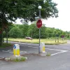
Traffic approaching from Mickleham itself is well advised to STOP here. The 30s bypass lies to the left, with southbound traffic still restricted to one lane and all traffic still restricted to 50mph.
Despite this being the new road built on an entirely new alignment, the worst is still to come: this incredibly tight left-hand turn for southbound traffic, which swings the road through a full 100° turn. This is why there's still only one lane, even though the road is now technically wide enough for two.
On the northbound side there are two lanes, but with some very conspicuous reminders of the speed limit.
This part of the road is a very typical thirties dual carriageway, with two 22ft (6.7m) carriageways with cycle paths on both sides and generous grassy verges. This cycle path is actually in use here.
After another turning through the central reserve, the restrictions end and both southbound lanes are open to traffic. There is a very tactless wiggle here as the two carriageways move closer together. (These signs have since been removed and the whole bypass is now restricted to 50mph.)
After the incredibly sharp and dangerous bends to the north of Mickleham, the dual carriageway is suddenly ruler straight into the far distance. There are no side turnings on this section, and no gaps in the central reservation, so the carriageways now run close together with a hedge in the middle.
The bypass ends in the shadow of Box Hill, rejoining the original line of the A24 again at Burford Bridge roundabout. We'll turn hard left here and follow the old road (now B2209) through Mickleham itself.
Heading northbound on the bypassed road, it doesn't look bad at all to begin with. In fact it's a pleasant drive through woodland; a little curvy and hilly perhaps, but not obviously a candidate for urgent replacement as early as the 1930s.
It's not until the road reaches Mickleham village itself that the reason for its bypass becomes clear: the sleepy and ancient village has a narrow and twisting main street with high walls on both sides in most places. It would have formed a troublesome bottleneck even in the 30s.
Towards the north end of the village an old sign, dating from the mid-1960s, politely warns traffic that it is about to return to the real world with a jolt.
Running north from Mickleham almost in a straight line to Leatherhead is a small lane that looks like it might have once been the original London to Dorking road. 1920s maps show the twisting route east of the river was the main road, so it probably never carried the A24.


