A49 underbridge, view north, 12 December 1997
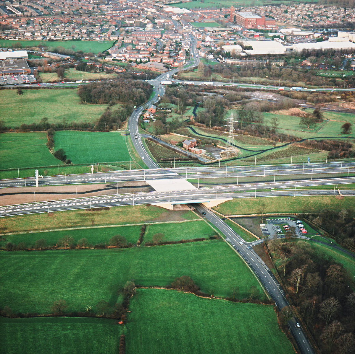
A49 underbridge, view north (see all photos of the same view)
The A49 bridge is one of the most overspecified structures on the project - it has extra space underneath in case the A49 is dualled in the future, and extra space on top for the M65 to be extended west. To the right, a small car park was built as part of the motorway contract for visitors to Cuerden Valley Park.
Structure 5 (A49 underbridge)
A49 Wigan Road
What's new
The road that made no sense
It was the UK's only single-carriageway motorway, and twenty years ago it ceased to exist. This is the story of the strange fascination it held, and of my place in history.
The forever bottleneck, part 2
The second part of the story, where we learn why exactly the M4 gets narrower on the final approach to Europe’s biggest city.
The forever bottleneck, part 1
The M4 into London was one of the UK's earliest and most ambitious motorway projects. It was bold, pioneering... and almost instantly regretted.
Have you seen...
New Medway Viaducts
Taken over the course of two years, from 2002 to 2003, these sixteen images chart the construction of two new bridges alongside the M2 Medway Viaduct.