Riley Green interchange, view north, 14 February 1997
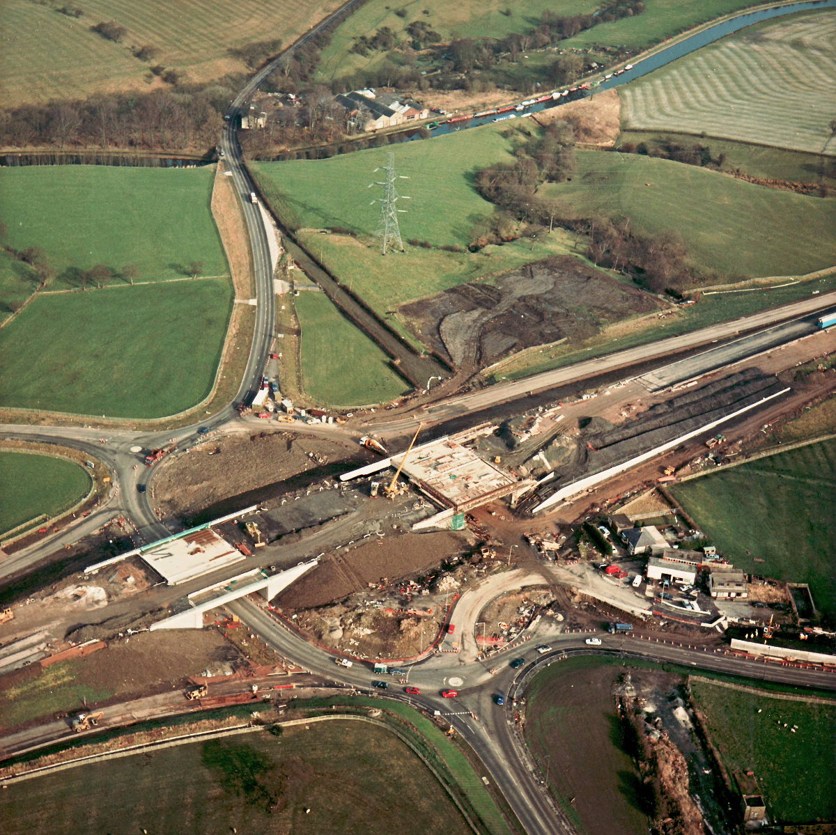
Riley Green interchange, view north (see all photos of the same view)
There's a lot of activity at Riley Green in this picture - it looks like a major effort to complete the two bridges so that the motorway can finally be laid across the top. At the upper right, it looks like an area of an adjacent field was in use for construction work for a time. This has now been re-levelled.
Structure 20/20a (Riley Green interchange bridges)
A674 Chorley Road
A675 Bolton Road
What's new
The road that made no sense
It was the UK's only single-carriageway motorway, and twenty years ago it ceased to exist. This is the story of the strange fascination it held, and of my place in history.
The forever bottleneck, part 2
The second part of the story, where we learn why exactly the M4 gets narrower on the final approach to Europe’s biggest city.
The forever bottleneck, part 1
The M4 into London was one of the UK's earliest and most ambitious motorway projects. It was bold, pioneering... and almost instantly regretted.
Have you seen...
M602 Eccles Bypass
Dive into 1960s optimism with the book celebrating one of Lancashire County Council's first bold steps in attempting to build a thrilling future for Greater Manchester as a motoring metropolis.