Brimmicroft footbridge, view north west, 14 February 1997
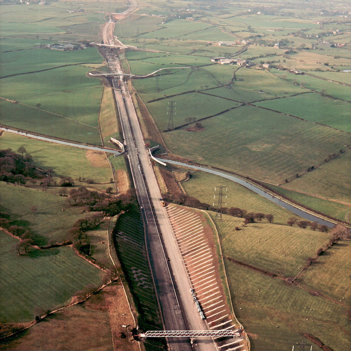
Brimmicroft overbridge, view north west (see all photos of the same view)
This high-level view shows the motorway west from Brimmicroft (at the bottom) through to almost the M61. The footbridge at Brimmicroft also carries a piped watercourse across the motorway, where the new road cuts through well below the water level. The pipeline for this appears to be visible across the bridge.
Structure 17 (Marsh Lane overbridge)
Structure 17a (Marsh Farm overbridge)
Structure 19 (Leeds-Liverpool Canal underbridge)
Structure 19a (Brimmicroft overbridge)
What's new
The road that made no sense
It was the UK's only single-carriageway motorway, and twenty years ago it ceased to exist. This is the story of the strange fascination it held, and of my place in history.
The forever bottleneck, part 2
The second part of the story, where we learn why exactly the M4 gets narrower on the final approach to Europe’s biggest city.
The forever bottleneck, part 1
The M4 into London was one of the UK's earliest and most ambitious motorway projects. It was bold, pioneering... and almost instantly regretted.
Have you seen...
The Improbable A39
It crosses cattle grids and untamed moorland, it climbs 1-in-4 hills and plummets through hairpin bends, it runs single-track through woodland and historic villages. It's rugged and beautiful. Is it really the A39?