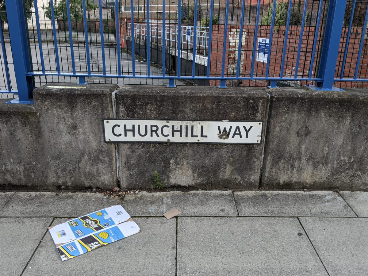
Liverpool's Churchill Way flyovers would have been 50 this year, but they were demolished at the end of 2019. While they stood they dominated the city centre landscape around Liverpool's central library, station and museum. Bryn Buck took a trip to Merseyside to see what's left now the bridges are gone.
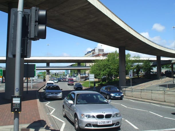
If you're not familiar with Liverpool you might not know the Churchill Way flyovers, and even if you are familiar with Liverpool, chances are you still very rarely had cause to use them. A pair of elevated roads, one running east and one west, they linked some of the huge dual carriageway relief roads around Islington and Lime Street to the city centre one way system formed by Great Crosshall Street and Dale Street. Designed to fit in with wider changes to the street network that never came to pass, for the last half century they didn't really do much at all, and the traffic passing along them was always comparatively light.
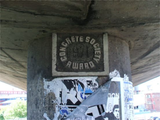
In 1971 the Concrete Society gave the flyovers their annual award, which was appropriately enough made of concrete itself and attached to the north flyover. Unfortunately that was about the pinnacle of the praise that Churchill Way ever received.
Designed in the early 1960s, the flyovers were meant to untangle the difficult space at the mouth of the Queensway Tunnel, which - at the time - was the only road link between Liverpool and the Wirral, and which dumped all its traffic straight into the city centre on Byrom Street, next to many of Liverpool's fine civic buildings. They opened to traffic in 1970.
The idea was that Byrom Street could be freed up to form an artery leading to and from the tunnel if the major conflicting traffic flow was lifted up and out of the way, that being traffic heading to and from the city centre from the east. Vehicles approaching Liverpool from Edge Lane and the East Lancs Road would be diverted onto two new flyover structures that would let them soar over the queues for the tunnel and head straight into the city.
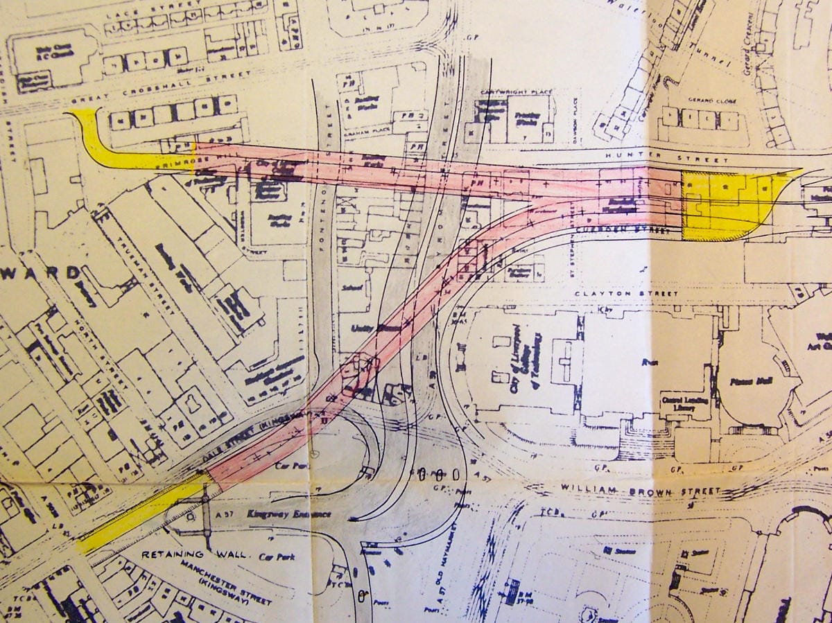
Except it never really worked out like that. The Queensway Tunnel was relieved by the newer Kingsway Tunnel just a few years later, massively reducing its traffic problems. The Liverpool Inner Motorway and the huge associated changes to the street network never came to pass. And as the streets of Liverpool were updated in the absence of those plans, the flyovers never found their place. Look at a street plan of Liverpool and you can immediately see that they never really led to anything at the eastern end, and indeed running parallel to them is a much bigger and busier dual carriageway at surface level whose traffic could never make use of them.
In late 2018 a structural survey found that they had been built with substandard materials and were seriously unsafe, and faced with a £60m repair bill, Liverpool City Council decided to bring in the demolition crews, at a still-eyewatering cost of £5.7m. Between September and December 2019 they were taken down.
Now that Churchill Way has gone away, what's this unloved patch of central Liverpool like? Bryn Buck, author of the Show Me A Sign blog, has been to take a look.
A reminder of the past
From Bryn's tour of the mouth of the Queensway Tunnel from 2005, here's a quick look at what was there when the flyovers still stood.
Looking north along Byrom Street, the two flyovers seen in succession - the south flyover near the camera and the north flyover in the distance.
The north flyover cut a straight line across from Great Crosshall Street. It cleverly incorporated a footbridge on a lower level, with steps and links to other pedestrian routes nearby.
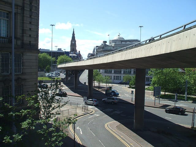
The south flyover, in contrast, curved left then right, snaking over from its eastern end to Dale Street which was a little way to the south-west.
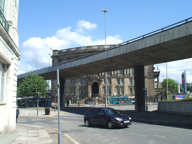
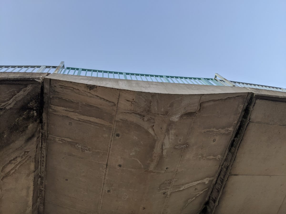
Seen from the opposite direction, that curving southern flyover was perhaps the worst of the two, slicing across the Georgian frontage of what is now the Liverpool World Museum.
From west to east
Fast forward to 2020, then, and the flyovers are gone. This first part of the tour follows the line of the northern flyover, from Great Crosshall Street to Lime Street.
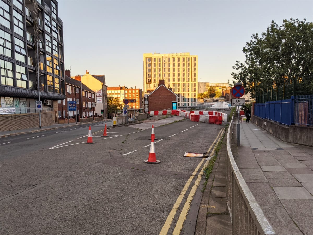
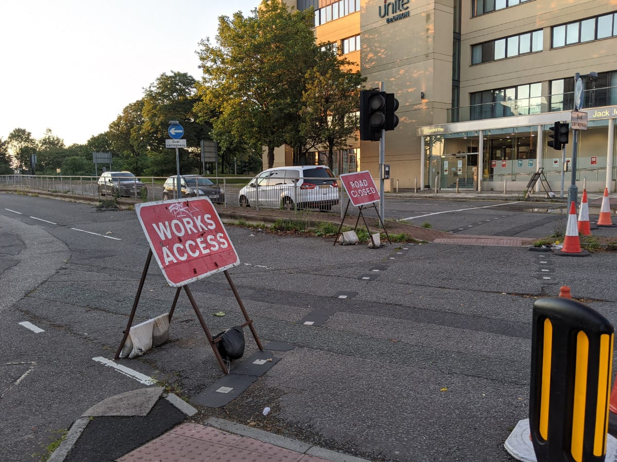
The right-hand exit from Great Crosshall Street is closed to traffic with a scattered line of cones and, beyond them, some plastic barriers. The reason for the road closure isn't very obvious from here.
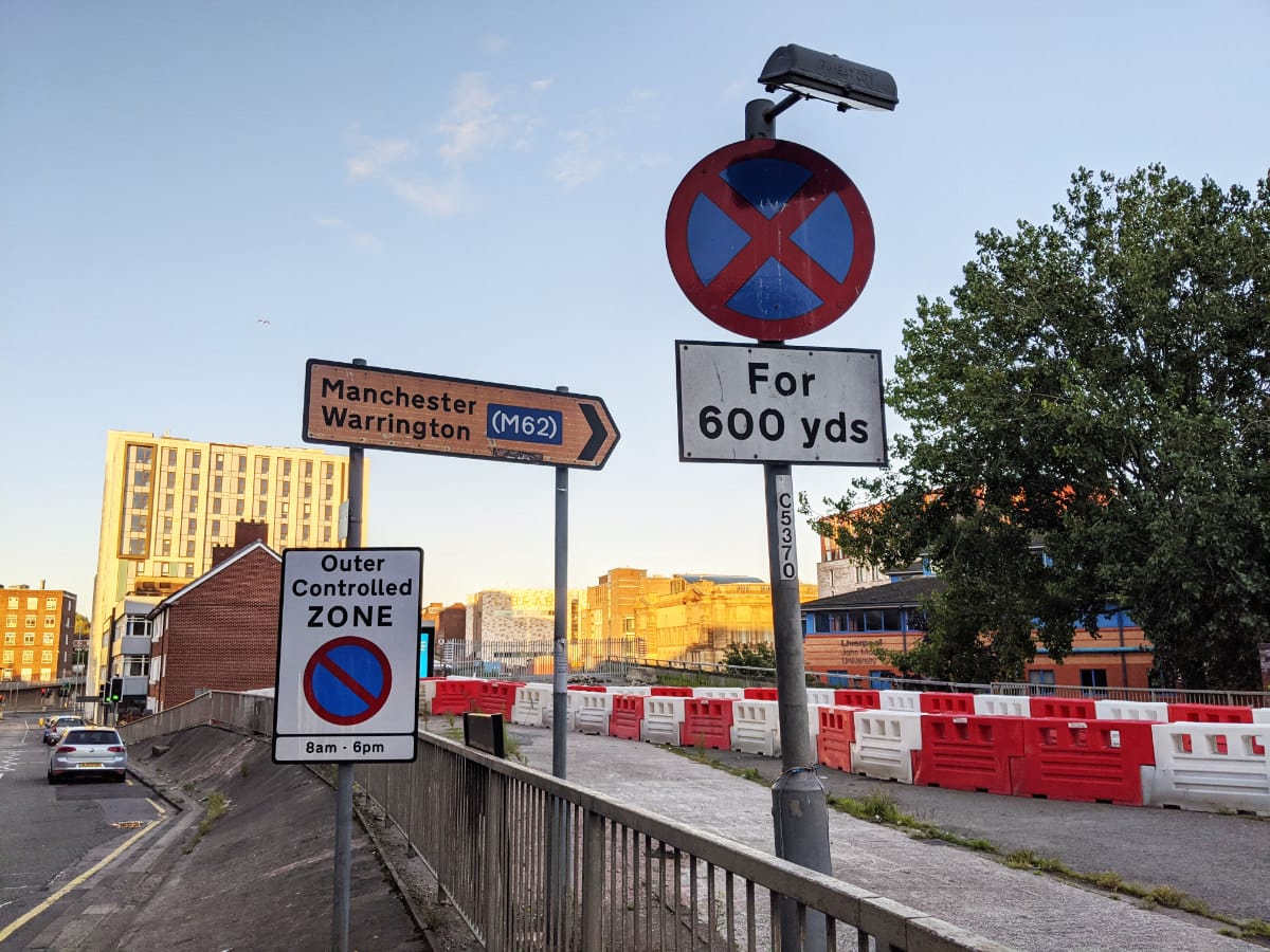
Faded signs suggest that this turning will still take you to Manchester via the M62, though you'd struggle to do that now without a helicopter.
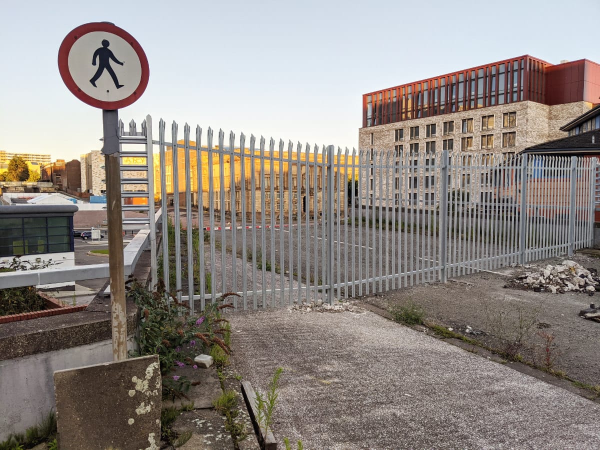
A "no pedestrians" sign stands by the new metal fencing that properly closes the road at the point the flyover began.
Looking through the metal fence, the change is more obvious. Two lanes of roadway come to a sudden stop. In the distance, just beyond the white marquee, the stubs of the flyover's other end can be seen.
From ground level, the same flyover stub looks like this - sawn clean off at the point it once launched into the air.
The north flyover included that once-innovative pedestrian footbridge, so its absence means some walking routes around the junction have been severed. Signs like this have been put up to guide pedestrians making their way at ground level.
Here's the sawn-off end of one of the pedestrian footbridges, now with nothing to connect to. Some of the guard rail has been re-purposed to provide it with a safe end.
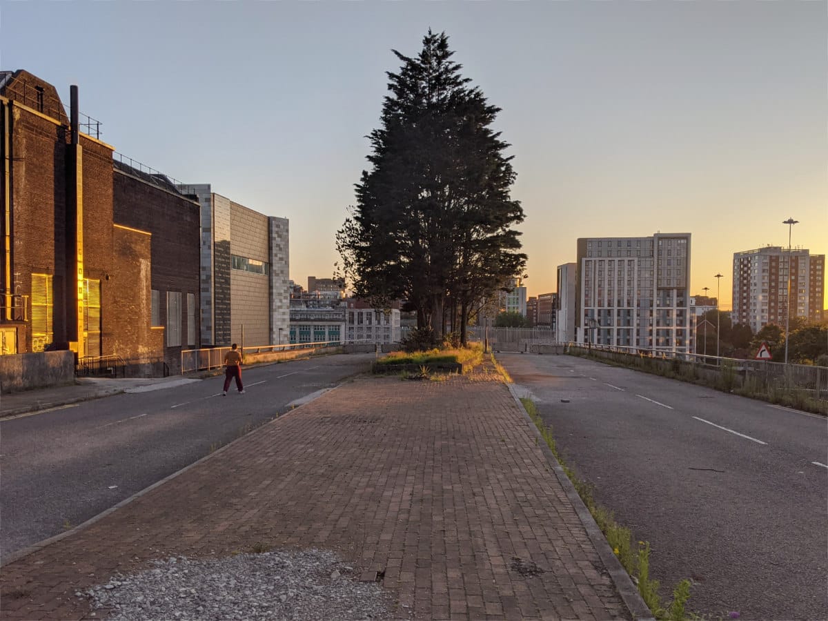
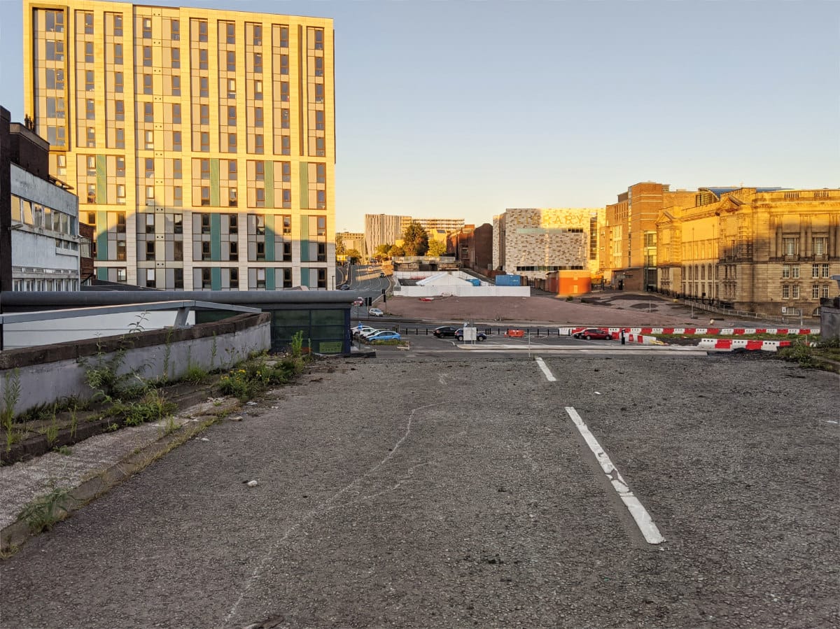
At the eastern end, where both flyovers used to return to ground level, a forlorn dual carriageway now heads only to another metal fence.
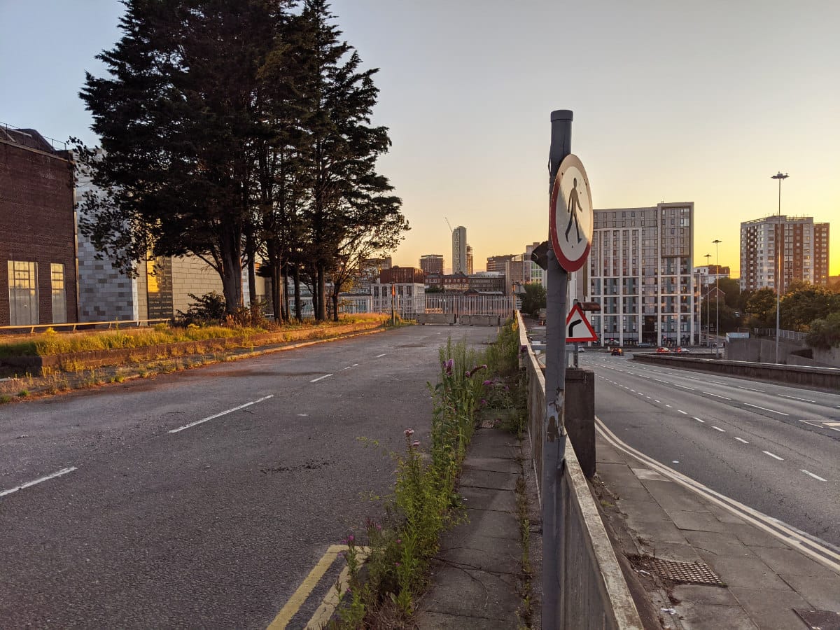
From here it's clear just how strangely redundant these structures were. Right alongside is a much wider road leading down to ground level, and connected at both ends to much more important arteries.
Facing east, traffic coming off the non-existent flyover would have run alongside that other road for a short distance before turning sharp right to reach Lime Street.
From east to west
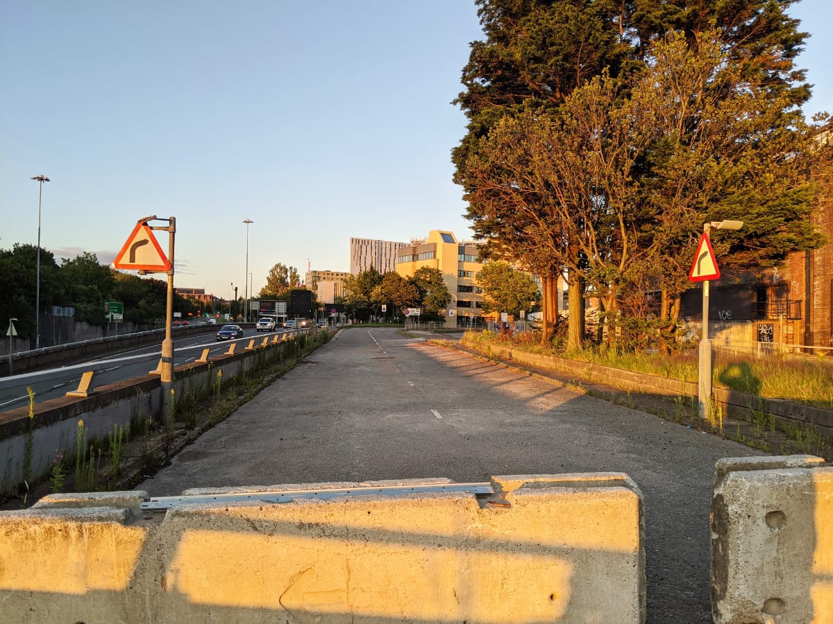
The second part of the tour traces the line of the curved southern flyover, which used to carry traffic towards the city centre.
At the eastern end, where the road meets Lime Street, the entrance is closed with cones and "Road Closed" signs on A-frames. But the street itself is still open to pedestrians because it has one or two buildings fronting on to it.
Being a road with buildings facing it, the flyovers and their approaches were a street in their own right, and there's a reminder of that here. It's not clear what will happen to preserve access to them while re-landscaping the area.
The setting sun makes for a dramatic view through the railings at the stub of the southern flyover. The opposite end isn't visible - the flyover snaked away between buildings to the left.
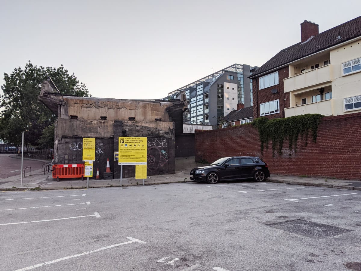
At the western end, the stub of the flyover, and its ramp descending to Dale Street, are completely gone. They once stood in the middle of this picture, just beyond the white van.

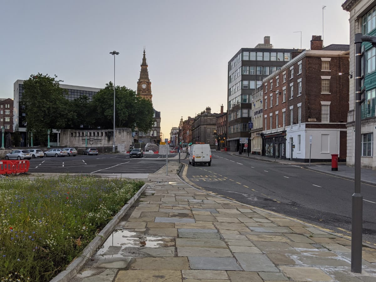
Turning around, there's at least one immediate reward now the flyovers are gone. This handsome view of the Liverpool World Museum hasn't been possible since 1970, but now it can be seen in all its grandeur, in the evening sunlight, and without a flyover scything across it.
More from Bryn
Bryn's Show Me A Sign blog covers everything to do with modern highway engineering - from low traffic neighbourhoods to the evolution of motorway signs.
![]()
Comments
Although, as you correctly say, these flyovers were by the Queensway Tunnel, the 1/2500 OS plan base on which the proposals are drawn clearly calls it the Kingsway Entrance. I went over there (from Ellesmere Port) in November when they were still clearing the rubble away and took a few photographs which I could send on to you if you wish.
Add new comment
Sources
- Details of structural defects and decision to demolish flyovers: "Churchill Way Flyovers to be Demolished", Regenerating Liverpool, 22 February 2019.
Thanks for this blog. A very interesting read indeed. Thank you for the time you've taken to snapshot history here.