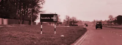
The Isle of Purbeck is an oddly isolated place. It's not really an island, being a peninsula connected to the mainland of Great Britain, but its location and the range of hills across its centre mean that reaching its principal town, Swanage, feels like entering a fairly remote location. By land, it's a 31km (19 mile) journey from Poole to Swanage, when the towns are only 12km (7 miles) apart.

In the early 1920s, Frank Aman, a businessman from the Isle of Wight, spotted the commercial potential in providing a faster way to Swanage for the increasing number of people driving to the coast to spend their holidays. What he eventually set up continues to provide a valuable local transport link and carries thousands of daytrippers every year. It also, inadvertently, created the earliest forerunner to a motorway anywhere in the UK.
A motor road and a ferry

The place for the ferry was obvious - Poole Harbour, the body of water separating Purbeck from the rest of civilisation, is connected to the English Channel by a narrow channel just 350m (380 yards) wide. The north side was built up and reached by Banks Road; the south side, however, was some distance from the nearest public road.
It made sense, then, that the new company would seek power from Parliament not just to set up and operate a ferry, but also to provide a road to connect it with Studland and thus the road to Swanage. And as the ferry was for motor traffic, the road built to accompany it was a road for motor traffic.
In early 1923, a bill was laid before the Commons to create the Bournemouth-Swanage Motor Road and Ferry. It specified:
"A motor road (Work No. 1) 2 miles 7 furlongs 7.50 chains or thereabouts in length wholly in the Parish of Studland in the Rural District of Wareham and Purbeck commencing at South Haven Point and terminating by a junction with the public road leading from Studland to Swanage."
It wasn't just called a motor road, however - the Act was unusual in specifying that the Company could make whatever by-laws they saw fit to govern the road and, in particular, that they could choose to prohibit certain classes of traffic if they so desired.
That's not strictly a motorway in the modern sense: a motorway is a road that no class of traffic is permitted to use unless specifically allowed to do so; this was a road that everybody could use unless the Company said otherwise. The Act was also careful to specify that pedestrians must be permitted to use the road and could not be charged for its use. But it is the first example of legislation where the aim was to restrict the use of a road to motor traffic only. It just went about it in a different way to more modern laws.

The other very motorway-like thing about this act was that - decades before the Town and Country Planning Act gave government bodies the power to restrict development along roads - it gave the Company the power to prevent other people building alongside their new road.
The final unusual step was in the way the Company would charge for its service: it could choose to levy charges on the ferry or the road, and chose to do it on the road. Even now motorists pay at toll booths on the private road, not on the ferry, and the signs pointing to it refer to it as a "toll ferry".
Big plans
The Sandbanks Ferry, as it is known locally, began service in 1926, just three years after powers were granted - in which time two slipways, a ferry and the all-important motor road had to be built. It was an immediate success.
Within three years of their ferry service starting, the Bournemouth-Swanage Motor Road and Ferry Company did something unusual: they went back to Parliament and sought new powers to build a high-level bridge linking their motor road directly to the mainland, and making the ferry redundant.

This was no tin-pot proposal either; Poole Harbour takes cross-channel ferries and other shipping traffic and so the bridge had to be tall enough to clear ocean-going shipping vessels. The design was drawn up by none other than Sir Owen Williams, the concrete architect who went on to create the twin towers at Wembley and the designs for the first section of M1.
His bridge climbed steeply on the south side, arched over the main shipping channel, and then - reaching the built-up north shore while still in mid air - dropped back down to earth on a spiral ramp, turning 360° to meet Banks Road next to the ferry slipway.
Whether the Company ever intended to build this bridge is not at all clear. It came so soon after the ferry started service, and would have been so expensive, that it seems quite improbable. In the 1950s, when building a bridge instead of commissioning a new ferry was a real possibility, the idea was thrown out by local residents as being far too intrusive in a very open and low-lying area. It may, in fact, have only been so that the Company owned sole rights to the building of a bridge at Sandbanks, meaning that nobody else could build a bridge and put them out of business.
84 years in service
Eighty years and four ferries later, the Bournemouth-Swanage Motor Road and Ferry Company is still going strong. A second draft of the bill that set up the company removed the clause that would have seen the motor road transferred to local authority control after 65 years, and as a result the road from Studland to Sandbanks is even now a private road, and a motor road at that. It is, however, free to use up to the toll booths close to the south slipway - and unlike most motorways, it's available for walking, cycling and all-day parking.

