This page explores the Burdock Way from most angles, taking a leisurely stroll from the western section buried in a cutting to the magnificent viaducts and the odd gyratory at the eastern end of the route.
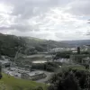
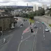
A view south across part of Halifax's town centre, across the foothills of the Pennines. The geography of this area is best described as sudden, and is the main reason that Halifax's town centre bypass is within the town and built to such extraordinary designs.
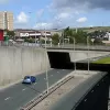
Looking towards the western terminus, the road is deep in a concrete trench. Beyond the next bridge, the carriageway widens. This is one of the slip road stubs which were to be the start of the southern phase (had I known this when I took the picture, I'd have gone closer).
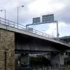
Facing south again, this time from the overbridge. From here it is again clear that the carriageway widens beyond the next bridge. Below, the central reservation widens for the second-tier flyover to begin. The section visible here would have been a short two-lane section, on either side of which a dual carriageway of the same size would have merged.
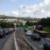
The view north towards the overbridge in the previous image makes the widening central reservation obvious.
North from that bridge, the central reservation is suddenly wide enough for a considerable expanse of grass and trees. There is already space for a dual carriageway down the middle - the merge here would have been very brief.
The streetlights on this section are original to the road - 1973 vintage. The road visible here would have been a sliproad between other roads rising in different directions on either side.
A sliproad joins eastbound from this flyover, and has what looks like an original restrictions sign. These appear at all entrances, including the entry points to the roundabout midway. Presumably horse drawn vehicles are required to turn around in the middle of the road there.
The sliproad meets the main carriageway just yards before the roundabout, and is signalised. If a conventional merge were used here, getting into lane for the roundabout would be virtually impossible. Had the rest of the plans been realised, this would have been a junction between two sliproads, and therefore not as congested.
The roundabout itself is built into the hillside, and immediately to the east the land drops steeply away. The next section of Burdock Way lifts off (on some sandstone-clad retaining walls) and mounts the viaducts across the valley.
A few steps further on, and the size of these structures is revealed. They appear newer than they are - the smooth white finish of the concrete is deceptive, as the structures were extensively renovated in 1994.
It is clear that a gap nicely wide enough for another support of the same size was left between the viaducts. The second tier would have slotted in quite neatly with little disruption to the existing road.
Gantry signs are mounted on the viaduct both ways to direct traffic. Eastbound, only the left hand lane is marked for through traffic on the A58 - clearly this was not the intended final layout.
As the viaducts part, a second gantry supplies local directions for the approaching interchange. The right hand sign incorporates a Give Way warning - the first sign of the unusual road layout ahead.
Facing west from the eastern end of the viaduct, the structures are quite graceful in a way, arcing smoothly together out over the valley.
The eastbound viaduct splits in mid air to provide an exit to the northbound A647, which looks wonderfully fast and free flowing until it screams to a halt at a give way line and traffic is shunted to the right.
Looking south, back towards the town centre, the skyline is very much commanded by the viaducts, and punctuated by a pair of gantry signs.
The junction at the eastern end is effectively a roundabout, but it is sited on a steep hillside and the viaducts join and leave in unusual places. Here the Give Way sign is visible - in fact, both lanes can be used for the A58, but only the right hand one must give way to the roundabout.
Beyond the unusual merge, there is a very short weaving space before the road splits into three. To the left, two lanes take the A58 climbing out of the town; to the right, two lanes climb over the middle of the roundabout to join the westbound Burdock Way across the viaduct, and down the middle, one lane vanishes into the undergrowth around the roundabout. Above it, a temporary metal-framed flyover connects the westbound A58 to the viaduct.
Looking back, it's clear just how abrupt the descent from the eastbound viaduct is; the Give Way line is there because the entry to the roundabout is blind until the last second. To the left of the image, the A647 joins the roundabout in a more conventional way.
Looking west as the A58 approaches the odd junction, and the flare of the carriageways leaves room for just one more carriageway. The answer is that the westbound side already takes off - this space is left for the eastbound side of the top deck to land.
Looking west from just a little way further up the A58, the free-flowing dual carriageway dream comes to a sudden halt at a set of traffic lights for a side road. Beyond this junction, the road returns to being a single carriageway. Looking at the central reservation, the two streams of traffic would have only just merged at this point, so some further upgrade of the A58 to remove this junction must have been planned.
The westbound off-slip for the strange eastern junction has to be signed with a warning for the steep slope. Behind it, the westbound A58 climbs to mount the upper viaduct, and is then carried downhill to a set of traffic lights to (temporarily) join the lower level.
