In the late 1970s, the Department of Transport proposed a motorway (perhaps the M65) between Lancashire and Yorkshire. The first section of this was to relieve the A650 in the Aire Valley north of Bradford. It was a landmark moment for anti-roads lobbyists, because to the surprise of the DTp, it was thrown out in the public enquiry and the plan had to be scrapped. It is the first real instance of the public demanding a road plan be cancelled.
Skip forward twenty years, and the residents of Bingley have now tired of the A650 choking up their town centre — the road is under construction, in a toned down dual carriageway form. So why was it held back twenty years ago?
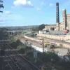
Most bypasses for towns take a new road around the outside of the town. But Bingley is in a steep valley, so the only place for the road is right through the town centre, in a narrow corridor of land between the railway and canal. This page contains two sets of photos taken in different stages of construction — the July photos taken by myself, and the September ones by Ant Butterfield.
July 2003
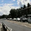
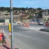
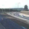
Welcome to Bingley — if you're arriving by road or just passing through you'll notice that it takes quite a long time. Some parts of the existing A650 are actually four lanes, but they're short and fairly useless inbetween traffic lights and pedestrian crossings. This line of traffic continued northbound all the way through the town, beginning to move again near Crossflats station.
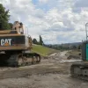
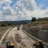
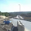
Let's start at the top. This is the view south from the A650 bridge at Crossflatts — construction work is still ongoing on this section.
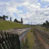
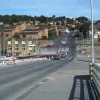
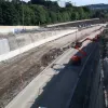
Looking south again from the end of the platform at Crossflatts station, the road from here is nearing completion — the road bed is awaiting its final surface, crash barriers and streetlights are in place, and landscaping is nearly done.
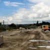
Don't be fooled into thinking it'll open any time soon though — the easy bits are done while some more tricky sections have hardly been started. This is the A650 bridge at Crossflatts. The existing railway bridge has been extended to pass over the relief road's course, but to do this with minimun disruption it's been done backwards. In order to keep the road open as much as possible, the bridge has been built but the excavation of the cutting underneath is yet to be done!
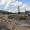
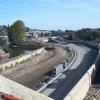
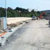
A little way south to Three Locks, near to Bingley town centre. This is where the canal joins in the route too. To the left is visible the retaining wall that supports the newly redirected canal, making space on the right for what is presently a very wide dirt track.
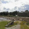
At Three Locks, there's a public footpath crossing the Relief Road, and the bridge is not yet open so it's possible to have a stroll on the road bed. This is the southern end of the nearly-finished section we saw at Crossflatts. Further down the road is still barely started.
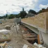
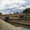
Further south still, the canal towpath takes us to this bridge. Once just a railway bridge, it has been extended to take in the new line of the canal and a wide central span for the Relief Road. For a few hundred yards here, alongside Bingley's main shopping street, the three carve a wide gash through the town.
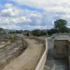
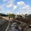
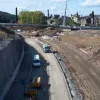
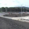
Looking south again from the bridge in the last shot, we get a panoramic view of the three modes of transport side by side in the monstrous cutting. The road here is still a mound of earth, but it's fairly easy to imagine how this will look when it's done.
Looking north again, the bridge from the last couple of photos is visible in the distance. Streets of terraced houses end on a new retaining wall on this section, visible on the left. Local sandstone is used for the walls and bridge parapets, which is clearly an effort to make the road a little more appealing and less out of place. But there's only so much you can do with a dual carriageway through the middle of a town.
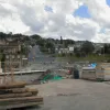
A view north again from further down the route, and a shiny new footbridge is being assembled. Many of the structures across the road seem to have been built to be visually appealling, again in an attempt to make the road a feature instead of an obstacle. The foreground shows the beginnings of the grade-separated junction that will grace this part of Bingley.
Here's the overbridge for that junction. Much of Bingley east of the A650 is like this — muddy verges, cones and piles of gravel and concrete blocks. The Relief Road construction appears to be creeping into the rest of the town in some places.
September 2003
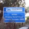
The Highways Agency make clear when the new road opens on this sign at Cottingley Bar, close to the northern end of the new route.
The new green footbridge, under construction in July, opened in September and replaced Treacle Cock Alley — the name will be sadly missed, but the alley will not. At the time of visiting in July crossing here involved walking across the road bed and then under a six-foot cattle creep under the railway.
South from Park Street overpass (the site of the panoramic shot from July) — the northbound side is now looking about finished, while southbound isn't started still.
New traffic lights, signs, islands and roadworks at Ferncliffe Road in preparation for the new junction.
The southbound entry slip road from Ferncliffe Road, now looking almost done. In July this was a dirt track.
The exit sliproad from the Relief Road heading northbound, looking not much advanced from its state in July.
The view north from Ferncliffe road, with the Britannia footbridge visible across the road and canal, looking much nearer completion.
The underpass on Ferncliffe Road, with the northbound side of the Relief Road now surfaced, but the southbound not so.
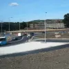
Traffic on the existing A650 is diverted on a temporary line around the new southern terminal roundabout.
The southern roundabout, and in the background, the Bankfield hotel which has been somewhat inconvenienced by the new road.
