Until 1966, South Wales was actually quite isolated from the nearby parts of south-west England and, in fact, from London. To get there you had a number of options. You could take the train, which ran in a tunnel beneath the Severn estuary (and still does today); you could drive through Gloucester, which was the southernmost road crossing of the river; you could load your car onto a train at Bristol and have it taken through the tunnel; or, if you were really determined (and lived locally enough for none of the other choices to be worthwhile), you could take your car down to the shore and load it onto the ferry.
The old car ferry between Aust and Beachley was old and slow, carrying about six cars or light vans at any one time and connecting the isolated village of Beachley, on a hard-to-reach peninsula between the Wye and Severn, to Aust, a tiny gathering of houses some miles from civilisation along a narrow B-road.
The ferry closed in 1966 when the M4 Severn Bridge (now M48) opened to traffic, but is not forgotten — having featured on a Bob Dylan album cover among much else — and the remains of its two terminals can still be seen today.
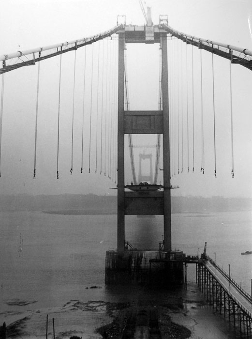
The construction of the Severn Bridge was one of the biggest and most famous achievements of the 1960s motorway programme. Work on the bridge took several years; here the cables have been put in place awaiting the arrival of road deck sections.

Looking west from the top of the tower on the Beachley side, the section across the Beachley peninsula is visible, leading to a gap where the Wye Bridge now stands. The section in the foreground is still in England; Wales lies across the Wye in the distance.

This third archive picture, from the top of the Beachley tower again, shows the road deck mostly in place and the shore close to Aust is visible opposite.

Today the Severn Bridge is a local road, bypassed by an even larger bridge downstream. But it remains incredibly handsome and striking — and far more characterful and beloved than its replacement.
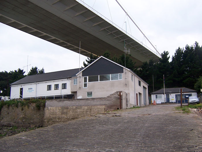
Here, at Beachley, it passes over the old ferry terminal, looking quite surreal where it appears to hang in mid-air over the new lifeboat building.

The cobbled slipway leads down into the river, still well-maintained and used for the coastguard and an occasional fishing trip.

A single mooring hook remains on the slipway. Over the river, the buildings at the former Severn View services are visible.
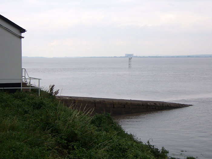
Looking upstream, the disused power plant on the eastern bank of the Severn is visible.

In case anybody was in doubt over the former importance of this site, a pub just next to the slipway is named the Old Ferry Inn. So that's clear, then.

From beneath the bridge, the rumbling sound of traffic overhead is occasionally broken by loud thuds and metallic chimes where lorries bounce across expansion joints. The road deck is hollow metal box sections, with a thin layer of surfacing on top, so traffic vibration is amplified down here.

It's clear when looking up that the bridge deck arrived in sections that were slotted together, one after the other, to form a roadway. Each section was towed in by barges on the river and lifted into place.

On the other side of the river at Aust, the terminal was not taken over by anybody else and has been slowly reclaimed by nature over the last 40-odd years.

We're definitely in the right place, though — here's the ticket barrier that foot passengers would have passed through.

The shore is separated from the river itself by marshy ground, and the ferry was reached by a lengthy wooden pier. Most of it has now collapsed.

The road deck on the left side was about wide enough for one car; a narrower section on the right formed a footpath. For whatever reason, the road deck is in a sorry state but the footpath has survived in much better condition.

The supports for the pier continue out into the water, and beyond it, the structure that killed off the ferry arches across the river.

To the left, the Aust ferry terminal has a second striking view — the newer M4 Second Severn Crossing, opened in 1996, and its lengthy approach viaducts.