Gorton Brook underbridge, view north, 3 April 1995
Gorton Brook underbridge, view north (see all photos of the same view)
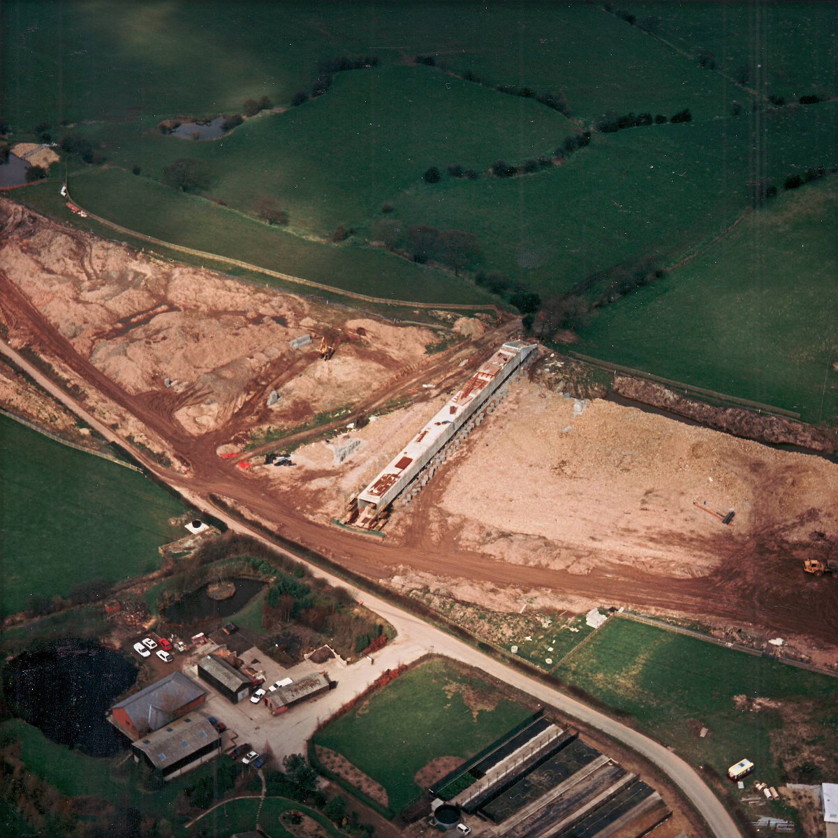
The new underbridge structure appears nearly complete here, and will later be covered when the motorway embankment is built on top of it. Brindle Road, running across the bottom of the picture, was severed when the M65 was built, so the underbridge here is not designed for general traffic and is simply a farm access for the fields to the north.
Structure 15 (Gorton Brook underbridge)
What's new
The road that made no sense
It was the UK's only single-carriageway motorway, and twenty years ago it ceased to exist. This is the story of the strange fascination it held, and of my place in history.
The forever bottleneck, part 2
The second part of the story, where we learn why exactly the M4 gets narrower on the final approach to Europe’s biggest city.
The forever bottleneck, part 1
The M4 into London was one of the UK's earliest and most ambitious motorway projects. It was bold, pioneering... and almost instantly regretted.
Have you seen...
Burdock Way

The humble West Yorkshire town of Halifax may well be the creator of the most adventurous urban road scheme in the country. It's astonishing, but what was built isn't even the half of it.