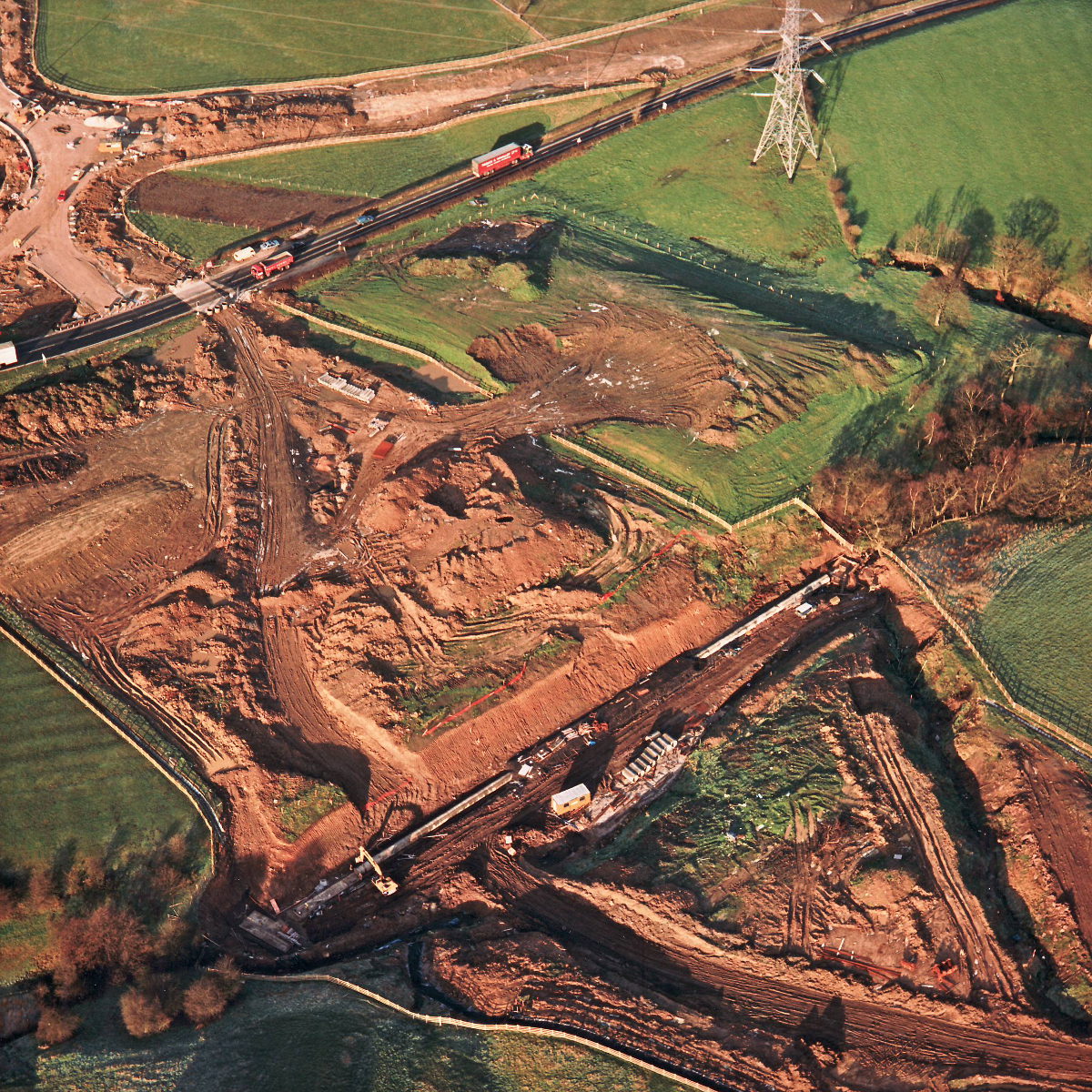
Stanworth Farm underpass, view north west, 12 January 1995
Stanworth culvert, view west (see all photos of the same view)
This is actually a view north west from Stanworth Farm underpass; visible at the bottom of the picture is Stanworth culvert, where a small brook is piped under the motorway embankment.
What's new
The road that made no sense
It was the UK's only single-carriageway motorway, and twenty years ago it ceased to exist. This is the story of the strange fascination it held, and of my place in history.
The forever bottleneck, part 2
The second part of the story, where we learn why exactly the M4 gets narrower on the final approach to Europe’s biggest city.
The forever bottleneck, part 1
The M4 into London was one of the UK's earliest and most ambitious motorway projects. It was bold, pioneering... and almost instantly regretted.
Have you seen...
M6 Hanchurch-Lymm
One of the longest lengths of motorway to open in one go, this book celebrates the opening of the M6 from the Potteries to the North West.