View east from Riley Green interchange to Stanworth rock cutting, 12 January 1995
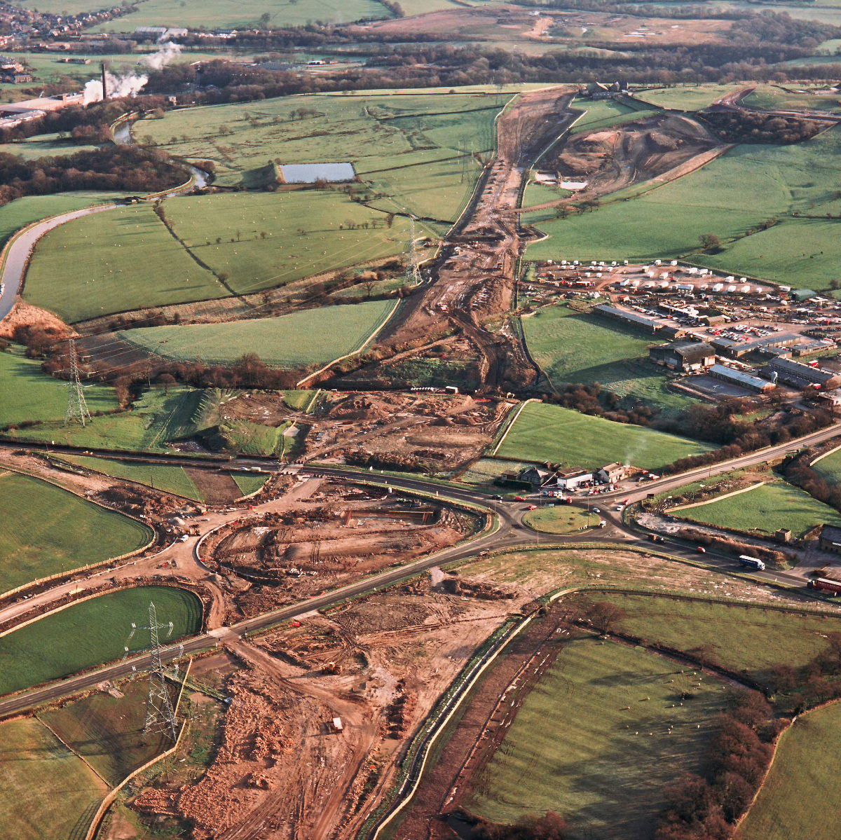
View east from Riley Green interchange to Stanworth rock cutting (see all photos of the same view)
The shape of Riley Green interchange is starting to emerge in the foreground. In the distance, the end of contract 1 is clearly visible; with work yet to start on contract 2, the construction site ends in a field just short of the woods.
A674 Chorley Road
A675 Bolton Road
What's new
The road that made no sense
It was the UK's only single-carriageway motorway, and twenty years ago it ceased to exist. This is the story of the strange fascination it held, and of my place in history.
The forever bottleneck, part 2
The second part of the story, where we learn why exactly the M4 gets narrower on the final approach to Europe’s biggest city.
The forever bottleneck, part 1
The M4 into London was one of the UK's earliest and most ambitious motorway projects. It was bold, pioneering... and almost instantly regretted.
Have you seen...
Mickleham Bends

Once it was one of the UK's most dangerous roads — just what is so special about a bit of dual carriageway in Surrey?