Sandy Lane overbridge, view north, 2 June 1997
Sandy Lane overbridge, view north (see all photos of the same view)
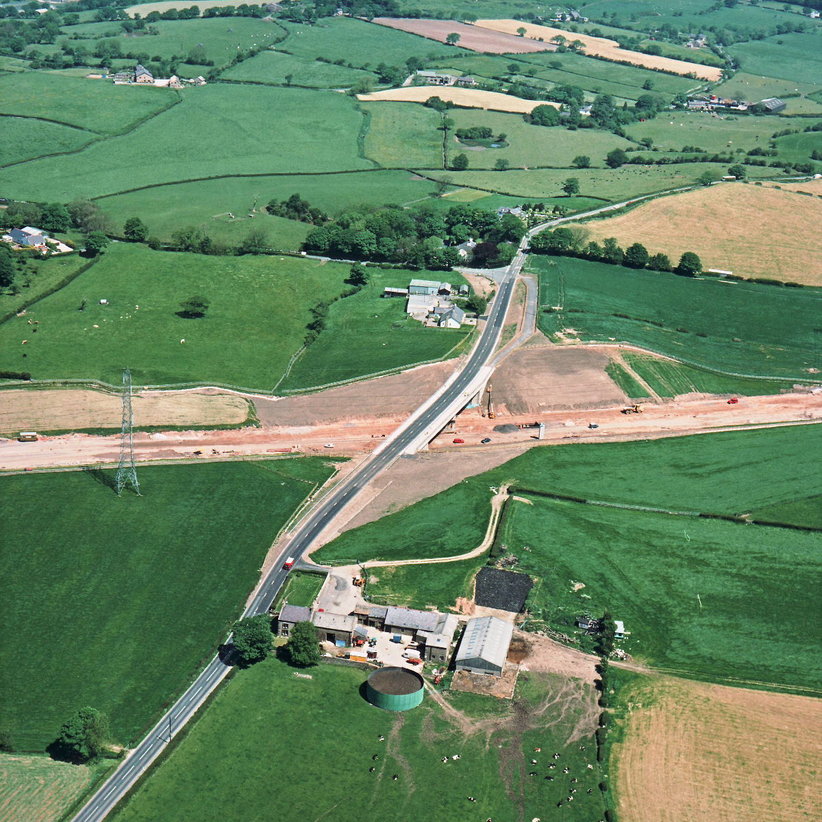
Sandy Lane bridge has only been completed and brought into use in the last three months. The temporary diversion that carried traffic around the bridge is now cleared away, and work is in progress to complete the motorway underneath on the short section that had been blocked by the diversion.
Structure 16 (Sandy Lane overbridge)
B5256 Sandy Lane
What's new
The road that made no sense
It was the UK's only single-carriageway motorway, and twenty years ago it ceased to exist. This is the story of the strange fascination it held, and of my place in history.
The forever bottleneck, part 2
The second part of the story, where we learn why exactly the M4 gets narrower on the final approach to Europe’s biggest city.
The forever bottleneck, part 1
The M4 into London was one of the UK's earliest and most ambitious motorway projects. It was bold, pioneering... and almost instantly regretted.
Have you seen...
From War to Worboys

The tale of how British traffic signing developed between the Second World War and the mid-1960s, bringing us from a system designed at the turn of the century to the signs we still use today.