Hill House Farm and Sandy Lane overbridges, view east, 14 February 1997
Hill House Farm and Sandy Lane overbridges, view east (see all photos of the same view)
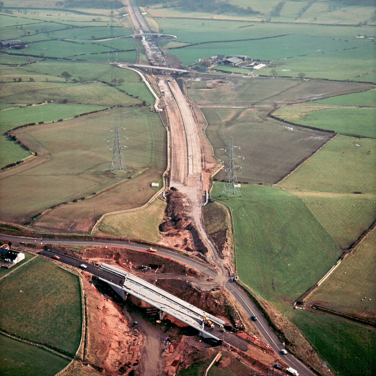
This view shows Sandy Lane at the bottom, and beyond the motorway running past Marsh Farm and Marsh Lane as far as the Leeds-Liverpool Canal. A black waterproofing membrane has been rolled out across the bridge deck but hasn't yet been put into place.
Structure 16 (Sandy Lane overbridge)
Structure 17 (Marsh Lane overbridge)
Structure 17a (Marsh Farm overbridge)
B5256 Sandy Lane
What's new
The road that made no sense
It was the UK's only single-carriageway motorway, and twenty years ago it ceased to exist. This is the story of the strange fascination it held, and of my place in history.
The forever bottleneck, part 2
The second part of the story, where we learn why exactly the M4 gets narrower on the final approach to Europe’s biggest city.
The forever bottleneck, part 1
The M4 into London was one of the UK's earliest and most ambitious motorway projects. It was bold, pioneering... and almost instantly regretted.
Have you seen...
Forth Bridges

There's plenty of pictures of the three magnificent bridges over the Firth of Forth at Queensferry. But not many are taken from beneath.