Hill House Farm and Sandy Lane overbridges, view east, 17 July 1996
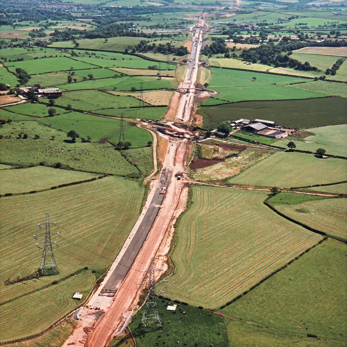
Hill House Farm and Sandy Lane overbridges, view east (see all photos of the same view)
Sandy Lane is just out of shot at the bottom of the picture, Marsh Lane bridge is in the middle with Marsh Farm bridge beyond it.
Structure 17 (Marsh Lane overbridge)
Structure 17a (Marsh Farm overbridge)
What's new
The road that made no sense
It was the UK's only single-carriageway motorway, and twenty years ago it ceased to exist. This is the story of the strange fascination it held, and of my place in history.
The forever bottleneck, part 2
The second part of the story, where we learn why exactly the M4 gets narrower on the final approach to Europe’s biggest city.
The forever bottleneck, part 1
The M4 into London was one of the UK's earliest and most ambitious motorway projects. It was bold, pioneering... and almost instantly regretted.
Have you seen...
Mistakes
Making road signs is a tricky business, but fortunately the professionals who design them get it right. Usually.