M6 interchange, view south, 29 April 1996
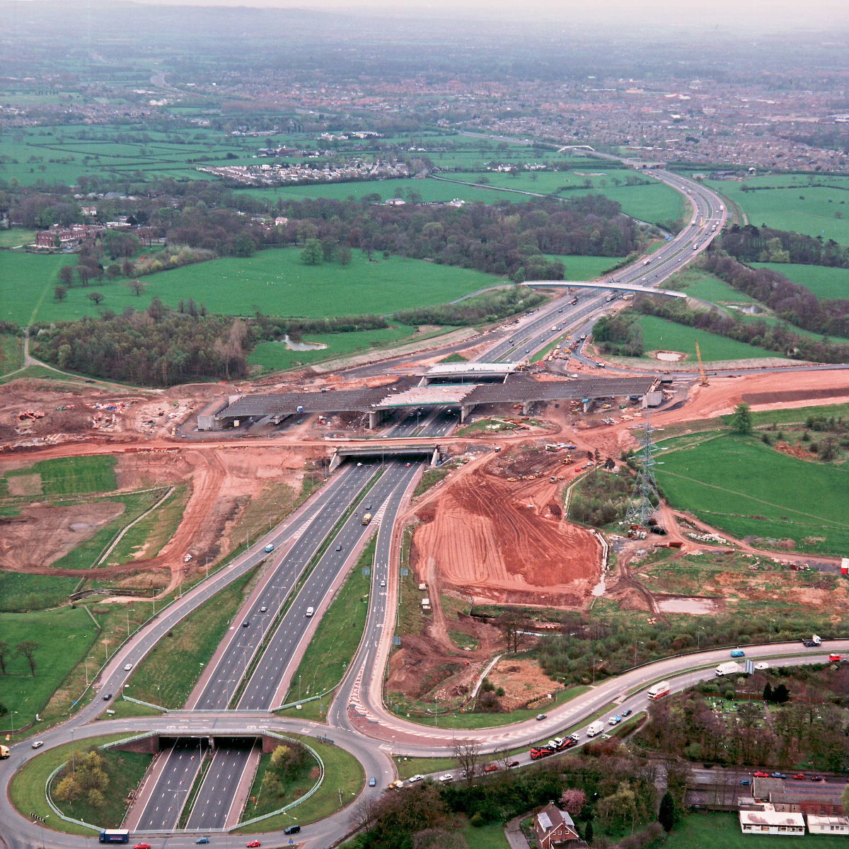
M6 interchange, view south (see all photos of the same view)
This wider picture shows the new M6 interchange in context. Junction 29, with the A6, is at the bottom of the picture. In the middle of the picture new embankments are being piled up next to the sliproads; eventually those sliproads will be closed and rebuilt so that they join the new roundabout at the M65.
Structure 4/4a/4c (M6 interchange bridges)
Structure 6a (Cuerden footbridge, M6)
A6 Preston Road
M6 motorway
What's new
The road that made no sense
It was the UK's only single-carriageway motorway, and twenty years ago it ceased to exist. This is the story of the strange fascination it held, and of my place in history.
The forever bottleneck, part 2
The second part of the story, where we learn why exactly the M4 gets narrower on the final approach to Europe’s biggest city.
The forever bottleneck, part 1
The M4 into London was one of the UK's earliest and most ambitious motorway projects. It was bold, pioneering... and almost instantly regretted.
Have you seen...
Studland Motor Road
The first motorway opened in 1958. The first road restricted to motor traffic, on the other hand, opened in 1923...