View west from Marsh Lane to Sandy Lane, 21 October 1996
View west from Marsh Lane to Sandy Lane (see all photos of the same view)
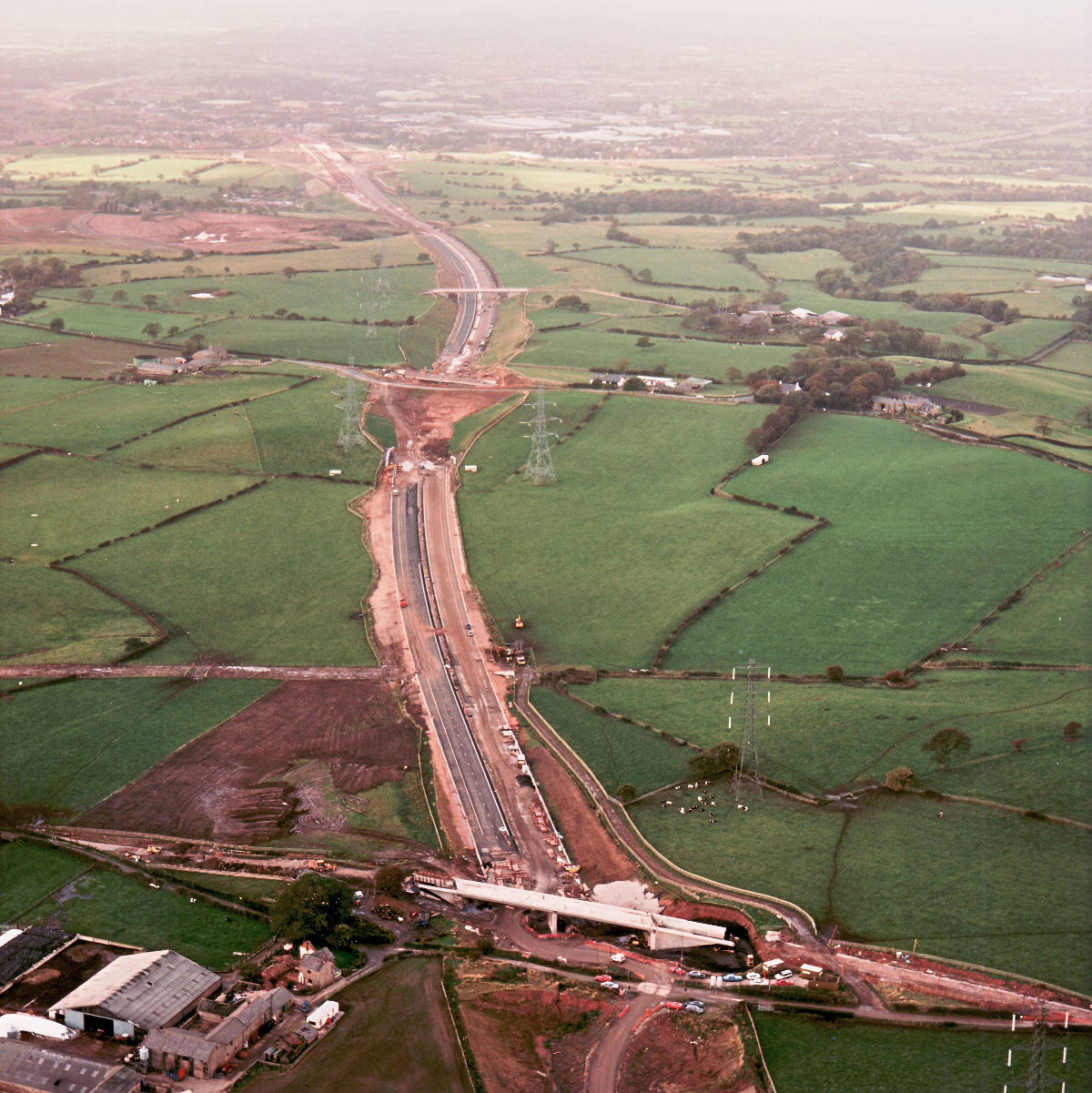
Marsh Lane bridge, at the bottom, and Sandy Lane, towards the top of the picture, are both in an advanced state of works now, but neither can yet carry traffic, meaning the temporary diversions for both are still blocking the line of the motorway. Between them, though, both carriageways have been built, surfaced and had markings laid in complete isolation.
Structure 16 (Sandy Lane overbridge)
Structure 17 (Marsh Lane overbridge)
B5256 Sandy Lane
What's new
The road that made no sense
It was the UK's only single-carriageway motorway, and twenty years ago it ceased to exist. This is the story of the strange fascination it held, and of my place in history.
The forever bottleneck, part 2
The second part of the story, where we learn why exactly the M4 gets narrower on the final approach to Europe’s biggest city.
The forever bottleneck, part 1
The M4 into London was one of the UK's earliest and most ambitious motorway projects. It was bold, pioneering... and almost instantly regretted.
Have you seen...
Clear and legible

A century ago, one short memorandum issued by the Ministry of Transport laid the groundwork for a system of standardised, uniform road signs and a great deal more.