View west from Marsh Lane to Sandy Lane, 2 June 1997
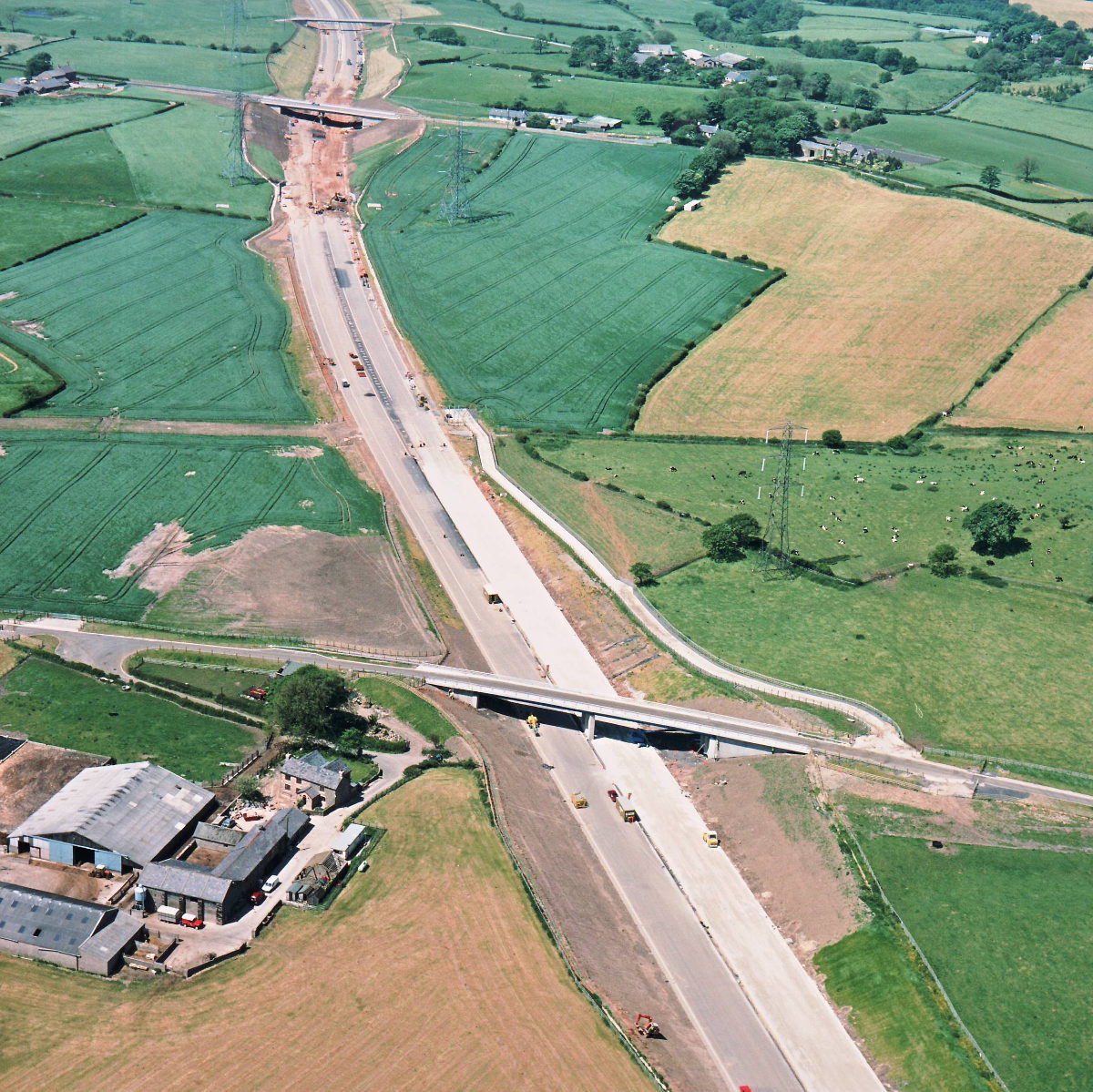
View west from Marsh Lane to Sandy Lane (see all photos of the same view)
Marsh Lane is at the bottom of this picture. In the distance, at Sandy Lane, work is happening at a rapid pace to close the gap in the otherwise mostly complete motorway formation.
Date
2 June 1997
(see all photos from this date)
Direction of view
West
Structures visible
Structure 16 (Sandy Lane overbridge)
Structure 17 (Marsh Lane overbridge)
Roads visible
B5256 Sandy Lane
What's new
The road that made no sense
It was the UK's only single-carriageway motorway, and twenty years ago it ceased to exist. This is the story of the strange fascination it held, and of my place in history.
The forever bottleneck, part 2
The second part of the story, where we learn why exactly the M4 gets narrower on the final approach to Europe’s biggest city.
The forever bottleneck, part 1
The M4 into London was one of the UK's earliest and most ambitious motorway projects. It was bold, pioneering... and almost instantly regretted.