Sandy Lane overbridge, view north, 16 October 1995
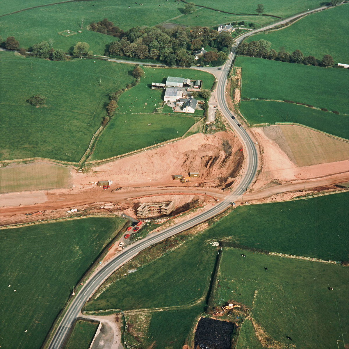
Sandy Lane overbridge, view north (see all photos of the same view)
Progress at Sandy Lane since the last set of photographs three months ago has not been great, but some small welfare buildings have appeared in the cutting below, perhaps indicating that work is about to start on the new bridge.
Structure 16 (Sandy Lane overbridge)
B5256 Sandy Lane
What's new
The road that made no sense
It was the UK's only single-carriageway motorway, and twenty years ago it ceased to exist. This is the story of the strange fascination it held, and of my place in history.
The forever bottleneck, part 2
The second part of the story, where we learn why exactly the M4 gets narrower on the final approach to Europe’s biggest city.
The forever bottleneck, part 1
The M4 into London was one of the UK's earliest and most ambitious motorway projects. It was bold, pioneering... and almost instantly regretted.
Have you seen...
Rainbow Signals

The annual London Pride event was accompanied, in 2016, by some quite unusual changes to traffic lights around Trafalgar Square. The green men went missing — and seven new symbols took their place.