View east from Riley Green interchange to Stanworth rock cutting, 10 January 1996
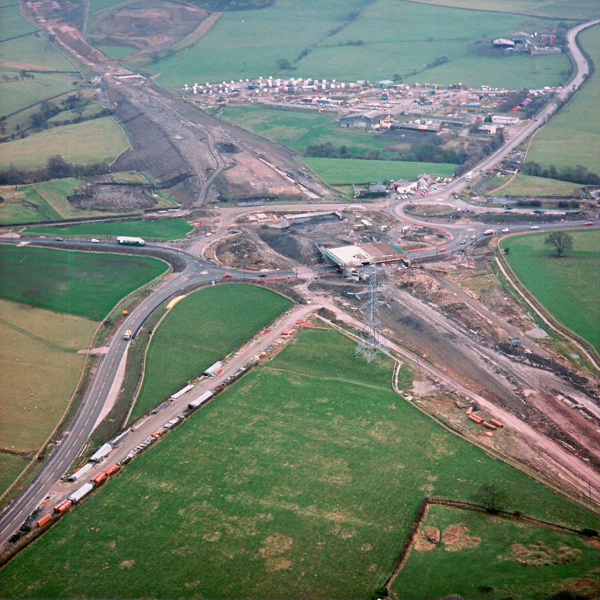
View east from Riley Green interchange to Stanworth rock cutting (see all photos of the same view)
From here the scale of the embankment carrying the motorway from Riley Green towards Stanworth can be seen. It has now reached approximately its full height. In the distance, the vast work compound is visible.
Structure 20/20a (Riley Green interchange bridges)
A674 Chorley Road
A675 Bolton Road
What's new
The road that made no sense
It was the UK's only single-carriageway motorway, and twenty years ago it ceased to exist. This is the story of the strange fascination it held, and of my place in history.
The forever bottleneck, part 2
The second part of the story, where we learn why exactly the M4 gets narrower on the final approach to Europe’s biggest city.
The forever bottleneck, part 1
The M4 into London was one of the UK's earliest and most ambitious motorway projects. It was bold, pioneering... and almost instantly regretted.
Have you seen...
Oxfordshire Signs
This is the story of one man at Oxfordshire County Council who pre-empted the development of modern road signs - much to the annoyance of the men from the Ministry.