This feature originally appeared on Nick Allan's now-closed website. All text and pictures on this page are his work.
The A74 was the only dual-carriageway route from Scotland to England. It was a low-standard dual carriageway that carried large volumes of traffic while having many at-grade intersections with both other major roads as well as farm tracks. It also had bus stops and houses along its length.
A new motorway was constructed parallel to the existing road, leaving the old road to be used as a local access road and one of the carriageways turned into a cycle-path. Today it is amazing to think that all the traffic on the six-lane motorway just a few metres away was once carried upon the empty tarmac that is now the B7078 and B7076.
The images work from just north of Lockerbie on the B7076 to south of Lesmahagow on the B7078. Cardinal directions are given on the assumption is north up the road towards Glasgow and south is down the road towards Carlisle, and so having the road as the north-south axis of the images.
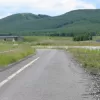
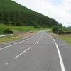
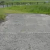
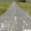
The first four photographs were taken just north of Lockerbie on the B7076, north of A74(M) junction 17.
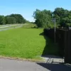
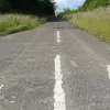
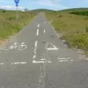
The first is facing south standing in the former northbound lanes of the A74. There road is passing over a bridge, although this is very difficult to see thanks to all the growth on the northbound carriageway. The giveaway is what appears to be a break in the barrier on the side of the southbound carriageway, which seen up close is the brick parapet for the bridge. Quite why this isn't protected by a barrier is a bit of mystery.
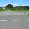
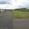
The second photograph shows the view northwards. One can see that the northbound carriageway has been landscaped over north of the access road to the houses to hide it. The houses must certainly be a lot quieter right now, as they would've had the road thundering past their back gardens.
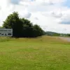
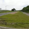
Looking south again in the third photograph one can just make out the bus stop by the fence of the house. This would have originally been located in a small layby as buses used to stop on the A74. The road was littered with signs warning of buses stopping on the carriageway. Remember, this road was effectively a motorway before! Quite strange that they haven't bothered to move the bus stop since they removed the carriageway.
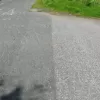
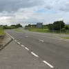
In this photograph, the lane markings of the old carriageway can be seen. The dashed markings closest to the photographer were the old sliproad/junction edge markings. The next set of lines are the centre line, and the lines after that are the old lines to indicate the edge of the right-turn gap in the central reservation. Beyond that are the accompanying right-turn lane markings for the southbound carriageway.
The next photos were taken just south of Johnstonebridge on the B7076, south of A74(M) junction 16.
This abandoned petrol station was abandoned even when the A74 was in use. In the distance the new A74(M) can be seen taking a lower alignment on the hillside. The original carriageways have been completely redesigned around here, with the northbound completely removed and the southbound widened to accommodate two large cycle lanes on either gutter.
The roadsign for the A74(M) also indicates that this is probably not the permanent name for the road. The road number is on a separate bit of sticker that is wider than the blue space allocated for it. One would assume that the blue backing to the words A74(M) will be removed to reveal "M6". The rebuild of the carriageways as mentioned in the caption for the first Johnstonebridge. The former northbound carriageway is completely removed and you'd be hard pressed to know it was there.
Nick Allan, this page's author, asked if anyone knew what was here. Three people did!
Alistair Bell remembers it:
"Opposite the abandoned petrol station was a tiny petrol station abandoned in the 1970s. The A74 dual carriageway was officially opened in 1973 and some artefacts from the original two lane road remained for some years where the original road was converted into a carriageway for the new road. Some old garages were briefly coverted to HGV weigh stations. I spent my childhood travelling up and down this road in the 1970s & early 1980s. My folks remeber the dual carriageway being built in the late 60s/early 70s and it is bizarre to think that all the traffic went on this road! I remember it taking a long time to reach Glasgow from Carlisle."
Bernadette Molloy went that way regularly:
"Across the road from the old petrol station there lay another one - also a Little Chef which we used to stop at."
And Ian Buckle was a regular:
"The site on the northbound side, opposite the abandoned petrol station, was a Little Chef. It closed down as soon as the new service area opened. It was always my breakfast stop when making early morning trips to the Scottish Highlands."
These photographs were taken just south of Beattock Village on the B7076.
Like the bus stop at Lockerbie, not all signs have been relocated. This sign for Beattock services looks very out of place, firstly for its positioning and more importantly its size. As it is designed to motorway-traffic standards it is absolutely massive compared to normal signage.
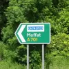
The A701 took over some of the former A74 alignment around Beattock Village. These next few photographs were taken just south of junction 15 of the A74(M).
Part of the old northbound carriageway has been kept along this stretch to be used as the a cycle path. At this driveway entrance the road shows through really well. One can pick out catseyes and lane markings quite easily.
Here a catseye can be seen and one of the former lane markings and over by the cycle path the old solid edge line can be seen.
Facing the other way for a moment the old junction edge markings can be seen underneath the current cycle path markings, along with the taper for the exit road from the carriageway.
Turning around again (please don't get dizzy now) we look at the junction markings from the other direction. Beyond the cycle path centre line the old carriageway edge markings can be seen, along with a junction edge marking to the left of the current cycle path centre line.
Opposite the junction is this signpost. Once again one can see how "A74(M)" appears so out of place and appears to have been stuck over something else. The words are so small compared to the rest of the sign that it would seem fairly sensible to assume that the white backing behind the current road number can be removed to reveal "M6".
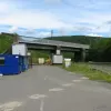
The Harthope Bridge where the West Coast mainline crosses over the top of the A74 was always a landmark on journeys up and down the A74. To get the road through the bridge it made quite a quick chicane. Always a bit hairy when travelling along, it now looks a bit empty today, with the former southbound carriageway now a railway storage yard. Some bollards appear to have been removed too, presumably installed to prevent people driving in.
Further up by March Farm, a bridge over the west coast mainline reveals the former road once again. The old northbound carriageway shows up at this bridge, with the left-hand edge marking standing out particularly. On the remaining southbound carriageway the road is festooned for its entire length with two way traffic signs and reminder arrows painted on the pavement. The right hand edge of the carriageway has been removed but the former lane marking can be seen...
Just a little bit further north up by Beattock Summit, the original A74 carries straight on while the new B7076 takes a little dogleg to climb over the A74(M) to the other side and returns to the old A74 on the other side of the new motorway.
The carriageway edge line gives away the road's former alignment as it the burned out remains of the line head straight ahead while the cycle lane has been curved to provide a perpendicular junction with the B7076. The original A74 continued straight over the path of the motorway and took a slight left turn as it did so.
Just over the other side of the new A74(M) from the previous photograph the B7076 picks up the old A74 again, with the old bridge over the River Clyde. Facing south, the current B7076 straddles both former carriageways of the A74. It is hard to believe that a dual carriageway was squeezed over this bridge. It was hard to believe when it was!
Turning to face west at the same point, the former northbound carriageway can be seen, complete with lane markings, as well as the new motorway directly behind it.
And turning to face east, the old carriageway can be seen in conjunction with a rather long forgotten sign, without a junction for it to sign anymore.
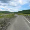
Further north on the B7078, on the moors north of Abington, a junction with the cycleway once again reveals the former northbound carriageway. Facing north at this point, the cycle path (incidentally cycle route number 74) can be seen to take the long climb up the hill with the sweeping bend. Just beyond the cycle path centre line markings, the former lane marking of the northbound carriageway can be seen running into the scrub. The wide central reservation also shows up here as a line of trees.
A little bit further north once more and a hotel has made use of the former road as car-park. The cycle path takes over one complete lane of the former northbound carriageway that has been resurfaced in a different tarmac. The cycle lane joins the carpark here, with the solid centre line marking the edge being of the bumpy type used to delineate the hard-shoulder on motorways.
This northwards view affords the best look so far of how the former road would've looked with two carriageways completely intact.
Further north still, the road runs uphill from its modern counterpart, with the cutting made for both carriageways standing out quite obviously. The cutting for the former carriageway stands out quite clearly here. Yet more of the two traffic signs are visible. A layby has remained on the former northbound carriageway, providing a resting point for cyclists. Over to the right, the M74 can be seen sweeping over the moor.
Finally just north of M74 junction 12 we witness the former A74 in all its full-size glory.
This is the first chance to see the A74 as it once was, complete with grassy central-reservation and narrow lanes.
Taking a few steps to the left reveals the former A74 climbing up a hill and over a bridge. It is strange to think that this is once what the main north-south road out of Scotland looked like.
North of junction 11 the former road continues as it once did, as a full dual carriageway, even if there is no-one to use it! Facing northwards the B7078 climbs another hill, with its old fashioned dual-carriageway design.
At the top of the hill shown a couple of photos ago, the old A74 looks very empty, as well as an abandoned M74 construction site. This part of the road was one of the earliest stages to get bypassed with the extension of the M74 southwards from its former terminal at junction 9 near Blackwood. This was part of the road ran straight through the middle of the town of Lesmahagow. Still, for some unknown reason, the decision was made to keep both carriageways.
Northwards, the old road looks exceptionally erie here, with the long abandoned cabins either side of the road. An old right-turn lane is visible in the foreground as the road makes it arrow-straight course over the horizon.
The long abandoned cabins on the east side of the B7078. One assumes they were part of an M74 construction site.
Comments
I travelled on the A74 in the sixties before it was converted into a dangerous dual carriageway. A company called M M Ltd was constructing it south of Crawford (where we left the X30 Gay Hostess bus from Manchester) and waited in the Merlindale Tea rooms for the local bus service to Wanlockhead (the highest village in Scotland) operated by J & J Leith and Sons of Sanquhar. I revisited it by car in May 2019 and the Tea rooms are now 2 houses. To think in the sixties the A74 was a single carriageway! First it was succeeded by what is now the A702 at Crawford, then the A74(M) to Abington, then M74.
Hi when i was going on holiday with my family my father drove down the road to the start of the m6 in cumbria. The engineers should have built it properly. Its the only main road to have disappeared during the last 40 years.
M M Ltd, i think had a depot in Carluke, Castlehill area, i think their yard is now Stuarts Coaches. I seem to remember there was a filling station "in the valley" down from Beattock Summit and North of Beattock village, didn't drive at the time so memory is vague...
Fond memories driving down this overtaking a queue on the motorway for miles and miles...
I love this road . I've ridden it four times now . Twice on my ER5 Kawasaki and twice on my Harley . It's probably psychological but it always seems much quicker than the M74 . You really have to do your homework and keep your wits about you at many of the more complicated junctions or else you might find yourself heading back the wrong way . Sometimes I've traveled for so long without seeing another vehicle that I have actually waved at an oncoming car just for a laugh .
Make that six times .
I cannot remember the last time I have driven the M74 between J13 Abington - J15 Moffat as I always use the old route because there's many places to stop and not worry about time limits for parking.
Further to my last comment of October 2017, the road has markedly deteriorated since then, such that in 2019 when I came this way again, I had to be very cautious. I think the council are just letting it sllde into disrepair, frankly. Obviously the low traffic levels don't help as with money tight, the busy roads are going to get the attention. So if you're going that way, look out.
I have to agree with you there . There are many good bits but there are some real backbone crunchers if you're not paying attention especially if you happen to be on a Harley with the original suspension . I still get a kick out of riding what I've come to call " The Lonely Road " though . No cameras or coppers is a bonus too if I want to " Make progress " ?
Back in 97 I was driving down the M74 and it was a dark and stormy night. Suddenly I had a car driving north to my left, I had a bit of a panic. Then I realised that the car was on what I now know is this road, but for a couple of seconds I thought I was on the wrong carriageway!
Back in the early 1960s my father along with several other men from the Leadhills and Wanlockhead villages worked for M&M constructing the A74 dual carriageway. I remember him mentioning a stretch called Paddys Rickle bridge.
The pre-motorway A74 has always fascinated me, and as somebody too young to remember it (aside from vaugley remembering the bit between Carlisle and Gretna, which was among the highest standard sections) I've been trying for about the past decade to find photos of what it used to look like. There have been some old c.1980s/early 1990s photos of it uploaded to the internet in recent years and I've found these very interesting to look at. From what I can tell from the photos I've seen, most of the road was a more or less identical standard to most of the non-motorway D2 stretches of A1 in England, some of which have been upgraded to A1(M) in recent years. Much of it seemed a comparatively acceptable standard but the bit to the south of Lesmahagow was always poor quality, and I suspect this was why it was the first bit of the old road to be replaced by motorway (I think it was also the oldest D2 stretch, with some of it having been built in the 1930s and 1940s). I know that most of the route was retrofitted with crash barriers and some sections had hard strips added during the late 1970s and early 1980s, but based on an old mid 1980s video I found about the construction of the M74 at Lesmahagow, that section of the A74 received no retrofits despite already having probably been the lowest standard stretch.
I think the photos on this page were taken about 20 years ago and it's extremely difficult to imagine how the old road looked in most of them despite it having been upgraded just a few years prior, so I suspect the landscapers did a pretty good job at hiding most traces of the former road.
There's an abandoned bridge over the railway at Kirkpatrick-Fleming adjacent to the modern road where you can still clearly see both carriageways of the old A74, complete with markings:
https://www.google.com/maps/@55.0231382,-3.1258995,150m/data=!3m1!1e3?e…
I think the junction of the former A74 that remains most intact today would be J22 of the A74(M), where the A75 starts - it had exactly the same layout prior to the road being upgraded. It's also still pretty easy to make out the former diamond interchange at Eaglesfield. Some of the other grade separated interchanges on the former road seem to have been effectively wiped from the map, such as at Lockerbie where it's difficult to make out any traces of the former road aside from a slightly wide verge to the west of the former southbound carriageway, which today carries both directions.
It would be interesting to know what the former D2 road was like at that rather narrow bridge over the River Clyde near Elvanfoot. I struggle to imagine how it would have looked given that it doesn't look suited for much more than wide S2.
I'm wasn't even born when the A74 (barring the Cumblerand Gap) was about, I'm not even from the North of England or South Scotland but I also fascinated by the A74, I'm interested in how the A74 looked back in its heyday, do you mind sharing what photos/videos you have found?
I drove on the a74 weekly from October 1980 to midd 1985 , as a delivery driver .
I loved the the road in every sense, it had character and made you alert after 100 miles on the m6.
I remember every landmark and cottage by the wayside, all the little roads that darted off here and there.
The only scary bits were the bridges over the rivers and railway, one of which was on a bend, and if you were overtaking a wagon on this bridge you had to be very careful.
The little chef's were magic and sadly missed nowadays.
Past Lesmahagow and on the 1966 2 lane motorway you could relax again.
Shaun, do you remember a filling station south of Beattock summit and north of Beattock itself? think i must have either imagined it or maybe it was further down, out the valley as it were....
After being inspired by this article, and the comments, I drove South from Jnc 14 to just before Gretna today. It's a great road, wide and smooth where it doesn't have to hack its way through later roundabouts or the few towns. Nodded slightly to myself when I spotted all the elements of the old road and gave a quiet cheer when I saw the bus stop. The M74 is actually a pleasant road to drive, but this was a good, nostalgic, change.













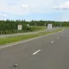
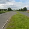


These roads are Scotland's Best Kept Motoring Secrets ! I use them every time I travel to Scotland because they are totally empty, one only passes the occasional car, or tractor. Of course there are few or even nil petrol stations, so one must make sure the tank is reasonably full.
Of course, being so empty and well graded, one can bat on a bit, and it's little slower than using the motorway with all its stress. Cruising at the 60 mph NSL is easy and one can exceed that for many, many miles, although I tend not to push the boat out too much !