The Hogarth Flyover is more than just a bridge carrying traffic — it's a metaphor for the whole of British transport planning in the late 20th century.
It was constructed in the early 1970s as a temporary solution to the traffic problems at the Hogarth Roundabout, which was due to be rebuilt in the near future as part of the Ringway plans. It was quickly put together with a cheap steel frame and was designed to last no more than a few years.
As you've probably guessed by now, that temporary flyover is still there. It's been in situ for more than 30 years and there's no intention to replace it. In fact, since these pictures were taken, it's undergone a major refurbishment project, with a largely new deck, surface and parapets, ensuring its survival and confirming that it's now a permanent fixture. It's make-do-and-mend on an epic scale.


The Hogarth Roundabout is the point where the A316 (carrying traffic from the M3) merges in to the A4 (carrying traffic from the M4). It is one of those awful places where traffic is pushed into smaller and smaller spaces on the way into London. We're approaching it from the A316.

Traffic in the middle lane passes through several sets of narrow 'gates' to prevent long or wide vehicles from trying to use the flyover.

And here it comes — a single lane of traffic rising from the middle of the road. The start of the slope isn't very graceful — it feels more like a ramp in a multi-storey car park than part of a major London radial route.

Traffic remaining at ground level gets the full set of options as only cars and motorbikes can use the flyover. In the background, it's becoming clear just how flimsy the structure is.

In true 1970s style, the roundabout has been equipped with welcoming pedestrian subways, decorated in brightly coloured tiles and graffiti.

The flyover itself crossing the roundabout — quite impressive in its own understated way. The central span has pairs of diagonal cross-braces, without which it would probably be in danger of falling over in a strong breeze.
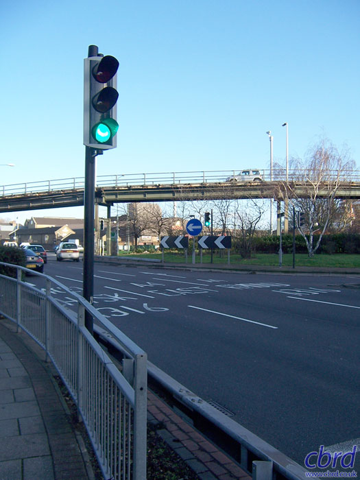
Approaching from the A4, the flyover is very obvious, though it could easily be mistaken for a footbridge. The traffic signals here are quite unusual — small and quite strange looking.

From the north side of the roundabout, the flyover again. It's not clear from most angles, but it actually goes through a double-bend, left then right.

A closer view from beneath. The closer you get, the more temporary it looks!

To the north of the roundabout, it's suddenly a fairly pleasant residential area. The neat terraced houses look quite odd placed right next to the flyover and the thundering traffic of the A4.

A look at the underside of the flyover as it descends towards the A4. It's a lot like a giant Meccano set.

Looking back up the slope, the descent is as steep as the climb.

Traffic coming down then has the opportunity to head in to London on the A4 or to branch off left to remain on the A316, which beyond here is a street through a residential area to Chiswick.

Another look up that slope — the flyover really is incredibly narrow! But then, for the money it must have cost, it represents an incredibly economic junction improvement. Perhaps more Meccano flyovers around London would be a cheap way to improve the traffic.

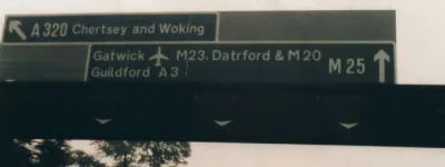
Traffic for the A316 to Chiswick gets priority as it swerves back onto the old road here. Note the confusing array of information that is impossible to take in as you try to stay on the narrow tarmac!

Most traffic goes straight ahead to merge with the three-lane A4 — the acceleration lane is generously long but not quite wide enough to accommodate a car. Quite scary!