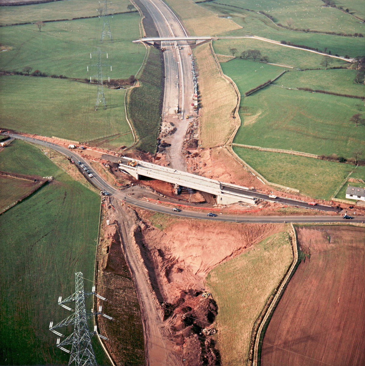
Sandy Lane overbridge, view west, 14 February 1997
Sandy Lane overbridge, view west (see all photos of the same view)
At Sandy Lane, the bridge is almost ready to receive a road surface. Until it's ready for use, though, the diversion can't be removed, which is now holding up progress on laying the road. In the distance, the advanced state of the rest of the road is apparent - this section is now lagging behind.
Structure 16 (Sandy Lane overbridge)
Structure 16a (Hill House Farm overbridge)
B5256 Sandy Lane
What's new
The road that made no sense
It was the UK's only single-carriageway motorway, and twenty years ago it ceased to exist. This is the story of the strange fascination it held, and of my place in history.
The forever bottleneck, part 2
The second part of the story, where we learn why exactly the M4 gets narrower on the final approach to Europe’s biggest city.
The forever bottleneck, part 1
The M4 into London was one of the UK's earliest and most ambitious motorway projects. It was bold, pioneering... and almost instantly regretted.
Have you seen...
M6 Hanchurch-Lymm
One of the longest lengths of motorway to open in one go, this book celebrates the opening of the M6 from the Potteries to the North West.