View east from Riley Green interchange to Stanworth rock cutting, 21 October 1996
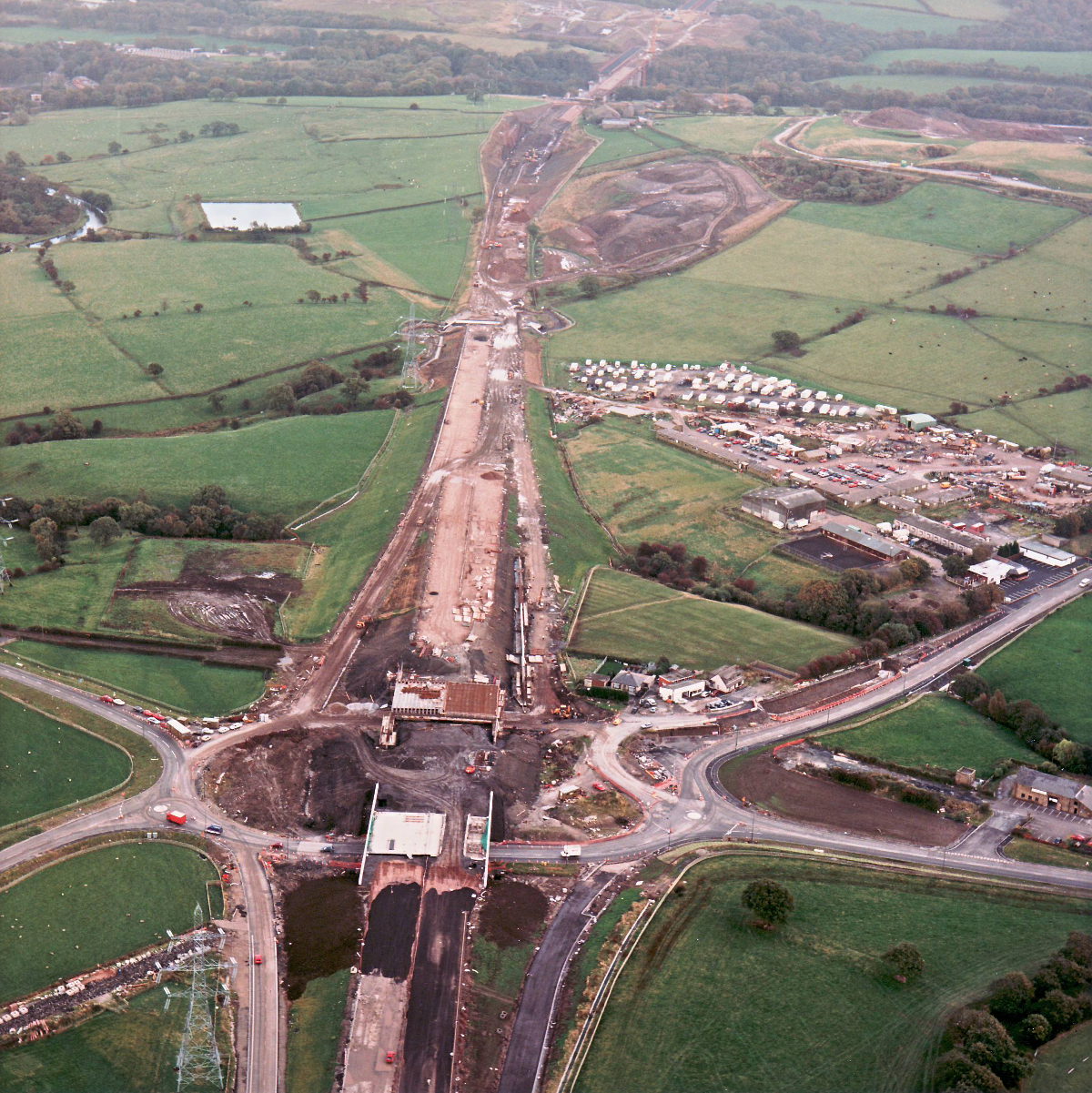
View east from Riley Green interchange to Stanworth rock cutting (see all photos of the same view)
On the right the temporary contractors' village can be seen, a field full of cars and caravans. It will be cleared away within the next six months as the scheme is completed. In the distance, work is still ongoing at Stanworth Farm underbridge.
Structure 20/20a (Riley Green interchange bridges)
Structure 21 (Stanworth Farm underpass)
A674 Chorley Road
A675 Bolton Road
What's new
The road that made no sense
It was the UK's only single-carriageway motorway, and twenty years ago it ceased to exist. This is the story of the strange fascination it held, and of my place in history.
The forever bottleneck, part 2
The second part of the story, where we learn why exactly the M4 gets narrower on the final approach to Europe’s biggest city.
The forever bottleneck, part 1
The M4 into London was one of the UK's earliest and most ambitious motorway projects. It was bold, pioneering... and almost instantly regretted.
Have you seen...
The Heads of the Valleys
The A465 Heads of the Valleys Road is one of the most spectacular trunk roads in the UK, and building it required some of the most remarkable civil engineering. This is the story of how the road was built in the 1960s, and how it's being rebuilt today.