View west from Tramway Lane underbridge, 21 October 1996
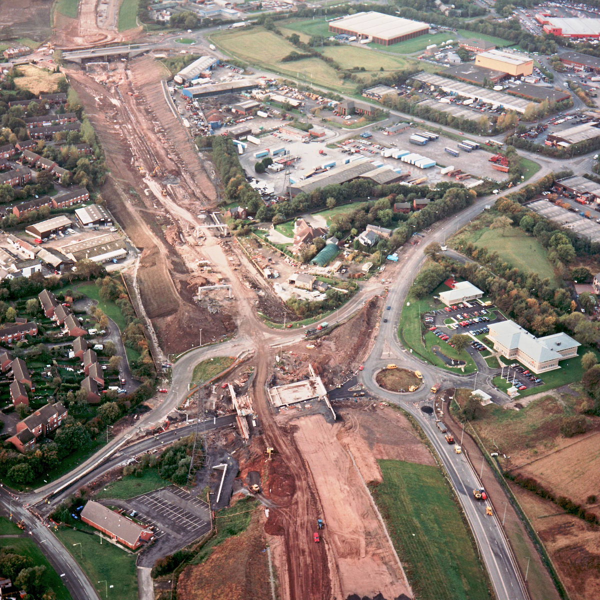
View west from Tramway Lane underbridge (see all photos of the same view)
This view shows the length of motorway between Tramway Lane (in the foreground) and the A6 Preston Road (in the distance). The road bed has now been formed on this length, and several overhead sign gantries installed. Tramway Lane itself now has tarmac laid on its new course under the motorway, but appears to be closed completely at this stage, perhaps to join the new section to the existing roads at either side.
Structure 8 (Tramway Lane underbridge)
What's new
The road that made no sense
It was the UK's only single-carriageway motorway, and twenty years ago it ceased to exist. This is the story of the strange fascination it held, and of my place in history.
The forever bottleneck, part 2
The second part of the story, where we learn why exactly the M4 gets narrower on the final approach to Europe’s biggest city.
The forever bottleneck, part 1
The M4 into London was one of the UK's earliest and most ambitious motorway projects. It was bold, pioneering... and almost instantly regretted.
Have you seen...
Smart Motorways
Motorways used to be really simple. Now they have electronic signals, variable speed limits, emergency lay-bys, part-time hard shoulders... Just what is so smart about Smart Motorways?