Riley Green interchange, view north east, 17 July 1996
Riley Green interchange, view north east (see all photos of the same view)
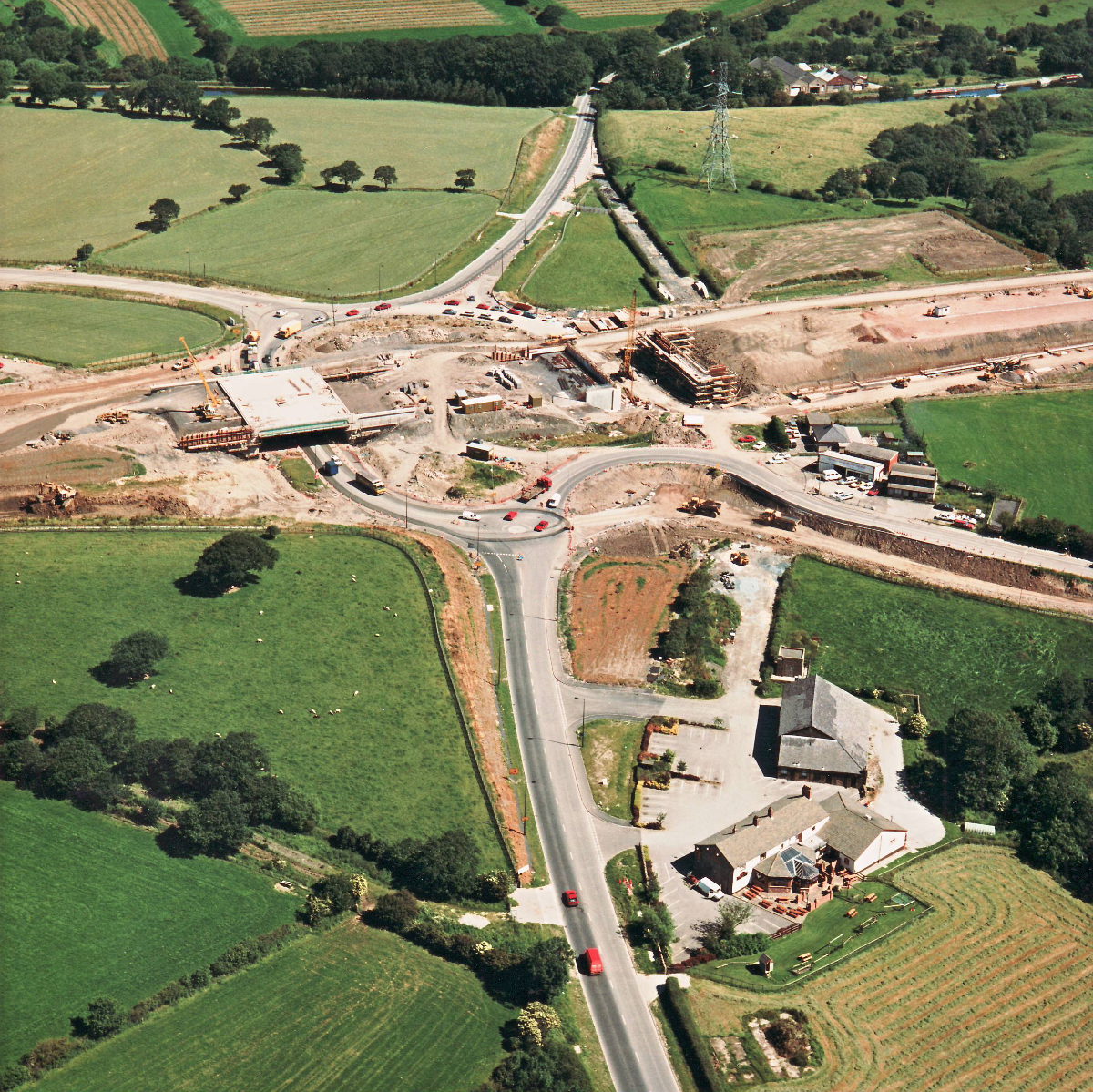
Riley Green Interchange is now taking shape, with bridge abutments for its second bridge now nearing completion.
Structure 20/20a (Riley Green interchange bridges)
A674 Chorley Road
A675 Bolton Road
What's new
The road that made no sense
It was the UK's only single-carriageway motorway, and twenty years ago it ceased to exist. This is the story of the strange fascination it held, and of my place in history.
The forever bottleneck, part 2
The second part of the story, where we learn why exactly the M4 gets narrower on the final approach to Europe’s biggest city.
The forever bottleneck, part 1
The M4 into London was one of the UK's earliest and most ambitious motorway projects. It was bold, pioneering... and almost instantly regretted.
Have you seen...
B7076 and B7078

What sound at first like a pair of forgotten country lanes turn out to have had a major part to play in the history of Scotland's roads.