View east from Sandy Lane to Marsh Lane, 20 July 1995
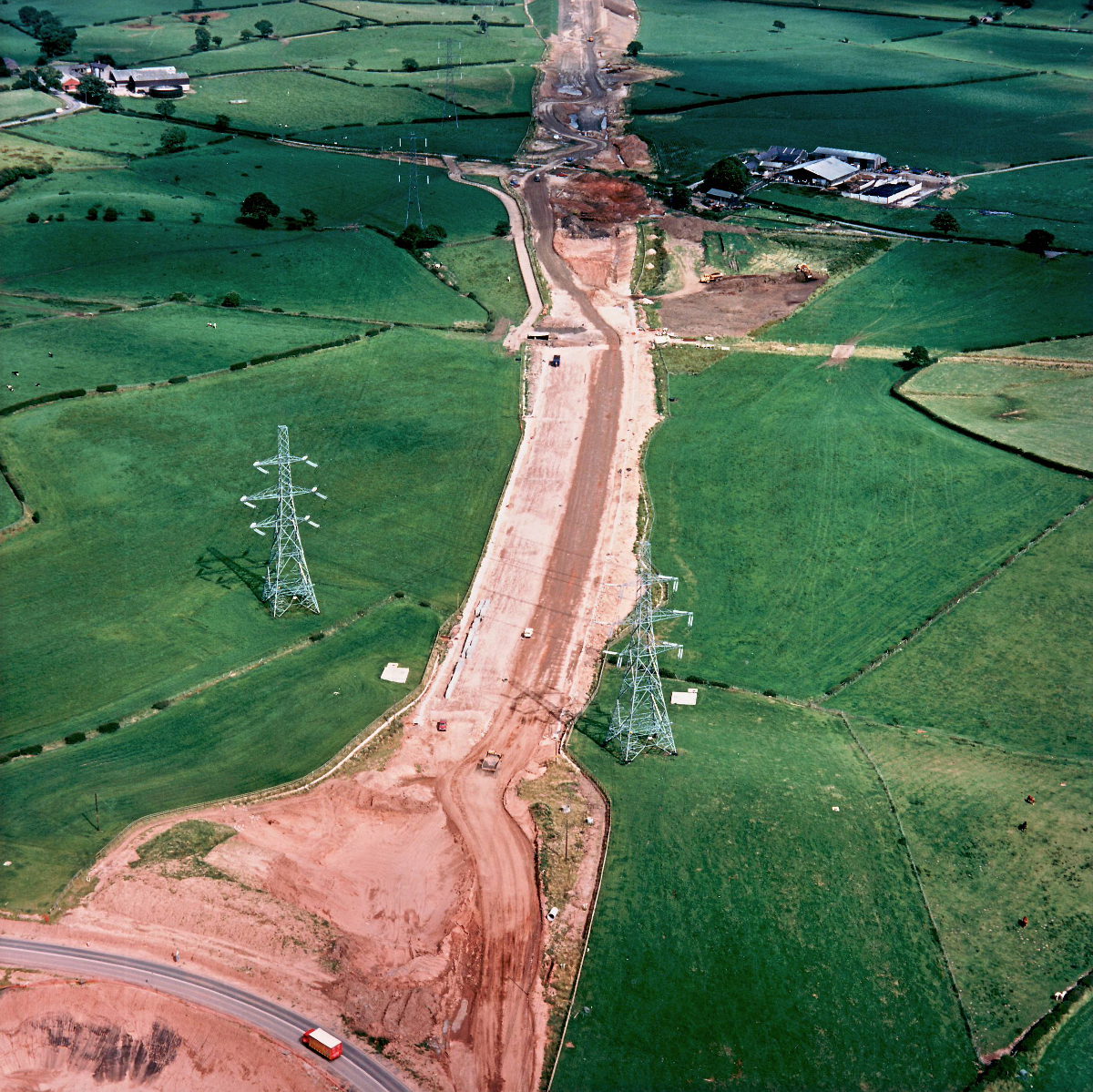
View east from Sandy Lane to Marsh Lane (see all photos of the same view)
The temporary diversion carrying Sandy Lane is visible at the bottom of the picture.
B5256 Sandy Lane
What's new
The road that made no sense
It was the UK's only single-carriageway motorway, and twenty years ago it ceased to exist. This is the story of the strange fascination it held, and of my place in history.
The forever bottleneck, part 2
The second part of the story, where we learn why exactly the M4 gets narrower on the final approach to Europe’s biggest city.
The forever bottleneck, part 1
The M4 into London was one of the UK's earliest and most ambitious motorway projects. It was bold, pioneering... and almost instantly regretted.
Have you seen...
Linnyshaw Moss

The UK's widest motorway is not where you might expect to find it — in fact, it's on the unassuming M61 near Manchester. This gallery offers an overhead view of one of the UK's most unique and spacious interchanges.