Riley Green interchange, view south east, 3 April 1995
Riley Green interchange, view south east (see all photos of the same view)
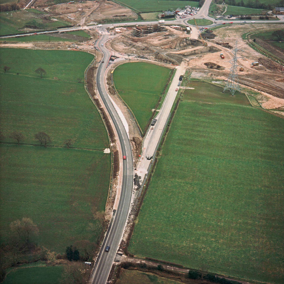
The new line of the A675, on the left, is clearly seen here, replacing the original course of the road which will be dug up and returned to farmland. Towards the top of the picture, traffic is temporarily routed around a short section of the future large roundabout and onto a short temporary length of road that ties in to the A674.
Structure 20/20a (Riley Green interchange bridges)
A674 Chorley Road
A675 Bolton Road
What's new
The road that made no sense
It was the UK's only single-carriageway motorway, and twenty years ago it ceased to exist. This is the story of the strange fascination it held, and of my place in history.
The forever bottleneck, part 2
The second part of the story, where we learn why exactly the M4 gets narrower on the final approach to Europe’s biggest city.
The forever bottleneck, part 1
The M4 into London was one of the UK's earliest and most ambitious motorway projects. It was bold, pioneering... and almost instantly regretted.
Have you seen...
Abbreviations

How do you describe a road? One way is to use these engineering abbreviations, much loved by the UK's community of road enthusiasts.