View east from Riley Green interchange to Stanworth rock cutting, 3 April 1995
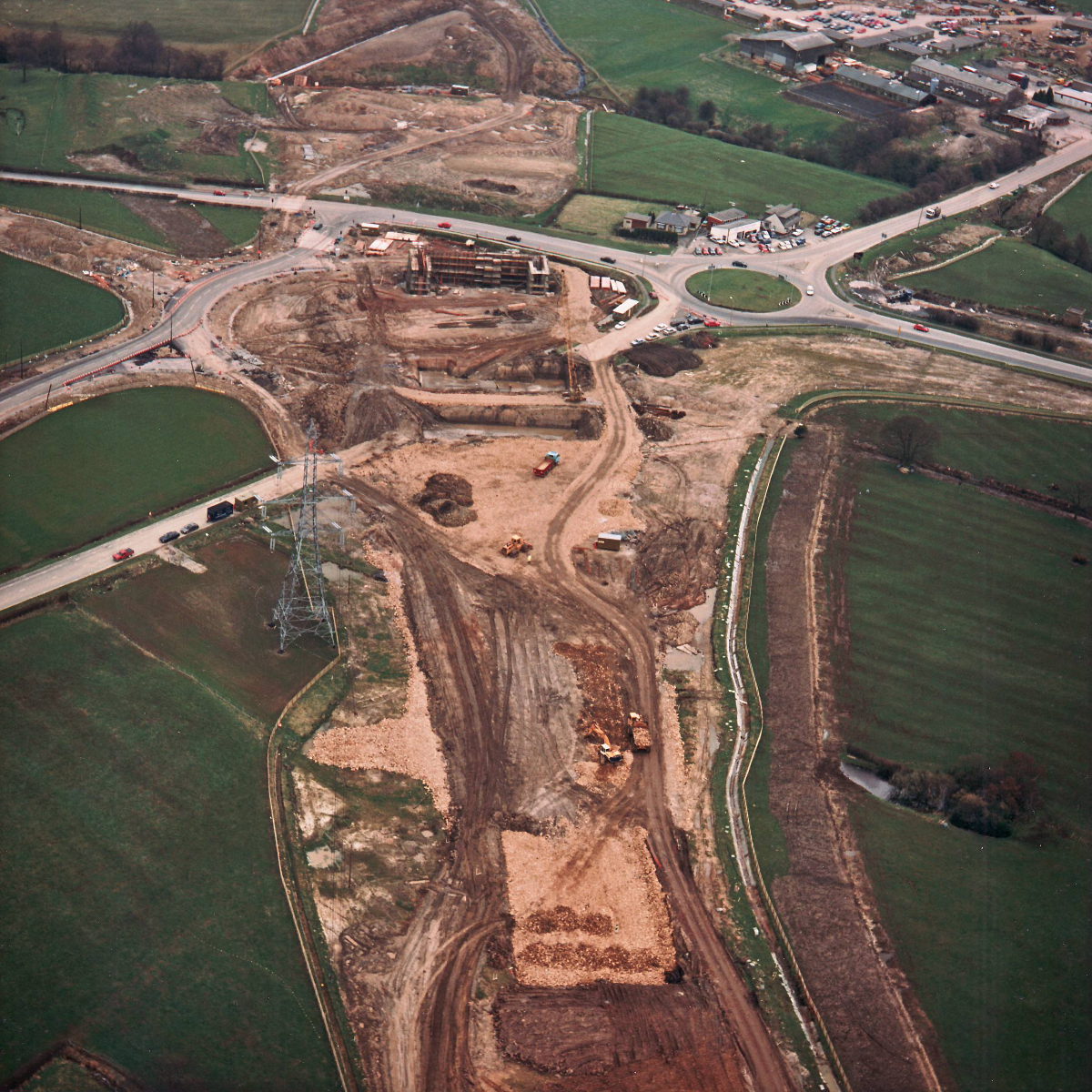
View east from Riley Green interchange to Stanworth rock cutting (see all photos of the same view)
Riley Green Interchange occupies the centre of this picture, with Stanworth rock cutting just out of frame at the top on this occasion. With the A675, on the left, diverted onto its new course, the old road has been dug up, allowing deep excavation to begin for bridge foundations.
Structure 20/20a (Riley Green interchange bridges)
A674 Chorley Road
A675 Bolton Road
What's new
The road that made no sense
It was the UK's only single-carriageway motorway, and twenty years ago it ceased to exist. This is the story of the strange fascination it held, and of my place in history.
The forever bottleneck, part 2
The second part of the story, where we learn why exactly the M4 gets narrower on the final approach to Europe’s biggest city.
The forever bottleneck, part 1
The M4 into London was one of the UK's earliest and most ambitious motorway projects. It was bold, pioneering... and almost instantly regretted.
Have you seen...
Almondsbury Interchange
The UK's first four-level interchange opened in 1966. Relive some of the wonder and excitement of this icon of the motorway era with the book published to mark its completion.