A49 underbridge, view west, 14 February 1997
A49 underbridge, view west (see all photos of the same view)
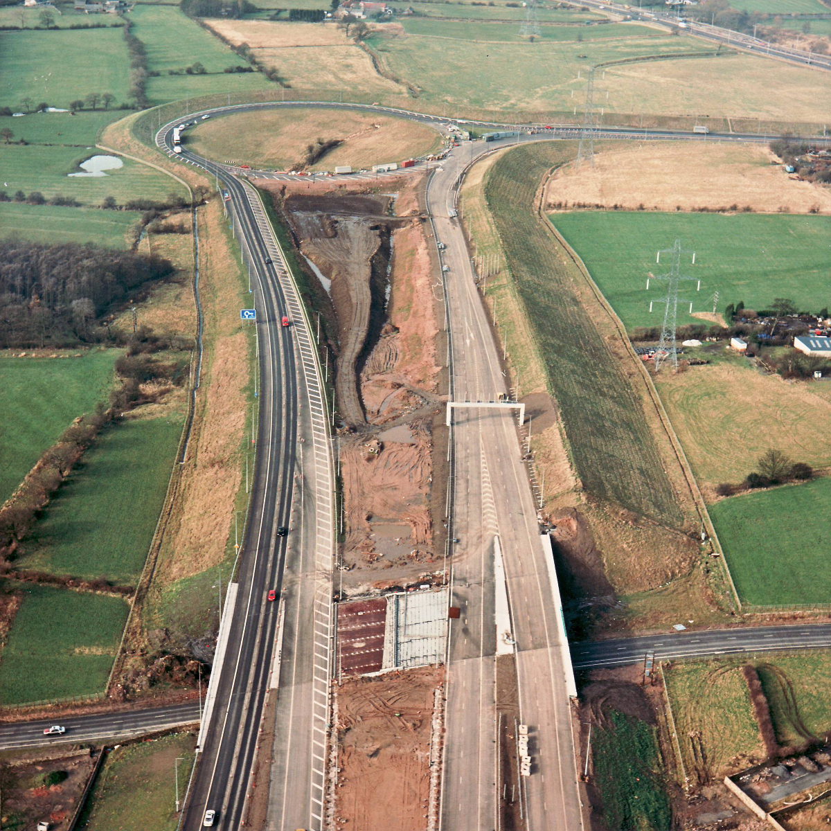
One carriageway of the new motorway has been in use for some time now, as part of the diversion route between the M6 and A6, but the change in this picture since October is that the other carriageways are now also surfaced and marked. A sign gantry has been erected and posts for other signs can be seen on the right.
Structure 5 (A49 underbridge)
A49 Wigan Road
What's new
The road that made no sense
It was the UK's only single-carriageway motorway, and twenty years ago it ceased to exist. This is the story of the strange fascination it held, and of my place in history.
The forever bottleneck, part 2
The second part of the story, where we learn why exactly the M4 gets narrower on the final approach to Europe’s biggest city.
The forever bottleneck, part 1
The M4 into London was one of the UK's earliest and most ambitious motorway projects. It was bold, pioneering... and almost instantly regretted.
Have you seen...
Alley by gaslight

Some of Central London's quieter streets are still, surprisingly, lit by old and rather beautiful gas lanterns. Here are a few, by day and by night.