Hill House Farm and Sandy Lane overbridges, view east, 12 December 1997
Hill House Farm and Sandy Lane overbridges, view east (see all photos of the same view)
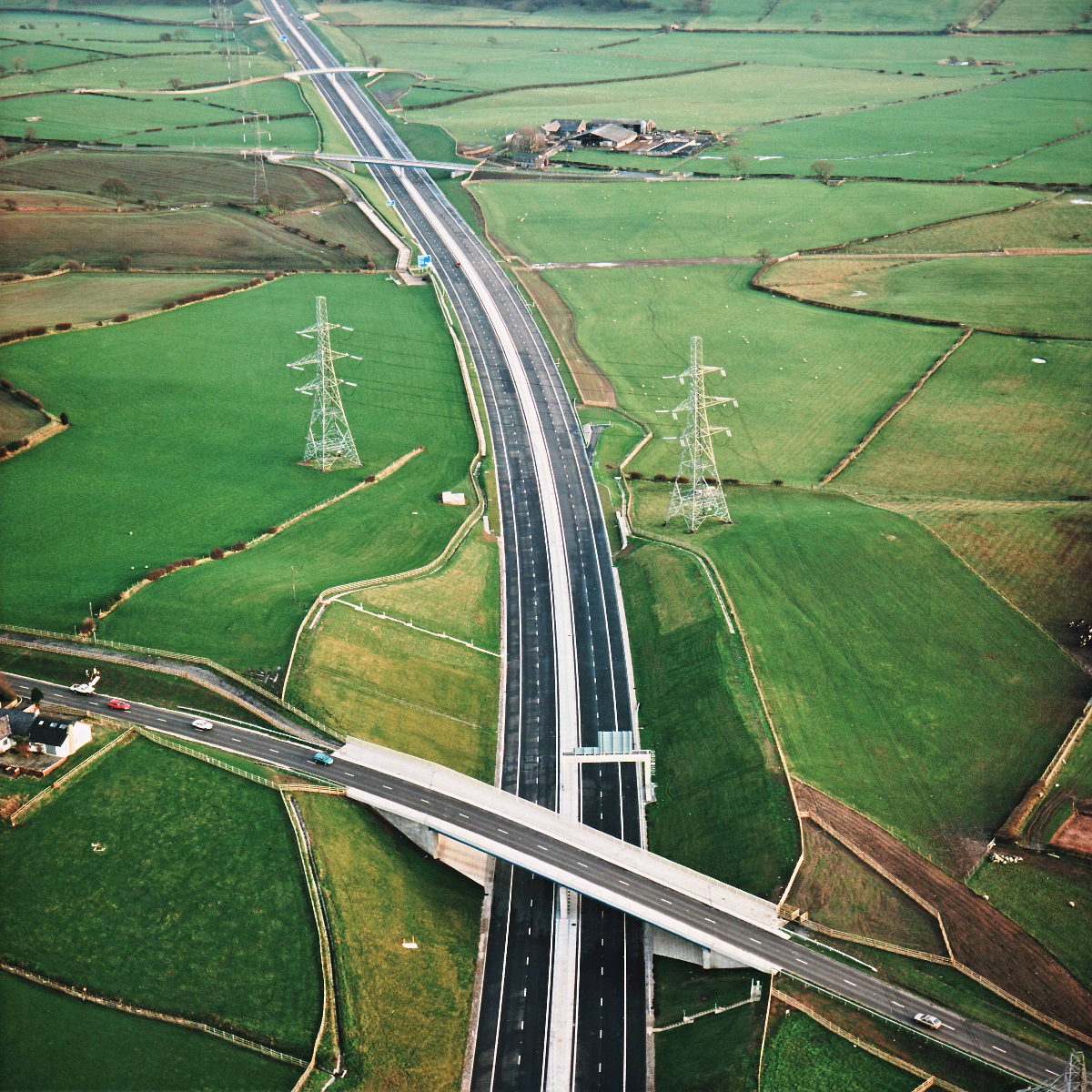
Sandy Lane is visible at the bottom of this picture; away into the distance are Marsh Lane, Marsh Farm and the Leeds-Liverpool Canal bridges. For the last three years this scene has been heavily scarred by churned earth and heavy plant; now the road is finished and its embankments grassed over the difference is remarkable.
Structure 16 (Sandy Lane overbridge)
Structure 17 (Marsh Lane overbridge)
Structure 17a (Marsh Farm overbridge)
B5256 Sandy Lane
What's new
The road that made no sense
It was the UK's only single-carriageway motorway, and twenty years ago it ceased to exist. This is the story of the strange fascination it held, and of my place in history.
The forever bottleneck, part 2
The second part of the story, where we learn why exactly the M4 gets narrower on the final approach to Europe’s biggest city.
The forever bottleneck, part 1
The M4 into London was one of the UK's earliest and most ambitious motorway projects. It was bold, pioneering... and almost instantly regretted.
Have you seen...
Road Numbers

We'd be lost without them, but there is nothing straightforward about the seemingly simple business of giving roads a number.