Walton Summit Motorway, looking east, 16 October 1995
Walton Summit Motorway, looking east (see all photos of the same view)
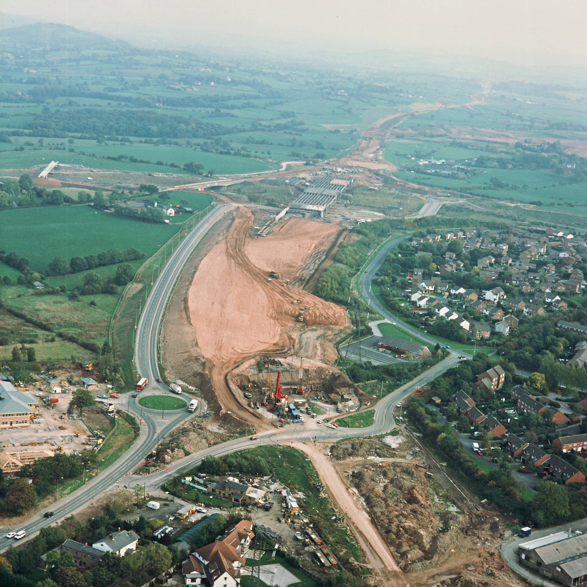
Tramway Lane underbridge is visible at the bottom of the picture, with pile driving taking place for its foundations. On the left the Walton Summit Motorway is in use, and has been for some time; next to it, the motorway embankment is now reaching its full height.
Structure 8 (Tramway Lane underbridge)
Structure 10a (Brindle Road overbridge, M61)
Structure 14/14a (M61 interchange bridges)
M61 motorway
Walton Summit Motorway
What's new
The road that made no sense
It was the UK's only single-carriageway motorway, and twenty years ago it ceased to exist. This is the story of the strange fascination it held, and of my place in history.
The forever bottleneck, part 2
The second part of the story, where we learn why exactly the M4 gets narrower on the final approach to Europe’s biggest city.
The forever bottleneck, part 1
The M4 into London was one of the UK's earliest and most ambitious motorway projects. It was bold, pioneering... and almost instantly regretted.
Have you seen...
North Cross Route

The route and the history of the North Cross Route, proposed in the 1960s as the northern side of London's innermost motorway ring road.