A personal account of the building of the M4 through South Wales, as witnessed by Simon Davies.
The M4 is my motorway - at least it is the one that I became most familiar with during my childhood. Well, let's face it, if you grew up in Swansea in the 70's and 80's, you had to go as far as the M5 to find a motorway with a different number!
Early bypasses
The earliest bits of the M4 in South Wales include the Newport to Severn Bridge section - opened in stretches between 1966 and 67. It was built to dual 2 lane standard, running west from the Wye Bridge (a magnificent bridge in its own right, but often overlooked as it is dwarfed by its neighbours). My Severn Bridge souvenir handbook says that the motorway was originally going to end at a new roundabout on the A48 at Crick, though the decision to extend the motorway to Coldra (Junction 24) was made and built before the Crick roundabout was constructed. The section from here to Tredegar Park (junction 28) was completed in 1967 (ish) and the motorway ended at the existing roundabout now located below junction 28 - which may explain the contorted slip road network.
Between junctions 25 and 26 are the Brynglas tunnels - as far as I am aware they are the only two bored tunnels on the UK motorway network (those on the M25 and the A1(M) are cut-and-cover). Junction 25 used to be a traditional grade separated roundabout, but in the early 1990's the present arrangement was built. The junction was made limited access to force local traffic to use the new relief road, leaving the M4 for long distance traffic. Between 1978 and 1996 (or whenever the second Severn Bridge was opened) the M4 between Junction 23 and 28 was widened to 3 lanes in each direction, all within existing boundaries. Hence you will see lots of Intermittent Hard Shoulder signs, and lane drop / gain at the main junctions. The tunnels remain 2 lane and look like staying that way. There were plans for a southern Newport motorway which would relieve the M4 through here but I don't know what (if anything) has happened to them.
The Port Talbot bypass (junction 39 to 41a) was built and opened in the mid 60's - maybe even before the Severn Bridge. It spent the first 10 years of its life as the A48(M) and was built largely on stilts. It was (and still is) a two lane motorway. The elevated section has always been subject to a 50mph limit - the alignment is tight and presumably it helps to keep the noise down in the rows of terraced houses below - the motorway runs at roof top level. This stretch of motorway started at the roundabout which can still be seen at junction 39, but in those days, both carriageways curved round to this roundabout. The motorway ended at the Baglan roundabout, which again is still there. In the 1980s they put traffic lights on this roundabout - as such it was claimed locally as being the only motorway which had traffic lights on the main carriageway.
The third isolated stretch was the Morriston bypass - junction 44 to 46. This road was always signed as M4. It opened in 1972, built as a 2 lane motorway. Again, it has never been widened. It, too has some unusual features - some of which can still be seen today. Junction 44 has a slip road which starts on the inside of the roundabout over the motorway. There is a climbing lane west of junction 45 - albeit very short. The motorway used to end at a roundabout. The roundabout is still there, and the west bound carriageway now forms the slip road. The eastbound carriageway was diverted when the motorway was extended in the late 1970s. When the M4 Morriston bypass was a stand alone stretch of motorway, there was a sign just east of the J46 roundabout which said London 191 miles. That 191 miles would have taken you all day to travel as you had to drive through the middle of Cardiff and other paces to get there. As the M4 gradually evolved into a single motorway, the sign disappeared - a bit odd really, as you can now do the journey without leaving the motorway - and it can be done legally in less than three hours.
That describes how the M4 looked when I first remember it - all these stretches opened either before I was born or before I was old enough to take note of these things!
Joining the dots
In the late 1970s another 4 stretches were built and opened. As I can't remember the exact order, I'll work from East to West.
The section from Junction 28 to the end of the A48(M) in Cardiff was built. The section from 28 to 29 was built as 3 lane motorway, the A48(M) was built as two lane motorway. At junction 28 the existing roundabout was retained and the motorway diverted to the west of the roundabout. (M4 runs north to south at this point).
The section from Junction 32 to 35 was built at around the same time. This was built as 3 lane motorway, starting from a 3 level stack roundabout at junction 32 with the A470, heading west towards Pencoed, east of Bridgend. Initially, junction 33 was omitted - it was only added some years later.
Junction 37 to 39 was added - again at the same sort of time, and again built to 3 lane standard. At junction 39, the east bound carriageway was diverted to junction 38. Junction 46 to 49 (two lane standard) was added at a similar time. Junction 46 was built as a limited access junction, allowing access to and from the east only. Within the last 12 months, the junction has been re modelled again and is now a full access junction. The motorway ends at a roundabout at Pont Abraham Services, where the A48 and then the A40 take over the mantle of the principal route to West Wales.
So, this leaves us with three gaps - Briton Ferry, Bridgend and Cardiff.
Again, I can't remember which came first - I think it might have been Cardiff Bypass. In their infinite wisdom, the Welsh Office built this bit with two lanes in each direction. The existing surrounding roads were three lanes, and at the same time they were widening the Newport bit to 3 lanes. The new bit of M4 kicked off from what is now junction 29. If you look closely as you head west along M4 you will see redundant eastbound carriageway where the old A48(M) ran straight into the M4. This section of road was built with no other junctions, so after passing junction 29, the next one was junction 32, and the one after that was junction 34. Within the last 10 years, junction 30 has been added.
The Bridgend section was opened in the early 80s. It was built to 3 lane standard and contains some good hills where the Police can catch you breaking the speed limit.
The Briton Ferry missing link was opened in the mid 1990s. Locals will tell you that the motorway was built as high as it is to enable shipping to navigate the River Neath, and to avoid a factory below. Sadly, since the road was designed in the 1970s, shipping in the river has disappeared and the factory has been demolished. Bits of this section are two lane (the flyovers), and other bits are three lane.
The rest of the road
And so, the M4 is complete in South Wales, except they moved a bit of it onto the new Severn Bridge, and invented the M48. The M4 between London and Pont Abraham, has a dozen service areas (including Severn View on M48 and Chieveley which is no longer signed from M4 since Reading opened). With the new Severn bridge, the old Aust (Severn View) services have declined and is now little more than a Little Chef / Burger King. The old service building is now a commercial office block. All a bit sad, really, as the Severn Bridge was the place that everyone stopped at on the old M4.
I'm less well up on when the English bit of the M4 was built - however I do know that the section between junction 7 and the (now) A404(M) was opened in 1960 and is the only bit of M4 marked on my 1961Johnston and Bacon Road Atlas of Great Britain. In those days it was known as the A4(M). By 1970 (ish) you could drive between Chiswick and Junction 12 on the M4, and between junction 18 and 28. The remainder of the English M4 was opened in 1971 and 1972. I have a Bartholemew Road Map (half inch scale) dated 1969 which shows the original junction 8 layout - it looks like a half cloverleaf linking onto the A308 (similar to Junction 9a). I will try and scan it in at some stage.
I think the section between Chiswick and junction 9 was built as dual two lane standard but by the time I first remember travelling on it (1973 or 4 ish) it was all three lane carriageway except the 'elevated' bit. Certainly, there are no hard shoulders over the bridges at junction 5, 6, (and maybe 3 and 4 as well). In addition, until the early 90's you could see where the third lane had been tagged on - it was a different colour from the rest of it!
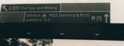
The section between junction 4 and 4b (Airport Spur and M25) was widened to 4 lanes when the M25 was built (1985 or 6 ish). Take a look at the bridge over the motorway between 4 and 4b - now only the east bound carriageway passes under the original bridge - the westbound M4 passes under a new bridge. When the M25 was first built through here, the M25 was opened but not the slip roads because they weren't finished!
The section between 4b and 5 was widened to 4 lanes in 1993.
Sights to see
Landmarks worth looking out for on the M4:
- Chiswick Flyover (J1-3) (hard to miss this one - a very narrow bridge - no hard shoulders, virtually no acceleration / deceleration lanes at J2 and a 40mph speed limit.
- M4 bus lane - junction 3 east bound to the elevated bit.
- Heathrow Airport (Junction 4 / 4a).
- Windsor Castle (on the left in the distance at junction 6).
- The madjeski stadium (or whatever it is called) can be seen off junction 11 in Reading.
- Find Membury services by looking for the TV tower next to the services between junction 14 and 15.
- Watch for the blue / green steel railway bridge near the M32 junction (J19) - possibly the ugliest structure on the M4.
- M5 junction - the original and best motorway intersection.
- Assorted bridges over the Severn between junctions 22 and 23.
- Brynglas tunnels at Newport.
- Castell Coch - a fairytale castle visible on the right when heading west past junction 32.
- Watch out for Port Talbot steel works straight in front of you as you go between junction 36 and 37 - then in all its industrial glory on your left as you pass junctions 38 to 40. You can tell we're scraping the bottom of the barrel for things to look for.
- Aberavon Rugby ground - on the left near junction 41.
- The old Briton Ferry bridge (on the right as you cross the new bridge).
- The DVLA building - large building on the left between junction 45 and 46.
How much more is there to tell about the M4? Well, loads probably, but you'll have to ask someone who remembers more than I do. If anyone can add to my vague recollections of dates and sequence of opening, I'd be grateful. You can't expect a small child to remember all of this, can you?
Simon Davies, 2002
With thanks to 'Moose' for information on this page.